Directions to Inverurie with public transportation
The following transport lines have routes that pass near Inverurie
How to get to Inverurie by bus?
Click on the bus route to see step by step directions with maps, line arrival times and updated time schedules.
How to get to Inverurie by train?
Click on the train route to see step by step directions with maps, line arrival times and updated time schedules.
Bus stations near Inverurie
- Market Place, Inverurie, 1 min walk,
- Health Centre, Inverurie, 4 min walk,
Bus routes to Inverurie
- 9, Inverurie - Union Square,
- X9, Inverurie - Portlethen,
- 10, Inverurie - Aberdeen (Bus Station),
- 10, Huntly - Inverurie,
- 10A, Huntly - Inverurie,
- 10A, Inverurie - Aberdeen (Bus Station),
- 10B, Inverurie - Aberdeen (Bus Station),
- 10B, Huntly - Inverurie,
- 221, Inverurie - Kemnay Academy,
- 240, Oldmeldrum - Kemnay,
- 403, Kingseat - Inverurie,
- 421, Inverurie - Alford,
- 22, Town and Port Elphinstone Circular - Inverurie,
- 248, New Byth - Inverurie,
- 308, Inverurie - New Deer,
- 452, Inverurie - Fraserburgh,
- 41, Tarves,
- 49, Ellon,
What are the nearest stations to Inverurie?
The nearest stations to Inverurie are:
- Market Place, Inverurie is 50 meters away, 1 min walk.
- Health Centre, Inverurie is 245 meters away, 4 min walk.
Which bus lines stop near Inverurie?
These bus lines stop near Inverurie: 10, X37.
Which train line stops near Inverurie?
SCOTRAIL
What’s the nearest bus stop to Inverurie?
The nearest bus stop to Inverurie is Market Place, Inverurie. It’s a 1 min walk away.
See Inverurie on the map
Public Transportation to Inverurie
Wondering how to get to Inverurie, United Kingdom? Moovit helps you find the best way to get to Inverurie with step-by-step directions from the nearest public transit station.
Moovit provides free maps and live directions to help you navigate through your city. View schedules, routes, timetables, and find out how long does it take to get to Inverurie in real time.
Looking for the nearest stop or station to Inverurie? Check out this list of stops closest to your destination: Market Place; Health Centre.
Bus: 10, X37, 9, X9, 10A, 22, 248, 308, 452, 41, 49.Train: SCOTRAIL.
Want to see if there’s another route that gets you there at an earlier time? Moovit helps you find alternative routes or times. Get directions from and directions to Inverurie easily from the Moovit App or Website.
We make riding to Inverurie easy, which is why over 1.5 million users, including users in Inverurie, trust Moovit as the best app for public transit. You don’t need to download an individual bus app or train app, Moovit is your all-in-one transit app that helps you find the best bus time or train time available.
For information on prices of bus and train, costs and ride fares to Inverurie, please check the Moovit app.
Use the app to navigate to popular places including to the airport, hospital, stadium, grocery store, mall, coffee shop, school, college, and university.
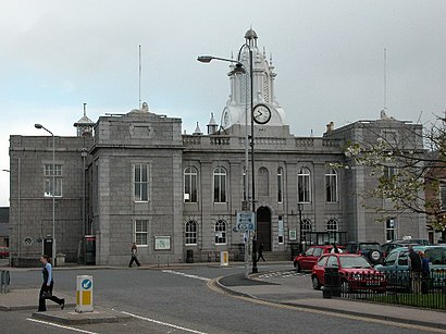
Inverurie Address: Market Place street in Inverurie
Attractions near Inverurie
AB51 3SN,Town Hall, Inverurie,Mitchells Inverurie,Inverurie Town Hall,Ab51 3sn,Market Place,Carnegie Library,Carnegie Inverurie Museum,The Square,Inverurie Panto,Road Runner Disco Scotland,Edwards Inverurie,The Ashvale Restaurant,Inverurie Library,Mitchells Inverurie Dairy,Gordon Arms Hotel,Market Place School,Solitaire,Station Road,McLaughlin AgenciesHow to get to popular attractions in Inverurie with public transportation
New Town, Edinburgh,Sauchiehall Street, Glasgow,St. Enoch Subway Station, Glasgow,Bearsden, Bearsden,IKEA, Glasgow,Scottish Event Campus (SEC), Glasgow,RBS Fettes Row, Edinburgh,Pleasance Courtyard, Edinburgh,Hyndland Railway Station (HYN), Glasgow,Glasgow Prestwick Airport (PIK), Prestwick,Glasgow Airport (GLA), Paisley,Kilmarnock Bus Station, Kilmarnock,Glasgow Airport, Paisley,England / Scotland Border, Carlisle District (B),Glenrothes Bus Station Car Park, Glenrothes,Marks & Spencer, Edinburgh,Asda, Glasgow,Shawlands, Glasgow,EICC, Edinburgh,Braehead Shopping Centre, GlasgowGet around Scotland by public transport!
Travelling around Scotland has never been so easy. See step by step directions as you travel to any attraction, street or major public transport station. View bus and train timetables, arrival times, service alerts and detailed routes on a map, so you know exactly how to get to anywhere in Scotland.
When travelling to any destination around Scotland use Moovit's Live Directions with Get Off Notifications to know exactly where and how far to walk, how long to wait for your line , and how many stops are left. Moovit will alert you when it’s time to get off — no need to constantly re-check whether yours is the next stop.
Wondering how to use public transport in Scotland or how to pay for public transport in Scotland? Moovit public transport app can help you navigate your way with public transport easily, and at minimum cost. It includes public transport fees, ticket prices, and costs. Looking for a map of Scotland public transport lines? Moovit public transport app shows all public transport maps in Scotland with all Bus, Train, Light rail and Ferry routes and stops on an interactive map.
Scotland has 4 transport type(s), including: Bus, Train, Light rail and Ferry, operated by several transport agencies, including First Greater Glasgow, First Aberdeen, Lothian Buses, McGill's Bus Service, Stagecoach East Scotland, Stagecoach Bluebird, Xplore Dundee, Community Transport Glasgow, Prentice Westwood, McCall's Coaches, J P Minibus, National Rail, R Robertson & Son, Burnbrae Garage, Ember