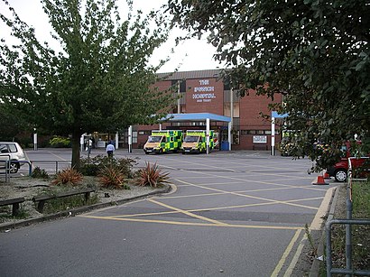
See Ipswich Hospital N H S Trust on the map
Directions to Ipswich Hospital N H S Trust with public transportation
The following transport lines have routes that pass near Ipswich Hospital N H S Trust
 Bus:
Bus: - Train:
How to get to Ipswich Hospital N H S Trust by bus?
Click on the bus route to see step by step directions with maps, line arrival times and updated time schedules.
How to get to Ipswich Hospital N H S Trust by train?
Click on the train route to see step by step directions with maps, line arrival times and updated time schedules.
Bus stations near Ipswich Hospital N H S Trust
- Woodbridge Road East, Copleston,1 min walk,
- Hospital, Rushmere,2 min walk,
Bus routes to Ipswich Hospital N H S Trust
- 5E,Ipswich,
- 6,Copleston,
- 75,Felixstowe,
- 77,Felixstowe Dock,
- 63,Framlingham,
- 64,Ipswich,
- 65,Rendlesham,
- 66,Martlesham Heath,
- 66A,Ipswich,
- 800,Ipswich,
What are the nearest stations to Ipswich Hospital N H S Trust?
The nearest stations to Ipswich Hospital N H S Trust are:
- Woodbridge Road East, Copleston is 64 meters away, 1 min walk.
- Hospital, Rushmere is 66 meters away, 2 min walk.
Which bus lines stop near Ipswich Hospital N H S Trust?
These bus lines stop near Ipswich Hospital N H S Trust: 66, 75, 800.
Which train line stops near Ipswich Hospital N H S Trust?
ABELLIO GREATER ANGLIA
What’s the nearest bus stop to Ipswich Hospital N H S Trust?
The nearest bus stop to Ipswich Hospital N H S Trust is Woodbridge Road East, Copleston. It’s a 1 min walk away.
See Ipswich Hospital N H S Trust on the map
Public Transportation to Ipswich Hospital N H S Trust
Wondering how to get to Ipswich Hospital N H S Trust, United Kingdom? Moovit helps you find the best way to get to Ipswich Hospital N H S Trust with step-by-step directions from the nearest public transit station.
Moovit provides free maps and live directions to help you navigate through your city. View schedules, routes, timetables, and find out how long does it take to get to Ipswich Hospital N H S Trust in real time.
Looking for the nearest stop or station to Ipswich Hospital N H S Trust? Check out this list of stops closest to your destination: Woodbridge Road East; Hospital.
Bus:Train:
Want to see if there’s another route that gets you there at an earlier time? Moovit helps you find alternative routes or times. Get directions from and directions to Ipswich Hospital N H S Trust easily from the Moovit App or Website.
We make riding to Ipswich Hospital N H S Trust easy, which is why over 1.5 million users, including users in Ipswich, trust Moovit as the best app for public transit. You don’t need to download an individual bus app or train app, Moovit is your all-in-one transit app that helps you find the best bus time or train time available.
For information on prices of bus and train, costs and ride fares to Ipswich Hospital N H S Trust, please check the Moovit app.
Use the app to navigate to popular places including to the airport, hospital, stadium, grocery store, mall, coffee shop, school, college, and university.
Location: Ipswich, East Anglia
Attractions near Ipswich Hospital N H S Trust
Heathside Special School,Utility Warehouse Discount Club,Heath Road Roundabout Bus Stop,East of England Co-operative Foodstore,Woodbridge Road East, Ipswich,Co-op,Cooperative Store,Wongs,63 Woodbridge Road,East of England Co-operative Post Office,Murtons,The Masons Arms,Unwins Wine Merchants,Protech Insurance Brokers Ltd,Wongs Take Away,The Seasonal Garden,Co-Operative Bank,SAVO,Michael Morgan Interiors,Laser Lighting & SoundHow to get to popular attractions in Ipswich with public transportation
Oliver Cromwell's House, East Cambridgeshire,Burwash Manor, South Cambridgeshire,Taverham Garden Centre, Broadland,Aldi, Norwich,Breydon Waters Holiday Park, Great Yarmouth,Gislingham, Mid Suffolk,Lucy Cavendish College, Cambridge,Cringleford, South Norfolk,Holiday Inn Norwich, Norwich,Caister On Sea, Great Yarmouth,Caister Holiday Park - Haven, Great Yarmouth,Cambridge Assessment, Cambridge,The FDC, Norwich,Hunstanton Beach, King'S Lynn And West Norfolk,Fat Cat Brewery Tap, Norwich,Nowton Park, St Edmundsbury,Murray Edwards College, Cambridge,Netherhall School and Sixth Form College, Cambridge,Mid Suffolk Leisure Centre, Mid Suffolk,Whittlesey, FenlandGet around Ipswich by public transport!
Travelling around Ipswich has never been so easy. See step by step directions as you travel to any attraction, street or major public transport station. View bus and train timetables, arrival times, service alerts and detailed routes on a map, so you know exactly how to get to anywhere in Ipswich.
When travelling to any destination around Ipswich use Moovit's Live Directions with Get Off Notifications to know exactly where and how far to walk, how long to wait for your line , and how many stops are left. Moovit will alert you when it’s time to get off — no need to constantly re-check whether yours is the next stop.
Wondering how to use public transport in Ipswich or how to pay for public transport in Ipswich? Moovit public transport app can help you navigate your way with public transport easily, and at minimum cost. It includes public transport fees, ticket prices, and costs. Looking for a map of Ipswich public transport lines? Moovit public transport app shows all public transport maps in Ipswich with all bus or train routes and stops on an interactive map.
Ipswich has 2 transport type(s), including: bus or train, operated by several transport agencies, including National Rail, Ambassador Travel, Harwich Harbour Ferry, Stephensons of Essex, Villager Minibus Sharnbrook, The Voluntary Network, Dews Coaches, Lord's Travel, Felixstowe Ferry Boat Yard, Hadleigh Community Transport, Beestons, Fenland Association for Community Transport, First Norfolk & Suffolk, National Rail and Mulleys Motorways