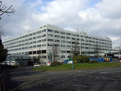
See John Radcliffe Hospital, Oxford, on the map
Directions to John Radcliffe Hospital (Oxford) with public transport
The following transport lines have routes that pass near John Radcliffe Hospital
 Bus:
Bus:
How to get to John Radcliffe Hospital by bus?
Click on the bus route to see step by step directions with maps, line arrival times and updated time schedules.
Bus stations near John Radcliffe Hospital in Oxford
- Jr Hospital Main Entrance, John Radcliffe Hospital,3 min walk,
- West Wing, John Radcliffe Hospital,4 min walk,
- Saxon Way, John Radcliffe Hospital (J11),7 min walk,
Bus lines to John Radcliffe Hospital in Oxford
- X3,Oxford,
- 14,John Radcliffe Hospital,
- X32,Great Western Park,
- 100,Blackbird Leys,
- H2,Carterton,
- ST2,Oxford City Centre,
- 700,Kidlington,
- 10,John Radcliffe Hospital,
- H5,John Radcliffe Hospital,
What are the nearest stations to John Radcliffe Hospital?
The nearest stations to John Radcliffe Hospital are:
- Jr Hospital Main Entrance, John Radcliffe Hospital is 161 meters away, 3 min walk.
- West Wing, John Radcliffe Hospital is 254 meters away, 4 min walk.
- Saxon Way, John Radcliffe Hospital (J11) is 436 meters away, 7 min walk.
Which bus lines stop near John Radcliffe Hospital?
These bus lines stop near John Radcliffe Hospital: 10, 14, 700, OXF, X3, X32.
What’s the nearest bus stop to John Radcliffe Hospital in Oxford?
The nearest bus stop to John Radcliffe Hospital in Oxford is Jr Hospital Main Entrance, John Radcliffe Hospital. It’s a 3 min walk away.
What time is the first bus to John Radcliffe Hospital in Oxford?
The 10 is the first bus that goes to John Radcliffe Hospital in Oxford. It stops nearby at 04:55.
What time is the last bus to John Radcliffe Hospital in Oxford?
The X3 is the last bus that goes to John Radcliffe Hospital in Oxford. It stops nearby at 00:37.
See John Radcliffe Hospital, Oxford, on the map
Public Transit to John Radcliffe Hospital in Oxford
Wondering how to get to John Radcliffe Hospital in Oxford, United Kingdom? Moovit helps you find the best way to get to John Radcliffe Hospital with step-by-step directions from the nearest public transit station.
Moovit provides free maps and live directions to help you navigate through your city. View schedules, routes, timetables, and find out how long does it take to get to John Radcliffe Hospital in real time.
Looking for the nearest stop or station to John Radcliffe Hospital? Check out this list of stops closest to your destination: Jr Hospital Main Entrance; West Wing; Saxon Way.
Bus:
Want to see if there’s another route that gets you there at an earlier time? Moovit helps you find alternative routes or times. Get directions from and directions to John Radcliffe Hospital easily from the Moovit App or Website.
We make riding to John Radcliffe Hospital easy, which is why over 1.5 million users, including users in Oxford, trust Moovit as the best app for public transit. You don’t need to download an individual bus app or train app, Moovit is your all-in-one transit app that helps you find the best bus time or train time available.
For information on prices of bus and train, costs and ride fares to John Radcliffe Hospital, please check the Moovit app.
Use the app to navigate to popular places including to the airport, hospital, stadium, grocery store, mall, coffee shop, school, college, and university.
John Radcliffe Hospital Address: Ethelred Court street in Oxford
Popular routes to John Radcliffe Hospital, Oxford
Attractions near John Radcliffe Hospital
Oxford City Community Hospital,Marks & Spencer Cafe,J R Nursery,M&S Café,Marks & Spencer,Lg1 West Wing League of Friends,Little Pioneer Co-Operative Childcare John Radcliffe Nursery,OX3 9DU,John Radcliffe Main Hospital,Post Graduate Centre - John Radcliffe Hospital,John Radcliffe Hospital,Oxford University Hospitals NHS Trust,Oxfordshire I.M.P.S,Oxford Heart Centre,Oxford Trauma Unit,Omi,Oral Surgery,Bpas Oxford,Jr Hospital Main Entrance (Stand J1), Oxford,John Radcliffe Hospital Bus StopHow to get to popular attractions in Oxford with public transportation
London Hilton Hotel, Mayfair,Whitgift School, South Croydon,Sainsbury's, Guildford,Crouch End, Crouch End,The Whittington Hospital, Upper Holloway,Nuffield Health Newbury Fitness & Wellbeing Gym, Newbury (W Berks),Hayes Railway Station, Hayes (Kent),Terminal 4, Heathrow,Catford Library, Catford,John Radcliffe Main Hospital, Oxford,Stanmore, Stanmore,Virgin Active Chelsea, Chelsea,Golders Green, Golders Green,Brentwood, Brentwood,Park Plaza Westminster Bridge, Waterloo,King's Cross St Pancras Underground Station, Pentonville,Brent, Colindale,Warner Bros. Studio Tour London - the Making Of Harry Potter, Three Rivers,Goring-on-Thames, South Oxfordshire,Heathrow Terminal 3, HeathrowGet around Oxford by public transport!
Travelling around Oxford has never been so easy. See step by step directions as you travel to any attraction, street or major public transport station. View bus and train timetables, arrival times, service alerts and detailed routes on a map, so you know exactly how to get to anywhere in Oxford.
When travelling to any destination around Oxford use Moovit's Live Directions with Get Off Notifications to know exactly where and how far to walk, how long to wait for your line , and how many stops are left. Moovit will alert you when it’s time to get off — no need to constantly re-check whether yours is the next stop.
Wondering how to use public transport in Oxford or how to pay for public transport in Oxford? Moovit public transport app can help you navigate your way with public transport easily, and at minimum cost. It includes public transport fees, ticket prices, and costs. Looking for a map of Oxford public transport lines? Moovit public transport app shows all public transport maps in Oxford with all bus or train routes and stops on an interactive map.
Oxford has 2 transport type(s), including: bus or train, operated by several transport agencies, including London Underground, London Buses, Transport for London, London Tramlink, Transport for London, National Rail, Bluestar, Berry's Coaches, Oxford Bus Company, Stagecoach West, Community First Wessex, Cresta Coaches, D & P Boat Hire, First Portsmouth, Fareham & Gosport and FYTbus