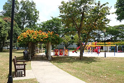
See Katong Park, Southeast, on the map
Directions to Katong Park (Southeast) with public transport
The following transport lines have routes that pass near Katong Park
 Bus:
Bus: - Metro:
How to get to Katong Park by bus?
Click on the bus route to see step by step directions with maps, line arrival times and updated time schedules.
How to get to Katong Park by metro?
Click on the metro route to see step by step directions with maps, line arrival times and updated time schedules.
Metro stations near Katong Park in Southeast
- Katong Park (Te24),4 min walk,
- Mountbatten (CC7),13 min walk,
Bus stations near Katong Park in Southeast
- Fort Rd - Opp Fort Gdns (91089),5 min walk,
- Mountbatten Rd - Bef Fort Rd (91049),8 min walk,
Bus lines to Katong Park in Southeast
- 30,Bedok Int ↔ Boon Lay Int,
- 158,Serangoon Int ↺ Rhu Cross,
- 401,Bedok Int ↺ Fort Rd,
- 158A,Aljunied Rd (Aljunied MRT Stn) → Rhu Cross → Aljunied Rd (opp Aljunied MRT Stn),
- 30E,[AM Peak]: Pasir Panjang Rd (Opp Heng Mui Keng Terrace) [PM Peak]: Bedok Int,
- 12,Kg Bahru Ter,
- 14,Bedok Int,
- 196,Clementi Int,
- 14A,Grange Rd (Somerset Youth Pk),
- 196A,Shenton Way (Opp Mas Bldg),
What are the nearest stations to Katong Park?
The nearest stations to Katong Park are:
- Katong Park (Te24) is 235 meters away, 4 min walk.
- Fort Rd - Opp Fort Gdns (91089) is 318 meters away, 5 min walk.
- Mountbatten Rd - Bef Fort Rd (91049) is 585 meters away, 8 min walk.
- Mountbatten (CC7) is 1006 meters away, 13 min walk.
Which bus lines stop near Katong Park?
These bus lines stop near Katong Park: 14, 30.
Which metro line stops near Katong Park?
THOMSON-EAST COAST LINE
What’s the nearest metro station to Katong Park in Southeast?
The nearest metro station to Katong Park in Southeast is Katong Park (Te24). It’s a 4 min walk away.
What’s the nearest bus stop to Katong Park in Southeast?
The nearest bus stop to Katong Park in Southeast is Fort Rd - Opp Fort Gdns (91089). It’s a 5 min walk away.
What time is the first metro to Katong Park in Southeast?
The CIRCLE LINE is the first metro that goes to Katong Park in Southeast. It stops nearby at 05:47.
What time is the last metro to Katong Park in Southeast?
The THOMSON-EAST COAST LINE is the last metro that goes to Katong Park in Southeast. It stops nearby at 00:34.
What time is the first bus to Katong Park in Southeast?
The 30 is the first bus that goes to Katong Park in Southeast. It stops nearby at 05:38.
What time is the last bus to Katong Park in Southeast?
The 30 is the last bus that goes to Katong Park in Southeast. It stops nearby at 01:30.
How much is the metro fare to Katong Park?
The metro fare to Katong Park costs about $1.09 - $2.36.
See Katong Park, Southeast, on the map
Public Transit to Katong Park in Southeast
Wondering how to get to Katong Park in Southeast, Singapore? Moovit helps you find the best way to get to Katong Park with step-by-step directions from the nearest public transit station.
Moovit provides free maps and live directions to help you navigate through your city. View schedules, routes, timetables, and find out how long does it take to get to Katong Park in real time.
Looking for the nearest stop or station to Katong Park? Check out this list of stops closest to your destination: Katong Park (Te24); Fort Rd - Opp Fort Gdns (91089); Mountbatten Rd - Bef Fort Rd (91049); Mountbatten (CC7).
Bus:Metro:
Want to see if there’s another route that gets you there at an earlier time? Moovit helps you find alternative routes or times. Get directions from and directions to Katong Park easily from the Moovit App or Website.
We make riding to Katong Park easy, which is why over 1.5 million users, including users in Southeast, trust Moovit as the best app for public transit. You don’t need to download an individual bus app or train app, Moovit is your all-in-one transit app that helps you find the best bus time or train time available.
For information on prices of bus and metro, costs and ride fares to Katong Park, please check the Moovit app.
Use the app to navigate to popular places including to the airport, hospital, stadium, grocery store, mall, coffee shop, school, college, and university.
Katong Park Address: Fort Rd street in Southeast
Attractions near Katong Park
Fort Tanjong Katong,Petite Folies,Pat's Schoolhouse - Katong,53 meyer road,123 Meyer Road,47a Meyer Rd,The Belevedere,#09-02,Tanjong Rhu Flyover,Facebook Vs Twitter Time,Fort Road & Marina East Drive,The View At Meyer,Fort Road,M.Link Trading,The Belvedere Meyer Rd,Meyer Rd,Questioning Thinking Creating LLP,Rose 2 (S) Pte. LTD.,The Seafront on Meyer Meyer Rd,THE SEAFRONT ON MEYER Meyer RdHow to get to popular attractions in Southeast with public transportation
MINDEF, Northwest,Vivocity, Singapore,Beach Pool, Southwest,Queensway Shopping Centre, Singapore,Prime Supermarket, Southwest,Phoon Huat, Northwest,The Coffee Bean & Tea Leaf, Singapore,West Coast Park Playground, Southwest,Dunearn Secondary School, Southwest,Setsco, Southwest,KFC, Singapore,Hillview Camp, Southwest,Lazarus Island, Southwest,Stamford Tyres, Southwest,Al-Firdaus Mosque, Southwest,Villa Verde, Southwest,Tan Tock Seng Hospital, Singapore,Assyakirin Mosque, Southwest,Tajimaya Japanese Charcoal Grill Yakiniku, Singapore,Admiralty Drive, NorthwestGet around Southeast by public transport!
Travelling around Southeast has never been so easy. See step by step directions as you travel to any attraction, street or major public transport station. View bus and train timetables, arrival times, service alerts and detailed routes on a map, so you know exactly how to get to anywhere in Southeast.
When travelling to any destination around Southeast use Moovit's Live Directions with Get Off Notifications to know exactly where and how far to walk, how long to wait for your line , and how many stops are left. Moovit will alert you when it’s time to get off — no need to constantly re-check whether yours is the next stop.
Wondering how to use public transport in Southeast or how to pay for public transport in Southeast? Moovit public transport app can help you navigate your way with public transport easily, and at minimum cost. It includes public transport fees, ticket prices, and costs. Looking for a map of Southeast public transport lines? Moovit public transport app shows all public transport maps in Southeast with all bus or metro routes and stops on an interactive map.
Southeast has 2 transport type(s), including: bus or metro, operated by several transport agencies, including SMRT, SBS Transit, SMRT, MRT/LRT Replacement Services, SBS Transit, SBS Transit, SMRT, Tower Transit, Go-Ahead Singapore, Premium Bus, City Direct Bus, Changi Airport, Sentosa Development Corporation, Sentosa Development Corporation and Cross Border Bus