Directions to Kemnay with public transportation
The following transport lines have routes that pass near Kemnay
 Bus:
Bus:
How to get to Kemnay by bus?
Click on the bus route to see step by step directions with maps, line arrival times and updated time schedules.
Bus stations near Kemnay
- Kendal Road, Kemnay,6 min walk,
- Green Meadows, Sauchen,97 min walk,
- Inverurie Hospital, Inverurie,101 min walk,
Bus routes to Kemnay
- X20,Aberdeen - Kemnay / Alford,
- 220,Aberdeen - Kemnay / Alford,
- 221,Inverurie - Kemnay Academy,
- 240,Oldmeldrum - Kemnay,
- 421,Inverurie - kemnay or Alford,
- 421,Inverurie - Alford,
- 218,Aberdeen,
- 22,Inverurie,
What are the nearest stations to Kemnay?
The nearest stations to Kemnay are:
- Kendal Road, Kemnay is 375 meters away, 6 min walk.
- Green Meadows, Sauchen is 7548 meters away, 97 min walk.
- Inverurie Hospital, Inverurie is 7833 meters away, 101 min walk.
Which bus lines stop near Kemnay?
These bus lines stop near Kemnay: 240, 421, X20.
What’s the nearest bus stop to Kemnay?
The nearest bus stop to Kemnay is Kendal Road, Kemnay. It’s a 6 min walk away.
See Kemnay on the map
Public Transportation to Kemnay
Wondering how to get to Kemnay, United Kingdom? Moovit helps you find the best way to get to Kemnay with step-by-step directions from the nearest public transit station.
Moovit provides free maps and live directions to help you navigate through your city. View schedules, routes, timetables, and find out how long does it take to get to Kemnay in real time.
Looking for the nearest stop or station to Kemnay? Check out this list of stops closest to your destination: Kendal Road; Green Meadows; Inverurie Hospital.
Bus:
Want to see if there’s another route that gets you there at an earlier time? Moovit helps you find alternative routes or times. Get directions from and directions to Kemnay easily from the Moovit App or Website.
We make riding to Kemnay easy, which is why over 1.5 million users, including users in Kemnay, trust Moovit as the best app for public transit. You don’t need to download an individual bus app or train app, Moovit is your all-in-one transit app that helps you find the best bus time or train time available.
For information on prices of bus and train, costs and ride fares to Kemnay, please check the Moovit app.
Use the app to navigate to popular places including to the airport, hospital, stadium, grocery store, mall, coffee shop, school, college, and university.
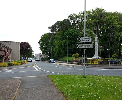
Kemnay Address: High Street street in Kemnay
Attractions near Kemnay
Alehousewells Nursery & Primary School,H & J Mackenzie,Kemnay Health Clinic,Mace Shop,Grampian Country Chickens (Rearing) Ltd.,Alexander Cook & Son,Brian Riach,Aquithie Quarantine & Boarding Kennels & Cattery,A Clark Plant Hire,Ian Christie Crane Plant Hire & Sales,The Laird's Throat,Kemnay Pet Supplies,S Clark Joiners,Grampian Grain Ltd.,Tag Consultants Ltd.,Burnett Arms Hotel,I C WAKLEY,Anne Armstrong,Budget Bicycles,Ab51 5qpHow to get to popular attractions in Kemnay with public transportation
Kilmarnock Bus Station, Kilmarnock,Shawlands, Glasgow,McEwan Square, Edinburgh,Bellshill, Bellshill,Altens Industrial Estate, Aberdeen,Gallowgate, Glasgow,Costco Wholesale, Glasgow,The Alexander Graham Bell (Wetherspoon), Edinburgh,The Queens Arms, Edinburgh,Glasgow Airport, Paisley,Bruntsfield Links, Edinburgh,Fir Park Stadium, Motherwell,Sauchiehall Street, Glasgow,EICC, Edinburgh,Kirkcaldy Bus Station, Kirkcaldy And Dysart,Glenrothes Bus Station Car Park, Glenrothes,IKEA, Loanhead,The Sir John Moore (Wetherspoon), Glasgow,Scottish National Gallery, Edinburgh,Ayr Railway Station (AYR), AyrGet around Kemnay by public transport!
Travelling around Kemnay has never been so easy. See step by step directions as you travel to any attraction, street or major public transport station. View bus and train timetables, arrival times, service alerts and detailed routes on a map, so you know exactly how to get to anywhere in Kemnay.
When travelling to any destination around Kemnay use Moovit's Live Directions with Get Off Notifications to know exactly where and how far to walk, how long to wait for your line , and how many stops are left. Moovit will alert you when it’s time to get off — no need to constantly re-check whether yours is the next stop.
Wondering how to use public transport in Kemnay or how to pay for public transport in Kemnay? Moovit public transport app can help you navigate your way with public transport easily, and at minimum cost. It includes public transport fees, ticket prices, and costs. Looking for a map of Kemnay public transport lines? Moovit public transport app shows all public transport maps in Kemnay with all bus or train routes and stops on an interactive map.
Kemnay has 2 transport type(s), including: bus or train, operated by several transport agencies, including First Greater Glasgow, First Aberdeen, Lothian Buses, McGill's Bus Service, Stagecoach East Scotland, Stagecoach Bluebird, Xplore Dundee, Community Transport Glasgow, Prentice Westwood, McCall's Coaches, J P Minibus, National Rail, R Robertson & Son, Burnbrae Garage and Ember