Directions to Keyhaven Marshes (New Forest) with public transport
The following transport lines have routes that pass near Keyhaven Marshes
How to get to Keyhaven Marshes by bus?
Click on the bus route to see step by step directions with maps, line arrival times and updated time schedules.
Bus stations near Keyhaven Marshes in New Forest
- Haglane Copse, Lymington, 33 min walk,
Bus lines to Keyhaven Marshes in New Forest
- X1, Bournemouth - Christchurch - Lymington,
- 789, Lymington - Bournemouth Grammar Schools,
- NFB, Brockenhurst,
What are the nearest stations to Keyhaven Marshes?
The nearest stations to Keyhaven Marshes are:
- Haglane Copse, Lymington is 2587 meters away, 33 min walk.
Which bus lines stop near Keyhaven Marshes?
These bus lines stop near Keyhaven Marshes: 119, X1.
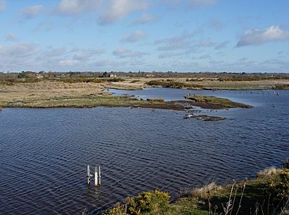
See Keyhaven Marshes, New Forest, on the map
Public Transit to Keyhaven Marshes in New Forest
Wondering how to get to Keyhaven Marshes in New Forest, United Kingdom? Moovit helps you find the best way to get to Keyhaven Marshes with step-by-step directions from the nearest public transit station.
Moovit provides free maps and live directions to help you navigate through your city. View schedules, routes, timetables, and find out how long does it take to get to Keyhaven Marshes in real time.
Looking for the nearest stop or station to Keyhaven Marshes? Check out this list of stops closest to your destination: Haglane Copse.
Bus: 119, X1, 789, NFB.
Want to see if there’s another route that gets you there at an earlier time? Moovit helps you find alternative routes or times. Get directions from and directions to Keyhaven Marshes easily from the Moovit App or Website.
We make riding to Keyhaven Marshes easy, which is why over 1.5 million users, including users in New Forest, trust Moovit as the best app for public transit. You don’t need to download an individual bus app or train app, Moovit is your all-in-one transit app that helps you find the best bus time or train time available.
For information on prices of bus and train, costs and ride fares to Keyhaven Marshes, please check the Moovit app.
Use the app to navigate to popular places including to the airport, hospital, stadium, grocery store, mall, coffee shop, school, college, and university.
Keyhaven Marshes Address: New Forest National Park, 9 Harewood Green, Milford on Sea, Lymington, Hampshire SO41 0TZ, UK street in New Forest
Attractions near Keyhaven Marshes
Hurst Castle,Lyndon,Saltmarsh,So41 0tr,Keyhaven Ferry To Hurst Castle,Keyhaven Slipway,Keyhaven Yacht Club,So4 0tr,West Solent Boat Builders LTD,15th Milford And Keyhaven Sea Scout Group,Hurst Castle Sailing Club,Keyhaven Road,So41 0tp,Castle Catering,Wc,Gun Inn,So41 0tz,Keyhaven,The Gun Inn,So41 0unHow to get to popular attractions in New Forest with public transportation
Clarks Village Outlet Shopping, Mendip,Salisbury City Centre, Wiltshire,Red Funnel Ferry Terminal 1, Southampton,Weston-super-Mare Seafront, North Somerset,Bath Bus Station, Bath And North East Somerset,Tiverton Parkway Railway Station (TVP), Mid Devon,Tesco, Poole,Victoria Park, Bristol, City Of,Cirencester, Cotswold,Wightlink Fastcat Terminal,Gloucester Quays Designer Outlet, Gloucester,Tesco, Exeter,Southsea Seafront, Portsmouth,Westbury Railway Station (WSB), Wiltshire,St Brendan's Sixth Form College, Bristol, City Of,Gloucestershire, Gloucester,Bristol Temple Meads Railway Station (BRI) (TPB), Bristol, City Of,IKEA, Southampton,M5 Avonmouth Bridge,Ashton Gate Stadium, Bristol, City OfGet around South West by public transport!
Travelling around South West has never been so easy. See step by step directions as you travel to any attraction, street or major public transport station. View bus and train timetables, arrival times, service alerts and detailed routes on a map, so you know exactly how to get to anywhere in South West.
When travelling to any destination around South West use Moovit's Live Directions with Get Off Notifications to know exactly where and how far to walk, how long to wait for your line , and how many stops are left. Moovit will alert you when it’s time to get off — no need to constantly re-check whether yours is the next stop.
Wondering how to use public transport in South West or how to pay for public transport in South West? Moovit public transport app can help you navigate your way with public transport easily, and at minimum cost. It includes public transport fees, ticket prices, and costs. Looking for a map of South West public transport lines? Moovit public transport app shows all public transport maps in South West with all Bus, Train and Ferry routes and stops on an interactive map.
South West has 3 transport type(s), including: Bus, Train and Ferry, operated by several transport agencies, including National Rail, Stagecoach South, Padstow Harbour Commissioners, Royal Buses, Tavistock Community Transport, River Link, Beaminster Town Council, Yeos Contracts, MD Coaches, Newport Bus, First Bristol, Bath & the West, First Kernow, St Mawes Ferry, First Wessex, Dorset & South Somerset, Isles of Scilly Steamship Co