See Kidderminster on the map
Directions to Kidderminster with public transportation
The following transport lines have routes that pass near Kidderminster
 Bus:
Bus: - Train:
How to get to Kidderminster by bus?
Click on the bus route to see step by step directions with maps, line arrival times and updated time schedules.
How to get to Kidderminster by train?
Click on the train route to see step by step directions with maps, line arrival times and updated time schedules.
Bus stations near Kidderminster
- Baldwin Road, Greenhill,3 min walk,
- Bruce Road, Greenhill,9 min walk,
- Hurcott Road Crossroads, Greenhill,10 min walk,
- Wolverhampton Road, Broadwaters,24 min walk,
- Kidderminster,27 min walk,
Bus routes to Kidderminster
- 7,Sion Hill,
- 192,Blakebrook & Habberley South - Halesowen South,
- 828,Blakebrook & Habberley South - Wyre Forest Rural,
- 580,Kinver,
- 125,Stourbridge,
- 9C,Kidderminster,
- WEST MIDLANDS RAILWAY,Birmingham Moor Street,
What are the nearest stations to Kidderminster?
The nearest stations to Kidderminster are:
- Baldwin Road, Greenhill is 160 meters away, 3 min walk.
- Bruce Road, Greenhill is 621 meters away, 9 min walk.
- Hurcott Road Crossroads, Greenhill is 712 meters away, 10 min walk.
- Wolverhampton Road, Broadwaters is 1872 meters away, 24 min walk.
- Kidderminster is 2046 meters away, 27 min walk.
Which bus lines stop near Kidderminster?
These bus lines stop near Kidderminster: 125, 192, 7.
Which train line stops near Kidderminster?
WEST MIDLANDS RAILWAY
What’s the nearest bus stop to Kidderminster?
The nearest bus stop to Kidderminster is Baldwin Road, Greenhill. It’s a 3 min walk away.
See Kidderminster on the map
Public Transportation to Kidderminster
Wondering how to get to Kidderminster, United Kingdom? Moovit helps you find the best way to get to Kidderminster with step-by-step directions from the nearest public transit station.
Moovit provides free maps and live directions to help you navigate through your city. View schedules, routes, timetables, and find out how long does it take to get to Kidderminster in real time.
Looking for the nearest stop or station to Kidderminster? Check out this list of stops closest to your destination: Baldwin Road; Bruce Road; Hurcott Road Crossroads; Wolverhampton Road; Kidderminster.
Bus:Train:
Want to see if there’s another route that gets you there at an earlier time? Moovit helps you find alternative routes or times. Get directions from and directions to Kidderminster easily from the Moovit App or Website.
We make riding to Kidderminster easy, which is why over 1.5 million users, including users in Kidderminster, trust Moovit as the best app for public transit. You don’t need to download an individual bus app or train app, Moovit is your all-in-one transit app that helps you find the best bus time or train time available.
For information on prices of bus and train, costs and ride fares to Kidderminster, please check the Moovit app.
Use the app to navigate to popular places including to the airport, hospital, stadium, grocery store, mall, coffee shop, school, college, and university.
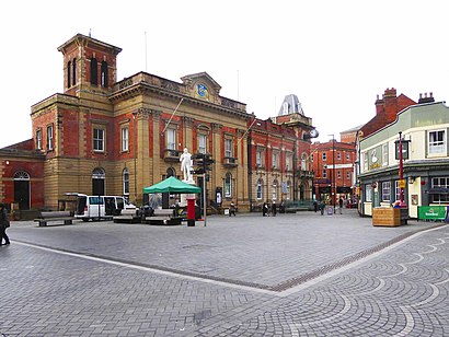
Kidderminster Address: Hurcott Road street in Kidderminster
Attractions near Kidderminster
R Dattani & B Dattani,Dy10 2sh,Hurcott Woods & Pools Wyre Forest Kidderminster,Newsmarket,Dy10 2ut,Broadwaters Park,Elizabeth and Giovanni's Unisex Hair Salon,The Land Oak,Hurcott Pool,Stanmore House Surgery,Offmoor Community Centre,Tennyson Way,Kidderminster Victoria Cricket Club,Tractus Design,Kidderminster Cricket Club,Wolverhampton Road (b4189 wolverhampton),A449,The Alexander Patterson School,56 Queen Elizabeth Road,101 Hurcott RoadHow to get to popular attractions in Kidderminster with public transportation
Birmingham Heartlands Hospital, Heartlands,Newtown, Newtown,Moseley Hall Hospital, Moseley,Walsall, St. Matthew's,Hilton Birmingham Metropole, Bickenhill,Sparkhill, Sparkhill,Phoenix Group, Wythall West,Staffordshire University, Milwich,Cineworld, Wednesfield South,Selly Oak, Bournville & Cotteridge,National Exhibition Centre, Bickenhill,Atherstone, Baddesley And Grendon,Victoria Law Courts, Ladywood,Stourbridge, Wollaston And Stourbridge Town,Longton Bus Station, Broadway And Longton East,Royal Orthopaedic Hospital, Northfield,Joseph Chamberlain 6th Form College, Sparkbrook & Balsall Heath East,Woodbourne Priory Hospital, Harborne,Coleshill, Coleshill South,Newcastle-Under-Lyme Bus Station, TownGet around Kidderminster by public transport!
Travelling around Kidderminster has never been so easy. See step by step directions as you travel to any attraction, street or major public transport station. View bus and train timetables, arrival times, service alerts and detailed routes on a map, so you know exactly how to get to anywhere in Kidderminster.
When travelling to any destination around Kidderminster use Moovit's Live Directions with Get Off Notifications to know exactly where and how far to walk, how long to wait for your line , and how many stops are left. Moovit will alert you when it’s time to get off — no need to constantly re-check whether yours is the next stop.
Wondering how to use public transport in Kidderminster or how to pay for public transport in Kidderminster? Moovit public transport app can help you navigate your way with public transport easily, and at minimum cost. It includes public transport fees, ticket prices, and costs. Looking for a map of Kidderminster public transport lines? Moovit public transport app shows all public transport maps in Kidderminster with all bus or train routes and stops on an interactive map.
Kidderminster has 2 transport type(s), including: bus or train, operated by several transport agencies, including National Express West Midlands, National Express Coventry, National Express, Diamond Bus, Arriva Midlands, Stagecoach Midlands, West Midlands Metro, Stagecoach West, Stagecoach South Wales, First Potteries, First Worcestershire, LandFlight, trentbarton, D & G Bus and Flexibus