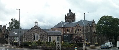
See Kilmacolm on the map
Directions to Kilmacolm with public transportation
The following transport lines have routes that pass near Kilmacolm
Bus:
How to get to Kilmacolm by Bus?
Click on the Bus route to see step by step directions with maps, line arrival times and updated time schedules.
Bus stations near Kilmacolm
- Porterfield Road, Kilmacolm,7 min walk,
{{TRANSIT_TYPE}#Capitalized} routes to Kilmacolm
- 1,Johnstone - Kilmacolm,
- 1A,Johnstone - Kilmacolm,
- X7,Greenock - Glasgow via Kilmacolm,
- 530,Port Glasgow - Kilmacolm,
What are the nearest stations to Kilmacolm?
The nearest stations to Kilmacolm are:
- Porterfield Road, Kilmacolm is 516 meters away, 7 min walk.
Which Bus lines stop near Kilmacolm?
These Bus lines stop near Kilmacolm: 1A, 530, X7
What’s the nearest bus stop to Kilmacolm?
The nearest bus stop to Kilmacolm is Porterfield Road, Kilmacolm. It’s a 7 min walk away.
What time is the first Bus to Kilmacolm?
The X7 is the first Bus that goes to Kilmacolm. It stops nearby at 05:54.
What time is the last Bus to Kilmacolm?
The X7 is the last Bus that goes to Kilmacolm. It stops nearby at 23:27.
See Kilmacolm on the map

Public Transportation to Kilmacolm
Wondering how to get to Kilmacolm, United Kingdom? Moovit helps you find the best way to get to Kilmacolm with step-by-step directions from the nearest public transit station.
Moovit provides free maps and live directions to help you navigate through your city. View schedules, routes, timetables, and find out how long does it take to get to Kilmacolm in real time.
Looking for the nearest stop or station to Kilmacolm? Check out this list of stops closest to your destination: Porterfield Road.
Bus:
Want to see if there’s another route that gets you there at an earlier time? Moovit helps you find alternative routes or times. Get directions from and directions to Kilmacolm easily from the Moovit App or Website.
We make riding to Kilmacolm easy, which is why over 1.5 million users, including users in Kilmacolm, trust Moovit as the best app for public transit. You don’t need to download an individual bus app or train app, Moovit is your all-in-one transit app that helps you find the best bus time or train time available.
For information on prices of Bus and Train, costs and ride fares to Kilmacolm, please check the Moovit app.
Use the app to navigate to popular places including to the airport, hospital, stadium, grocery store, mall, coffee shop, school, college, and university.
Kilmacolm Address: Bridge of Weir Road street in Kilmacolm

Popular routes to Kilmacolm
From GlasgowFrom EdinburghFrom JohnstoneFrom GlasgowFrom Glasgow Central StationFrom PaisleyFrom Port GlasgowFrom PaisleyFrom EdinburghFrom Glasgow FortPopular routes from Kilmacolm
To KilmacolmTo KilmacolmTo KilmacolmTo KilmacolmTo KilmacolmTo KilmacolmTo KilmacolmTo KilmacolmTo KilmacolmTo KilmacolmAttractions near Kilmacolm
- The Ginger Cat Childre
- Travel.Actually
- Munroe
- Douglas F McDonald
- Royal Bank of Scotland
- Woolly Walks Alpaca Trekking
- Amazon Counter-Co-Op Kilmacolm
- Edwin A Fisher
- Karen Rankin Catering
- WW
- Kingsley Wood
- Cairn - Kilmacolm
- Treasured
- Wilma Tailoring Alterations
- Discover Piano
- Fencetec
- EV Charging Station
- Kidston Hall
- Glen Golf Design
- House & Home Remedies
How to get to popular attractions in Kilmacolm with public transportation
- Annandale Water Motorway Services (RoadChef), Dumfries And Galloway
- Fir Park Stadium, Motherwell
- Asda, Glasgow
- Edinburgh Castle, Edinburgh
- The Guildford Arms, Edinburgh
- Tesco Extra, Edinburgh
- The Crystal Palace (Wetherspoon), Glasgow
- Queen Elizabeth University Hospital, Glasgow
- Buchanan Bus Station, Glasgow
- Hard Rock Cafe Edinburgh, Edinburgh
- Partick Railway Station (PTK), Glasgow
- Buchanan Street Bus Station, Glasgow
- Drumgelloch Railway Station (DRU), Airdrie
- Royal Infirmary Of Edinburgh (Little France), City Of Edinburgh
- Haudagain Roundabout, Aberdeen
- The Sir John Moore (Wetherspoon), Glasgow
- Nuffield Health, Edinburgh
- Paisley Gilmour Street Railway Station (PYG), Paisley
- Corstorphine, Edinburgh
- Langside, Glasgow