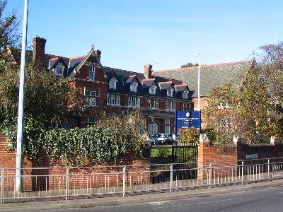
See King Edward Vi Grammar School, Chelmsford, on the map
Directions to King Edward Vi Grammar School (Chelmsford) with public transport
The following transport lines have routes that pass near King Edward Vi Grammar School
 Bus:
Bus: - Train:
How to get to King Edward Vi Grammar School by bus?
Click on the bus route to see step by step directions with maps, line arrival times and updated time schedules.
How to get to King Edward Vi Grammar School by train?
Click on the train route to see step by step directions with maps, line arrival times and updated time schedules.
Bus stations near King Edward Vi Grammar School in Chelmsford
- Kings Road, Chelmsford,2 min walk,
- Cockney Corner, Chelmsford,6 min walk,
- Swiss Avenue, Chelmsford,7 min walk,
Bus lines to King Edward Vi Grammar School in Chelmsford
- C1,BROOMFIELD HOSPITAL - GALLEYWOOD,
- C10,CITY CENTRE - CHANNELS,
- 16,Wethersfield - Chelmsford,
- 32,Ongar - Chelmsford,
- 42A,Bishops Stortford, Interchange - Chelmsford, Bus Stn,
- 70,BRAINTREE - CHELMSFORD,
- 170,MARKS FARM - CHELMSFORD,
- 370,COLCHESTER - CHELMSFORD,
- 370,CHELMSFORD - COLCHESTER,
- 510,Southminster - Chelmsford,
- C2,Chelmsford City Centre,
- C3,Chelmsford City Centre,
What are the nearest stations to King Edward Vi Grammar School?
The nearest stations to King Edward Vi Grammar School are:
- Kings Road, Chelmsford is 151 meters away, 2 min walk.
- Cockney Corner, Chelmsford is 432 meters away, 6 min walk.
- Swiss Avenue, Chelmsford is 512 meters away, 7 min walk.
Which bus lines stop near King Edward Vi Grammar School?
These bus lines stop near King Edward Vi Grammar School: 170, 351, C1, C10, X30.
Which train line stops near King Edward Vi Grammar School?
GREATER ANGLIA
What’s the nearest bus stop to King Edward Vi Grammar School in Chelmsford?
The nearest bus stop to King Edward Vi Grammar School in Chelmsford is Kings Road, Chelmsford. It’s a 2 min walk away.
What time is the first bus to King Edward Vi Grammar School in Chelmsford?
The C1 is the first bus that goes to King Edward Vi Grammar School in Chelmsford. It stops nearby at 05:21.
What time is the last bus to King Edward Vi Grammar School in Chelmsford?
The C10 is the last bus that goes to King Edward Vi Grammar School in Chelmsford. It stops nearby at 23:24.
See King Edward Vi Grammar School, Chelmsford, on the map
Public Transit to King Edward Vi Grammar School in Chelmsford
Wondering how to get to King Edward Vi Grammar School in Chelmsford, United Kingdom? Moovit helps you find the best way to get to King Edward Vi Grammar School with step-by-step directions from the nearest public transit station.
Moovit provides free maps and live directions to help you navigate through your city. View schedules, routes, timetables, and find out how long does it take to get to King Edward Vi Grammar School in real time.
Looking for the nearest stop or station to King Edward Vi Grammar School? Check out this list of stops closest to your destination: Kings Road; Cockney Corner; Swiss Avenue.
Bus:Train:
Want to see if there’s another route that gets you there at an earlier time? Moovit helps you find alternative routes or times. Get directions from and directions to King Edward Vi Grammar School easily from the Moovit App or Website.
We make riding to King Edward Vi Grammar School easy, which is why over 1.5 million users, including users in Chelmsford, trust Moovit as the best app for public transit. You don’t need to download an individual bus app or train app, Moovit is your all-in-one transit app that helps you find the best bus time or train time available.
For information on prices of bus, train and Tube, costs and ride fares to King Edward Vi Grammar School, please check the Moovit app.
Use the app to navigate to popular places including to the airport, hospital, stadium, grocery store, mall, coffee shop, school, college, and university.
Location: Chelmsford, London
Attractions near King Edward Vi Grammar School
Moniquehbeauty,All Avenues Heating & Plumbing Services,Electronic Presentation Services,K W Solutions,Huqqabar,Athi Estates,RJC-Creativetech,Okeley Care Home,MDX Photography,Decmir,Talent Pool Academy Chelmsford,Boarded Barns,Cm1 1rw,St John Payne Pta - Chelmsford Uk,Chelmsford County High School for Girls,Phoenix Road Creative,Patching Hall Lane,CC Canton,Sedera,Juan's TapasHow to get to popular attractions in Chelmsford with public transportation
Windsor Royal Shopping, Windsor,Kingston Hospital, Norbiton,Clapton Pond, Clapton,Covent Garden Station, Covent Garden,Westbourne Studios, Westbourne Park,Acton, Acton,Cineworld, Ashford,Brentwood, Brentwood,Cricklewood, Cricklewood,Folkestone Bus Station, Shepway,Hamleys, Soho,St. Michael's Mead, Bishop'S Stortford,Stratford Station, Stratford,Queen Mary's Hospital, Sidcup,Chase Farm Hospital, Enfield,Bellerbys College, Brighton And Hove,Nuffield Health Newbury Fitness & Wellbeing Gym, Newbury (W Berks),Trafalgar Square, Charing Cross,Windsor Castle, Windsor,Brookwood Railway Station (BKO), WokingGet around Chelmsford by public transport!
Travelling around Chelmsford has never been so easy. See step by step directions as you travel to any attraction, street or major public transport station. View bus and train timetables, arrival times, service alerts and detailed routes on a map, so you know exactly how to get to anywhere in Chelmsford.
When travelling to any destination around Chelmsford use Moovit's Live Directions with Get Off Notifications to know exactly where and how far to walk, how long to wait for your line , and how many stops are left. Moovit will alert you when it’s time to get off — no need to constantly re-check whether yours is the next stop.
Wondering how to use public transport in Chelmsford or how to pay for public transport in Chelmsford? Moovit public transport app can help you navigate your way with public transport easily, and at minimum cost. It includes public transport fees, ticket prices, and costs. Looking for a map of Chelmsford public transport lines? Moovit public transport app shows all public transport maps in Chelmsford with all bus, train or Tube routes and stops on an interactive map.
Chelmsford has 3 transport type(s), including: bus, train or Tube, operated by several transport agencies, including London Underground, London Buses, Transport for London, London Tramlink, Transport for London, National Rail, Bluestar, Berry's Coaches, Oxford Bus Company, Stagecoach West, Community First Wessex, Cresta Coaches, D & P Boat Hire, First Portsmouth, Fareham & Gosport and FYTbus