See Kissing Point Road, Dundas, on the map
Directions to Kissing Point Road (Dundas) with public transport
The following transport lines have routes that pass near Kissing Point Road
 Bus:
Bus: - Train:
How to get to Kissing Point Road by bus?
Click on the bus route to see step by step directions with maps, line arrival times and updated time schedules.
How to get to Kissing Point Road by train?
Click on the train route to see step by step directions with maps, line arrival times and updated time schedules.
Bus stations near Kissing Point Road in Dundas
- Kissing Point Rd At Park Rd,3 min walk,
- Dundas Uniting Church Park Rd,4 min walk,
- Kissing Point Rd At Burke St,4 min walk,
Bus lines to Kissing Point Road in Dundas
- 545,Parramatta to Macquarie Park via Telopea & Eastwood,
- 602W,St. Patricks, Dundas to Parramatta Station,
- 607W,St. Patricks, Dundas to Westfield , North Rocks,
- N61,Carlingford Station,
- 521,Parramatta,
- 617W,Rydalmere,
- 605W,Westfield , North Rocks to St. Patricks, Dundas,
- 606W,Baker & Pennant Hills Rd to St. Patricks, Dundas,
- 608W,Parramatta Station to St. Patricks, Dundas,
- 730W,Baulkham Hills HS to North Rocks Shopping Centre via Telopea & Carlingford,
What are the nearest stations to Kissing Point Road?
The nearest stations to Kissing Point Road are:
- Kissing Point Rd At Park Rd is 216 meters away, 3 min walk.
- Dundas Uniting Church Park Rd is 237 meters away, 4 min walk.
- Kissing Point Rd At Burke St is 301 meters away, 4 min walk.
Which bus lines stop near Kissing Point Road?
These bus lines stop near Kissing Point Road: 520, T80.
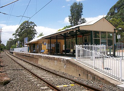
Which train line stops near Kissing Point Road?
T6
What’s the nearest bus stop to Kissing Point Road in Dundas?
The nearest bus stop to Kissing Point Road in Dundas is Kissing Point Rd At Park Rd. It’s a 3 min walk away.
See Kissing Point Road, Dundas, on the map
Public Transit to Kissing Point Road in Dundas
Wondering how to get to Kissing Point Road in Dundas, Australia? Moovit helps you find the best way to get to Kissing Point Road with step-by-step directions from the nearest public transit station.
Moovit provides free maps and live directions to help you navigate through your city. View schedules, routes, timetables, and find out how long does it take to get to Kissing Point Road in real time.
Looking for the nearest stop or station to Kissing Point Road? Check out this list of stops closest to your destination: Kissing Point Rd At Park Rd; Dundas Uniting Church Park Rd; Kissing Point Rd At Burke St.
Bus:Train:
Want to see if there’s another route that gets you there at an earlier time? Moovit helps you find alternative routes or times. Get directions from and directions to Kissing Point Road easily from the Moovit App or Website.
We make riding to Kissing Point Road easy, which is why over 1.5 million users, including users in Dundas, trust Moovit as the best app for public transit. You don’t need to download an individual bus app or train app, Moovit is your all-in-one transit app that helps you find the best bus time or train time available.
For information on prices of bus and train, costs and ride fares to Kissing Point Road, please check the Moovit app.
Use the app to navigate to popular places including to the airport, hospital, stadium, grocery store, mall, coffee shop, school, college, and university.
Kissing Point Road Address: Kissing Point Rd, New South Wales, Australia street in Dundas
Attractions near Kissing Point Road
Dundas West,Bus Stop 2117174,Dundas,Dundas Preschool / kindergarten / LDC,151A Kirby Street,Dundas Sports & Recreation Club,Shell Coles Express,Dundas Bowling Club,Telopea Primary School,Coles Express,Telopea Public School,Elder Road,Dundas Sports Club,Sturt Park,The Albion Hotel,Dundas Library,Dundas,St Patricks Marist College Dundas,Telopea Post Office,Telopea AddertonHow to get to popular attractions in Dundas with public transportation
North Ryde Station, North Ryde,Charlestown Square, Charlestown (NSW),Crowne Plaza, Coogee (NSW),Flemington Station, Homebush West,Castle Towers, Castle Hill (NSW),Narwee Station, Narwee,Toongabbie Station, Toongabbie (NSW),Forestway, Frenchs Forest,Coogee Pavilion, Coogee (NSW),Circular Quay, No. 3 Wharf, Sydney,The Clock Hotel, Surry Hills,Epping Station (Concourse), Epping (NSW),Parramatta, Parramatta,Central, Haymarket,Kogarah Station, Kogarah,Macquarie Centre Shopping Centre, Macquarie Park,Newtown, Newtown (NSW),Ivy, Sydney,Charlestown Square Shopping Centre, Charlestown (NSW),Cruise Bar, The Rocks (Sydney - NSW)Get around Dundas by public transport!
Travelling around Dundas has never been so easy. See step by step directions as you travel to any attraction, street or major public transport station. View bus and train timetables, arrival times, service alerts and detailed routes on a map, so you know exactly how to get to anywhere in Dundas.
When travelling to any destination around Dundas use Moovit's Live Directions with Get Off Notifications to know exactly where and how far to walk, how long to wait for your line , and how many stops are left. Moovit will alert you when it’s time to get off — no need to constantly re-check whether yours is the next stop.
Wondering how to use public transport in Dundas or how to pay for public transport in Dundas? Moovit public transport app can help you navigate your way with public transport easily, and at minimum cost. It includes public transport fees, ticket prices, and costs. Looking for a map of Dundas public transport lines? Moovit public transport app shows all public transport maps in Dundas with all bus or train routes and stops on an interactive map.
Dundas has 2 transport type(s), including: bus or train, operated by several transport agencies, including Sydney Metro, Sydney Trains, Sydney Light Rail, Sydney Ferries, Intercity Trains, Intercity Train, NSW TrainLink, CDC NSW R14, U-Go Mobility, Keolis Downer Northern Beaches, Manly Fast Ferry, Transdev John Holland Buses, Busways, Busways North West and Dysons Buslines