Directions to Kissing Point Road (Ermington) with public transport
The following transport lines have routes that pass near Kissing Point Road
How to get to Kissing Point Road by bus?
Click on the bus route to see step by step directions with maps, line arrival times and updated time schedules.
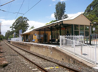
How to get to Kissing Point Road by train?
Click on the train route to see step by step directions with maps, line arrival times and updated time schedules.
Bus stations near Kissing Point Road in Ermington
- Stewart St Opp Lottie Stewart Hospital,2 min walk,
- Stewart St At Kissing Point Rd,3 min walk,
- Yates Ave At King St,5 min walk,
Bus lines to Kissing Point Road in Ermington
- 513,Carlingford to West Ryde via Dundas Valley,
- 521,Parramatta to Eastwood via Park Rd,
- 603W,St. Patricks, Dundas to Ryde Shops,
- 604W,St. Patricks, Dundas to Eastwood Station,
- 618W,Ryde Shops to Cumberland High School,
- 619W,St. Michaels, Meadowbank to West Ryde Station,
- 730W,Baulkham Hills HS to North Rocks Shopping Centre via Telopea & Carlingford,
- 601W,St. Patricks Dundas,
- 545,Macquarie Park,
What are the nearest stations to Kissing Point Road?
The nearest stations to Kissing Point Road are:
- Stewart St Opp Lottie Stewart Hospital is 131 meters away, 2 min walk.
- Stewart St At Kissing Point Rd is 203 meters away, 3 min walk.
- Yates Ave At King St is 309 meters away, 5 min walk.
Which bus line stops near Kissing Point Road?
520
Which train lines stop near Kissing Point Road?
These train lines stop near Kissing Point Road: T1, T6.
What’s the nearest bus stop to Kissing Point Road in Ermington?
The nearest bus stop to Kissing Point Road in Ermington is Stewart St Opp Lottie Stewart Hospital. It’s a 2 min walk away.
See Kissing Point Road, Ermington, on the map
Public Transit to Kissing Point Road in Ermington
Wondering how to get to Kissing Point Road in Ermington, Australia? Moovit helps you find the best way to get to Kissing Point Road with step-by-step directions from the nearest public transit station.
Moovit provides free maps and live directions to help you navigate through your city. View schedules, routes, timetables, and find out how long does it take to get to Kissing Point Road in real time.
Looking for the nearest stop or station to Kissing Point Road? Check out this list of stops closest to your destination: Stewart St Opp Lottie Stewart Hospital; Stewart St At Kissing Point Rd; Yates Ave At King St.
Bus:520513521603W604W618W601W545Train:T1T6
Want to see if there’s another route that gets you there at an earlier time? Moovit helps you find alternative routes or times. Get directions from and directions to Kissing Point Road easily from the Moovit App or Website.
We make riding to Kissing Point Road easy, which is why over 1.5 million users, including users in Ermington, trust Moovit as the best app for public transit. You don’t need to download an individual bus app or train app, Moovit is your all-in-one transit app that helps you find the best bus time or train time available.
For information on prices of bus and train, costs and ride fares to Kissing Point Road, please check the Moovit app.
Use the app to navigate to popular places including to the airport, hospital, stadium, grocery store, mall, coffee shop, school, college, and university.
Location: Ermington, Sydney
Attractions near Kissing Point Road
Little Zak's Academy,3,Wesley Tebbutt Lodge,Timor Barracks,26 Stewart Street,Mark Street,Dundas,BP Dundas,Bp,Brush Park Scout Hall,Seven Kings Pizzeria,Dundas Valley Soccer Club,Yates Avenue Public School,Vulcano Pizzeria & Restaurant,39 Delaware Road,Container Cafe,Dundas Valley Milk Bar,Curtis Oval,Florida Avenue,Singapore GourmetHow to get to popular attractions in Ermington with public transportation
Epping Station (Concourse), Epping (NSW),The Rose Hotel, Chippendale,Pontoon Bar, Sydney,Macarthur Station, Campbelltown (NSW),Mortdale Station, Mortdale,St Marys Station, St Marys (NSW),Quakers Hill Station, Quakers Hill,The Eight Modern Chinese Restaurant, Haymarket,Toko, Surry Hills,Macquarie Centre Shopping Centre, Macquarie Park,The Clock Hotel, Surry Hills,Central Station (Eddy Avenue Forecourt), Haymarket,Rouse Hill Town Centre, Rouse Hill,UNSW, Kensington (NSW),Westfield Warringah Mall, Brookvale,University Of Newcastle (Callaghan Campus), Callaghan,Goulburn, Goulburn,The Dolphin Hotel, Surry Hills,Circular Quay, No. 3 Wharf, Sydney,Helm Bar, SydneyGet around Ermington by public transport!
Travelling around Ermington has never been so easy. See step by step directions as you travel to any attraction, street or major public transport station. View bus and train timetables, arrival times, service alerts and detailed routes on a map, so you know exactly how to get to anywhere in Ermington.
When travelling to any destination around Ermington use Moovit's Live Directions with Get Off Notifications to know exactly where and how far to walk, how long to wait for your line , and how many stops are left. Moovit will alert you when it’s time to get off — no need to constantly re-check whether yours is the next stop.
Wondering how to use public transport in Ermington or how to pay for public transport in Ermington? Moovit public transport app can help you navigate your way with public transport easily, and at minimum cost. It includes public transport fees, ticket prices, and costs. Looking for a map of Ermington public transport lines? Moovit public transport app shows all public transport maps in Ermington with all bus or train routes and stops on an interactive map.
Ermington has 2 transport type(s), including: bus or train, operated by several transport agencies, including Sydney Metro, Sydney Trains, Sydney Light Rail, Sydney Ferries, Intercity Trains, Intercity Train, NSW TrainLink, CDC NSW R14, U-Go Mobility, Keolis Downer Northern Beaches, Manly Fast Ferry, Transdev John Holland Buses, Busways, Busways North West and Dysons Buslines