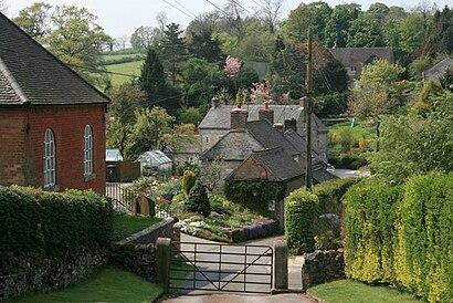
Directions to Kniveton (Derbyshire Dales) with public transport
The following transport lines have routes that pass near Kniveton
Directions to Kniveton (Derbyshire Dales) with public transport
The following transport lines have routes that pass near Kniveton
How to get to Kniveton by bus?
Click on the bus route to see step by step directions with maps, line arrival times and updated time schedules.
Bus lines to Kniveton in Derbyshire Dales
- 110,Ashbourne - Matlock,
- 111,Ashbourne - Matlock,
- 411,Parwich - Queen Elizabeth Grammar School,
What are the nearest stations to Kniveton?
The nearest stations to Kniveton are:
- Red Lion, Kniveton is 460 meters away, 6 min walk.
Which bus lines stop near Kniveton?
These bus lines stop near Kniveton: 110, 111.
What’s the nearest bus stop to Kniveton in Derbyshire Dales?
The nearest bus stop to Kniveton in Derbyshire Dales is Red Lion, Kniveton. It’s a 6 min walk away.
See Kniveton, Derbyshire Dales, on the map
Public Transit to Kniveton in Derbyshire Dales
Wondering how to get to Kniveton in Derbyshire Dales, United Kingdom? Moovit helps you find the best way to get to Kniveton with step-by-step directions from the nearest public transit station.
Moovit provides free maps and live directions to help you navigate through your city. View schedules, routes, timetables, and find out how long does it take to get to Kniveton in real time.
Looking for the nearest stop or station to Kniveton? Check out this list of stops closest to your destination: Red Lion.
Bus: 110, 111, 411.
Want to see if there’s another route that gets you there at an earlier time? Moovit helps you find alternative routes or times. Get directions from and directions to Kniveton easily from the Moovit App or Website.
We make riding to Kniveton easy, which is why over 1.5 million users, including users in Derbyshire Dales, trust Moovit as the best app for public transit. You don’t need to download an individual bus app or train app, Moovit is your all-in-one transit app that helps you find the best bus time or train time available.
For information on prices of bus, costs and ride fares to Kniveton, please check the Moovit app.
Use the app to navigate to popular places including to the airport, hospital, stadium, grocery store, mall, coffee shop, school, college, and university.
Location: Derbyshire Dales, East Midlands
Attractions near Kniveton
Kniveton Methodist Chapel,Red Lion Inn,Lester Lowe Ltd,St Michael'S,Kniveton Village Hall,Kniveton (Cofe) Primary School,The Ketch At Kineton,White House Farm,DE6 1,Standlow Farm Holiday cottages,Holly Cottage,Offcote Grange,Wigber Low,Parkston Stable,Offcote House Farm,Offcote House Farm,Peak District National Park,Hall Fields Farm,Valley View Barn,Trent Vor/DmeHow to get to popular attractions in Derbyshire Dales with public transportation
Holly Tree Farm, Nottingham,Nottingham Royal Concert Hall, Nottingham,Ferry Meadows, Peterborough,Boots D90 Staff Shop, Nottingham,NHS Walk In Centre, Nottingham,University Of Leicester, Leicester,Mam Tor,Eye, Ear, Nose and Throat, Nottingham,Leicester College (Abbey Park Campus), Leicester,Rolls-Royce, Derby,Attenborough Nature Reserve, Nottingham,Crown Court, Derby,John Port Spencer Academy,NN18, Corby,RAF College Cranwell, North Kesteven,Corby Urgent Care Centre , Corby,Giles Academy, Boston,Amazon-DNG1, North West Leicestershire,Rosebay Camping, Peterborough,Chesterfield College, ChesterfieldGet around East Midlands by public transport!
Travelling around East Midlands has never been so easy. See step by step directions as you travel to any attraction, street or major public transport station. View bus and train timetables, arrival times, service alerts and detailed routes on a map, so you know exactly how to get to anywhere in East Midlands.
When travelling to any destination around East Midlands use Moovit's Live Directions with Get Off Notifications to know exactly where and how far to walk, how long to wait for your line , and how many stops are left. Moovit will alert you when it’s time to get off — no need to constantly re-check whether yours is the next stop.
Wondering how to use public transport in East Midlands or how to pay for public transport in East Midlands? Moovit public transport app can help you navigate your way with public transport easily, and at minimum cost. It includes public transport fees, ticket prices, and costs. Looking for a map of East Midlands public transport lines? Moovit public transport app shows all public transport maps in East Midlands with all Bus, Train and Light rail routes and stops on an interactive map.
East Midlands has 3 transport type(s), including: Bus, Train and Light rail, operated by several transport agencies, including National Rail, Ashbourne Community Transport, Delaine Buses, Arriva Midlands, Centrebus, Our Centre, Hulleys of Baslow, D & G Bus, Stagecoach East Midlands, North Lincolnshire Council, Roberts Coaches, Lawson's of Corby, Hawkes Coaches, East Yorkshire, Soar Valley Community Bus