Directions to Kotara (Cardiff) with public transport
The following transport lines have routes that pass near Kotara
How to get to Kotara by bus?
Click on the bus route to see step by step directions with maps, line arrival times and updated time schedules.
How to get to Kotara by train?
Click on the train route to see step by step directions with maps, line arrival times and updated time schedules.
Bus stations near Kotara in Cardiff
- Charlestown Rd At Blackbutt Pde, 3 min walk,
- Myall Rd At Charlestown Rd, 4 min walk,
- Myall Rd Before Charlestown Rd, 5 min walk,
Bus lines to Kotara in Cardiff
- 11, Newcastle,
- 262, Cameron Park,
- 704, Charlestown,
- 763, Glendale HS,
- 781, Macquarie College,
- 841, Hunter Christian,
- 1511, Linuwel School,
- 2501, Bishop Tyrrell Coll,
- 44, Warners Bay,
- 264, Minmi,
- 734, Hunter School of Performing Arts,
- 776, St Thereses PS,
- 778, Kotara South,
- 858, Lakelands,
- 863, Charlestown,
What are the nearest stations to Kotara?
The nearest stations to Kotara are:
- Charlestown Rd At Blackbutt Pde is 190 meters away, 3 min walk.
- Myall Rd At Charlestown Rd is 301 meters away, 4 min walk.
- Myall Rd Before Charlestown Rd is 345 meters away, 5 min walk.
Which bus lines stop near Kotara?
These bus lines stop near Kotara: 11, 262, 44.
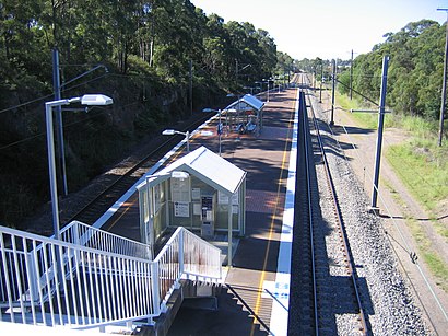
Which train line stops near Kotara?
CCN
What’s the nearest bus stop to Kotara in Cardiff?
The nearest bus stop to Kotara in Cardiff is Charlestown Rd At Blackbutt Pde. It’s a 3 min walk away.
See Kotara, Cardiff, on the map
Public Transit to Kotara in Cardiff
Wondering how to get to Kotara in Cardiff, Australia? Moovit helps you find the best way to get to Kotara with step-by-step directions from the nearest public transit station.
Moovit provides free maps and live directions to help you navigate through your city. View schedules, routes, timetables, and find out how long does it take to get to Kotara in real time.
Looking for the nearest stop or station to Kotara? Check out this list of stops closest to your destination: Charlestown Rd At Blackbutt Pde; Myall Rd At Charlestown Rd; Myall Rd Before Charlestown Rd.
Bus: 11, 262, 44, 704, 763, 781, 264, 734, 776, 778, 863.Train: CCN.
Want to see if there’s another route that gets you there at an earlier time? Moovit helps you find alternative routes or times. Get directions from and directions to Kotara easily from the Moovit App or Website.
We make riding to Kotara easy, which is why over 1.5 million users, including users in Cardiff, trust Moovit as the best app for public transit. You don’t need to download an individual bus app or train app, Moovit is your all-in-one transit app that helps you find the best bus time or train time available.
For information on prices of bus and train, costs and ride fares to Kotara, please check the Moovit app.
Use the app to navigate to popular places including to the airport, hospital, stadium, grocery store, mall, coffee shop, school, college, and university.
Location: Cardiff, Sydney
Attractions near Kotara
New Lambton,19 Blackbutt Parade,Tathra Reserve,Garden Suburb Public School,Carramar Park,Myall Road Bridge,Douglas R Murray and Jessica B Murray,Garden Suburb Community Hall,Garden Suburb Primary,Charlestown Road,Silverash Place,Peter Lewis,Hillsborough,Beulah Place,112 Kuranda Crescent,Lance Yorke Oval,Wall Close,Tathra Reserve,Let's Face It Skin and Laser Clinic,Campbell ReserveHow to get to popular attractions in Cardiff with public transportation
Bus Stop - M2 Motorway (Cropley Dr), Baulkham Hills,Narrandera, Narrandera,Bus Stop - M2 Motorway (Gooden Reserve), Winston Hills,Hyde Park Inn, Sydney,SAE institute, Sydney,Ropes Crossing, Ropes Crossing,Butter, Surry Hills,North Ryde RSL, North Ryde,227 Elizabeth Street, Sydney,Rozelle, Rozelle,Paddy's Market, Homebush West,Heffron Park, Maroubra,Hungry Jack's, Miranda (NSW),Pyrmont Bridge Hotel, Pyrmont,Cabarita Park, Cabarita (NSW),Freshwater Senior College, Curl Curl,Lyne Park, Rose Bay (NSW),Camelot Lounge, Marrickville,Ian Thorpe Aquatic Centre, Ultimo,The BOX on the Water, Ettalong BeachGet around Sydney by public transport!
Travelling around Sydney has never been so easy. See step by step directions as you travel to any attraction, street or major public transport station. View bus and train timetables, arrival times, service alerts and detailed routes on a map, so you know exactly how to get to anywhere in Sydney.
When travelling to any destination around Sydney use Moovit's Live Directions with Get Off Notifications to know exactly where and how far to walk, how long to wait for your line , and how many stops are left. Moovit will alert you when it’s time to get off — no need to constantly re-check whether yours is the next stop.
Wondering how to use public transport in Sydney or how to pay for public transport in Sydney? Moovit public transport app can help you navigate your way with public transport easily, and at minimum cost. It includes public transport fees, ticket prices, and costs. Looking for a map of Sydney public transport lines? Moovit public transport app shows all public transport maps in Sydney with all Bus, Train, Metro, Light rail and Ferry routes and stops on an interactive map.
Sydney has 5 transport type(s), including: Bus, Train, Metro, Light rail and Ferry, operated by several transport agencies, including Sydney Metro, Sydney Trains, Sydney Light Rail, Sydney Ferries, Intercity Trains, Intercity Train, NSW TrainLink, CDC NSW R14, U-Go Mobility, Keolis Downer Northern Beaches, Manly Fast Ferry, Transdev John Holland Buses, Busways, Busways North West, Dysons Buslines