Directions to Kwan Im Thong Hood Cho Temple (Singapore) with public transport
The following transport lines have routes that pass near Kwan Im Thong Hood Cho Temple
How to get to Kwan Im Thong Hood Cho Temple by bus?
Click on the bus route to see step by step directions with maps, line arrival times and updated time schedules.
How to get to Kwan Im Thong Hood Cho Temple by metro?
Click on the metro route to see step by step directions with maps, line arrival times and updated time schedules.
Bus stations near Kwan Im Thong Hood Cho Temple in Singapore
- Victoria St - Opp Bugis Stn Exit C (01112), 1 min walk,
- Victoria St - Aft Bugis Stn Exit C (01119), 2 min walk,
- Victoria St - Bugis Stn Exit A (01113), 3 min walk,
- Bencoolen St - Ibis S'Pore on Bencoolen (07517), 3 min walk,
- Middle Rd - Bef Waterloo St (07561), 3 min walk,
- Bencoolen St - Opp Nafa Campus 3 (07518), 3 min walk,
- Rochor Rd - Fu Lu Shou Cplx (07551), 4 min walk,
- Rochor Canal Rd - Rochor Stn (07531), 7 min walk,
- Lasalle Mcnally Campus, 8 min walk,
Metro stations near Kwan Im Thong Hood Cho Temple in Singapore
- Jalan Besar (DT22), 8 min walk,
- Bugis (EW12|DT14), 10 min walk,
- Bras Basah (CC2), 12 min walk,
Bus lines to Kwan Im Thong Hood Cho Temple in Singapore
- 7, Bedok Int ↔ Clementi Int,
- 12, Pasir Ris Int ↔ Kg Bahru Ter,
- 63, Eunos Int ↺ Jln Rumah Tinggi,
- 80, Sengkang Int ↔ HarbourFront Int,
- 175, Clementi Int ↔ Lor 1 Geylang Ter,
- 197, Bedok Int ↔ Jurong East Int,
- 851, Yishun Int ↔ Bt Merah Int,
- 960, Woodlands Int ↔ Marina Ctr Ter,
- 980, Sembawang Int ↔ Lor 1 Geylang Ter,
- 12E, Pasir Ris Int ↔ Kg Bahru Ter,
- 851E, Yishun Int ↔ New Bridge Road,
- 960E, Woodlands Int ↔ Marina Ctr Ter,
- 2, Kg Bahru Ter,
- 33, Kent Ridge Ter,
- 130, Shenton Way Ter,
- 133, Shenton Way Ter,
- 32, Bedok Int,
- 51, Hougang Ctrl Int,
- 61, Eunos Int,
- 145, Toa Payoh Int,
What are the nearest stations to Kwan Im Thong Hood Cho Temple?
The nearest stations to Kwan Im Thong Hood Cho Temple are:
- Victoria St - Opp Bugis Stn Exit C (01112) is 15 meters away, 1 min walk.
- Victoria St - Aft Bugis Stn Exit C (01119) is 92 meters away, 2 min walk.
- Victoria St - Bugis Stn Exit A (01113) is 167 meters away, 3 min walk.
- Bencoolen St - Ibis S'Pore on Bencoolen (07517) is 179 meters away, 3 min walk.
- Rochor Rd - Fu Lu Shou Cplx (07551) is 199 meters away, 4 min walk.
- Middle Rd - Bef Waterloo St (07561) is 200 meters away, 3 min walk.
- Bencoolen St - Opp Nafa Campus 3 (07518) is 210 meters away, 3 min walk.
- Rochor Canal Rd - Rochor Stn (07531) is 494 meters away, 7 min walk.
- Jalan Besar (DT22) is 577 meters away, 8 min walk.
- Lasalle Mcnally Campus is 591 meters away, 8 min walk.
- Bugis (EW12|DT14) is 720 meters away, 10 min walk.
- Bras Basah (CC2) is 894 meters away, 12 min walk.
Which bus lines stop near Kwan Im Thong Hood Cho Temple?
These bus lines stop near Kwan Im Thong Hood Cho Temple: 131, 147, 166, 175, 56, 61, 7, 80, 851, 857, 980.
Which metro lines stop near Kwan Im Thong Hood Cho Temple?
These metro lines stop near Kwan Im Thong Hood Cho Temple: DOWNTOWN LINE, EAST WEST LINE.
What’s the nearest metro station to Kwan Im Thong Hood Cho Temple in Singapore?
The nearest metro station to Kwan Im Thong Hood Cho Temple in Singapore is Jalan Besar (DT22). It’s a 8 min walk away.
What’s the nearest bus stop to Kwan Im Thong Hood Cho Temple in Singapore?
The nearest bus stop to Kwan Im Thong Hood Cho Temple in Singapore is Victoria St - Opp Bugis Stn Exit C (01112). It’s a 1 min walk away.
What time is the first metro to Kwan Im Thong Hood Cho Temple in Singapore?
The CIRCLE LINE is the first metro that goes to Kwan Im Thong Hood Cho Temple in Singapore. It stops nearby at 06:07.
What time is the last metro to Kwan Im Thong Hood Cho Temple in Singapore?
The DOWNTOWN LINE is the last metro that goes to Kwan Im Thong Hood Cho Temple in Singapore. It stops nearby at 00:54.
What time is the first bus to Kwan Im Thong Hood Cho Temple in Singapore?
The 170 is the first bus that goes to Kwan Im Thong Hood Cho Temple in Singapore. It stops nearby at 05:21.
What time is the last bus to Kwan Im Thong Hood Cho Temple in Singapore?
The 51 is the last bus that goes to Kwan Im Thong Hood Cho Temple in Singapore. It stops nearby at 00:50.
See Kwan Im Thong Hood Cho Temple, Singapore, on the map
Public Transit to Kwan Im Thong Hood Cho Temple in Singapore
Wondering how to get to Kwan Im Thong Hood Cho Temple in Singapore, Singapore? Moovit helps you find the best way to get to Kwan Im Thong Hood Cho Temple with step-by-step directions from the nearest public transit station.
Moovit provides free maps and live directions to help you navigate through your city. View schedules, routes, timetables, and find out how long does it take to get to Kwan Im Thong Hood Cho Temple in real time.
Looking for the nearest stop or station to Kwan Im Thong Hood Cho Temple? Check out this list of stops closest to your destination: Victoria St - Opp Bugis Stn Exit C (01112); Victoria St - Aft Bugis Stn Exit C (01119); Victoria St - Bugis Stn Exit A (01113); Bencoolen St - Ibis S'Pore on Bencoolen (07517); Rochor Rd - Fu Lu Shou Cplx (07551); Middle Rd - Bef Waterloo St (07561); Bencoolen St - Opp Nafa Campus 3 (07518); Rochor Canal Rd - Rochor Stn (07531); Jalan Besar (DT22); Lasalle Mcnally Campus; Bugis (EW12|DT14); Bras Basah (CC2).
Bus: 131, 147, 166, 175, 56, 61, 7, 80, 851, 857, 980, 12, 63, 2, 33, 130, 133, 32, 51, 145.Metro: DOWNTOWN LINE, EAST WEST LINE, CIRCLE LINE.
Want to see if there’s another route that gets you there at an earlier time? Moovit helps you find alternative routes or times. Get directions from and directions to Kwan Im Thong Hood Cho Temple easily from the Moovit App or Website.
We make riding to Kwan Im Thong Hood Cho Temple easy, which is why over 1.5 million users, including users in Singapore, trust Moovit as the best app for public transit. You don’t need to download an individual bus app or train app, Moovit is your all-in-one transit app that helps you find the best bus time or train time available.
For information on prices of bus, metro and MRT & LRT, costs and ride fares to Kwan Im Thong Hood Cho Temple, please check the Moovit app.
Use the app to navigate to popular places including to the airport, hospital, stadium, grocery store, mall, coffee shop, school, college, and university.
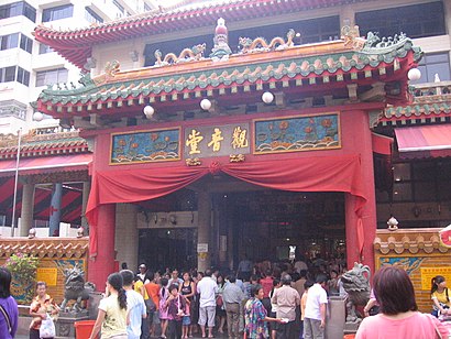
Kwan Im Thong Hood Cho Temple Address: 178 Waterloo St. street in Singapore
Attractions near Kwan Im Thong Hood Cho Temple
Tian Teck Tua 天德,四马路观音堂,步步高脚底按摩,龟苓膏@四马路,Queen Street Trading Pte Ltd,星洲神佛用品超级市场,Shanks Consulting (S) Pte LTD (Like Minds Consulting Pte. LTD.),Teviron Marketing (Kyodo Marketing Pte LTD),South East Asia Hotel,Sparq Solutions,Petbee Pte. LTD.,Far East Aluminium Works (Singapore) Pte. LTD.,Novoglobe Pte. LTD.,Tse Seng Kee (S) Pte. LTD.,Haka Maritime,Frontier Asia Shipping & Transportation Pte. LTD.,Xplod Enterprise,Claud Declarice Pte. LTD.,Vinc Vita Mining Corporation Pte. LTD.,J.A Brothers Pte. LTD.How to get to popular attractions in Singapore with public transportation
Shangri-La Hotel, Singapore,Kim Hock Corporation Pte Ltd, Southwest,Sunshine Court Blk 476B, Choa Chu Kang Avenue 5, Southwest,Senior Citizen Corner, Southwest,Singapore University Of Social Sciences (Suss), Northwest,Yakult Factory, Northwest,Tengah airbase skyhawk, Southwest,Deleon's House😉, Southwest,Chinatown Complex, Singapore,Comtech Centre, B1 Foodcourt, Southwest,LTA Vehicle & Transit Licensing Div, Singapore,4 Kian Teck Ave, Southwest,Sembawang Camp Guardroom, Northwest,Springdale Condominium, Northwest,Rang Mahal Pavilion, Southwest,Church Of the Nativity Of the Blessed Virgin Mary, Northeast,Alexandra Technopark Block B, Southwest,Marina Bay Financial Centre Tower 3, Singapore,HTA Guardhouse, Southwest,Enterprise Road, SouthwestGet around Singapore by public transport!
Travelling around Singapore has never been so easy. See step by step directions as you travel to any attraction, street or major public transport station. View bus and train timetables, arrival times, service alerts and detailed routes on a map, so you know exactly how to get to anywhere in Singapore.
When travelling to any destination around Singapore use Moovit's Live Directions with Get Off Notifications to know exactly where and how far to walk, how long to wait for your line , and how many stops are left. Moovit will alert you when it’s time to get off — no need to constantly re-check whether yours is the next stop.
Wondering how to use public transport in Singapore or how to pay for public transport in Singapore? Moovit public transport app can help you navigate your way with public transport easily, and at minimum cost. It includes public transport fees, ticket prices, and costs. Looking for a map of Singapore public transport lines? Moovit public transport app shows all public transport maps in Singapore with all Bus, Train, Metro, MRT & LRT, Ferry and Cable Car routes and stops on an interactive map.
Singapore has 6 transport type(s), including: Bus, Train, Metro, MRT & LRT, Ferry and Cable Car, operated by several transport agencies, including SMRT, SBS Transit, MRT/LRT Replacement Services, Tower Transit, Go-Ahead Singapore, Premium Bus, City Direct Bus, Changi Airport, Sentosa Development Corporation, Cross Border Bus, Singapore Cable Car Network, NUS Shuttle (ComfortDelGro), NTU Shuttle (ComfortDelGro), JTC Corp, Shuttle Bus (Appx. Schedule)