Directions to Largs Station with public transportation
The following transport lines have routes that pass near Largs Station
How to get to Largs Station by bus?
Click on the bus route to see step by step directions with maps, line arrival times and updated time schedules.
How to get to Largs Station by train?
Click on the train route to see step by step directions with maps, line arrival times and updated time schedules.
Train stations near Largs Station
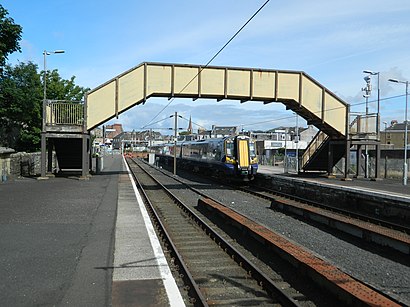
- Largs, 1 min walk,
Bus stops near Largs Station
- Crawford Street, Largs, 1 min walk,
- Manse Court, Largs, 3 min walk,
Ferry stations near Largs Station
- Largs Ferry Terminal, Largs, 5 min walk,
Bus routes to Largs Station
- 40, local service - Largs,
- 252, Arbroath - Largs,
- 253, Forfar - Largs,
- 576, Greenock - Largs,
- 578, Greenock - Largs,
- 585A, Largs, Brisbane Glen - Stevenston, Golf Avenue,
- 901, Largs - Glasgow,
- 906, Largs - Glasgow,
- 906X, Largs - Glasgow,
- 50, Kilwinning,
- 260, Largs,
- 585, Ayr,
- 904, Johnstone,
What are the nearest stations to Largs Station?
The nearest stations to Largs Station are:
- Largs is 11 meters away, 1 min walk.
- Crawford Street, Largs is 61 meters away, 1 min walk.
- Manse Court, Largs is 152 meters away, 3 min walk.
- Largs Ferry Terminal, Largs is 302 meters away, 5 min walk.
Which bus lines stop near Largs Station?
These bus lines stop near Largs Station: 585, 901, 904, 906.
Which train line stops near Largs Station?
SCOTRAIL
What’s the nearest train station to Largs Station?
The nearest train station to Largs Station is Largs. It’s a 1 min walk away.
What’s the nearest bus stop to Largs Station?
The nearest bus stop to Largs Station is Crawford Street, Largs. It’s a 1 min walk away.
What’s the nearest ferry station to Largs Station?
The nearest ferry station to Largs Station is Largs Ferry Terminal, Largs. It’s a 5 min walk away.
What time is the first train to Largs Station?
The SCOTRAIL is the first train that goes to Largs Station. It stops nearby at 06:35.
What time is the last train to Largs Station?
The SCOTRAIL is the last train that goes to Largs Station. It stops nearby at 23:48.
What time is the first bus to Largs Station?
The 901 is the first bus that goes to Largs Station. It stops nearby at 06:30.
What time is the last bus to Largs Station?
The 578 is the last bus that goes to Largs Station. It stops nearby at 00:00.
What time is the first ferry to Largs Station?
The CM7 is the first ferry that goes to Largs Station. It stops nearby at 06:45.
What time is the last ferry to Largs Station?
The CM7 is the last ferry that goes to Largs Station. It stops nearby at 20:40.
See Largs Station on the map
Public Transportation to Largs Station
Wondering how to get to Largs Station, United Kingdom? Moovit helps you find the best way to get to Largs Station with step-by-step directions from the nearest public transit station.
Moovit provides free maps and live directions to help you navigate through your city. View schedules, routes, timetables, and find out how long does it take to get to Largs Station in real time.
Looking for the nearest stop or station to Largs Station? Check out this list of stops closest to your destination: Largs; Crawford Street; Manse Court; Largs Ferry Terminal.
Bus: 585, 901, 904, 906, 40, 252, 253, 576, 578, 50, 260.Train: SCOTRAIL.Ferry: CM7.
Want to see if there’s another route that gets you there at an earlier time? Moovit helps you find alternative routes or times. Get directions from and directions to Largs Station easily from the Moovit App or Website.
We make riding to Largs Station easy, which is why over 1.5 million users, including users in Largs, trust Moovit as the best app for public transit. You don’t need to download an individual bus app or train app, Moovit is your all-in-one transit app that helps you find the best bus time or train time available.
For information on prices of bus and train, costs and ride fares to Largs Station, please check the Moovit app.
Use the app to navigate to popular places including to the airport, hospital, stadium, grocery store, mall, coffee shop, school, college, and university.
Largs Station Address: Crawford Street Largs Largs KA30 8 street in Largs
Attractions near Largs Station
Largs Railway Station,Vape Shop,Sublime Exclusive Beauty & Lifestyle,Gogo Street, Largs,Largs Hardware & Gallery Eight,Think It Through Therapy,Largs Counselling & Therapy Centre,Thomas Cook Travel Shop,The Bakers Oven,M&Co,Semichem,Mamo,Scotmid,Russell Architecture Limited,K C Pet Supplies,Robert Nathan,Eyeglass Opticians,Clark Memorial Parish Church,Mobile Phone Center,Burnlea Nursing Care HomeHow to get to popular attractions in Largs with public transportation
World's End, Edinburgh,East Kilbride Shopping Centre, East Kilbride,Drumgelloch Railway Station (DRU), Airdrie,Ninewells Hospital, Dundee,Partick Railway Station (PTK), Glasgow,Perth Railway Station (PTH), Perth,Tesco Extra, Edinburgh,Airlink Bus Stop | Edinburgh Airport, Ratho Station,Dundee Railway Station (DEE), Dundee,Starbucks, Edinburgh,Shawlands, Glasgow,Starbucks, Edinburgh,Crossmyloof Railway Station (CMY), Glasgow,Glasgow Central Railway Station (GLC), Glasgow,Tesco, Aberdeen,Buchanan Bus Station, Glasgow,Scottish National Gallery, Edinburgh,Corstorphine, Edinburgh,Glasgow Airport, Paisley,Royal Infirmary Of Edinburgh (Little France), City Of EdinburghGet around Scotland by public transport!
Travelling around Scotland has never been so easy. See step by step directions as you travel to any attraction, street or major public transport station. View bus and train timetables, arrival times, service alerts and detailed routes on a map, so you know exactly how to get to anywhere in Scotland.
When travelling to any destination around Scotland use Moovit's Live Directions with Get Off Notifications to know exactly where and how far to walk, how long to wait for your line , and how many stops are left. Moovit will alert you when it’s time to get off — no need to constantly re-check whether yours is the next stop.
Wondering how to use public transport in Scotland or how to pay for public transport in Scotland? Moovit public transport app can help you navigate your way with public transport easily, and at minimum cost. It includes public transport fees, ticket prices, and costs. Looking for a map of Scotland public transport lines? Moovit public transport app shows all public transport maps in Scotland with all Bus, Train, Light rail and Ferry routes and stops on an interactive map.
Scotland has 4 transport type(s), including: Bus, Train, Light rail and Ferry, operated by several transport agencies, including First Greater Glasgow, First Aberdeen, Lothian Buses, McGill's Bus Service, Stagecoach East Scotland, Stagecoach Bluebird, Xplore Dundee, Community Transport Glasgow, Prentice Westwood, McCall's Coaches, J P Minibus, National Rail, R Robertson & Son, Burnbrae Garage, Ember