Directions to Leeds Bradford Airport with public transportation
The following transport lines have routes that pass near Leeds Bradford Airport
How to get to Leeds Bradford Airport by bus?
Click on the bus route to see step by step directions with maps, line arrival times and updated time schedules.
Bus stations near Leeds Bradford Airport
- Leeds Bradford International Airport,3 min walk,
- Bayton Lane Jct,7 min walk,
Train stations near Leeds Bradford Airport
- Horsforth,53 min walk,
Bus routes to Leeds Bradford Airport
- A1,Leeds Bradford Airport,
- A2,Harrogate,
- A3,Bradford City Centre,
- 27,Headingley,
- 34,Guiseley,
What are the nearest stations to Leeds Bradford Airport?
The nearest stations to Leeds Bradford Airport are:
- Leeds Bradford International Airport is 31 meters away, 3 min walk.
- Bayton Lane Jct is 537 meters away, 7 min walk.
- Horsforth is 4099 meters away, 53 min walk.
Which bus lines stop near Leeds Bradford Airport?
These bus lines stop near Leeds Bradford Airport: A1, A2, A3.
What’s the nearest bus stop to Leeds Bradford Airport?
The nearest bus stop to Leeds Bradford Airport is Leeds Bradford International Airport. It’s a 3 min walk away.
What time is the first train to Leeds Bradford Airport?
The NORTHERN is the first train that goes to Leeds Bradford Airport. It stops nearby at 09:17.
What time is the last train to Leeds Bradford Airport?
The NORTHERN is the last train that goes to Leeds Bradford Airport. It stops nearby at 23:43.
What time is the first bus to Leeds Bradford Airport?
The A2 is the first bus that goes to Leeds Bradford Airport. It stops nearby at 06:12.
What time is the last bus to Leeds Bradford Airport?
The A1 is the last bus that goes to Leeds Bradford Airport. It stops nearby at 23:15.
See Leeds Bradford Airport on the map
Public Transportation to Leeds Bradford Airport
Wondering how to get to Leeds Bradford Airport, United Kingdom? Moovit helps you find the best way to get to Leeds Bradford Airport with step-by-step directions from the nearest public transit station.
Moovit provides free maps and live directions to help you navigate through your city. View schedules, routes, timetables, and find out how long does it take to get to Leeds Bradford Airport in real time.
Looking for the nearest stop or station to Leeds Bradford Airport? Check out this list of stops closest to your destination: Leeds Bradford International Airport; Bayton Lane Jct; Horsforth.
Bus:A1A2A32734Train:LONDON NORTH EASTERN RAILWAYNORTHERN
Want to see if there’s another route that gets you there at an earlier time? Moovit helps you find alternative routes or times. Get directions from and directions to Leeds Bradford Airport easily from the Moovit App or Website.
We make riding to Leeds Bradford Airport easy, which is why over 1.5 million users, including users in Leeds, trust Moovit as the best app for public transit. You don’t need to download an individual bus app or train app, Moovit is your all-in-one transit app that helps you find the best bus time or train time available.
For information on prices of bus, costs and ride fares to Leeds Bradford Airport, please check the Moovit app.
Use the app to navigate to popular places including to the airport, hospital, stadium, grocery store, mall, coffee shop, school, college, and university.
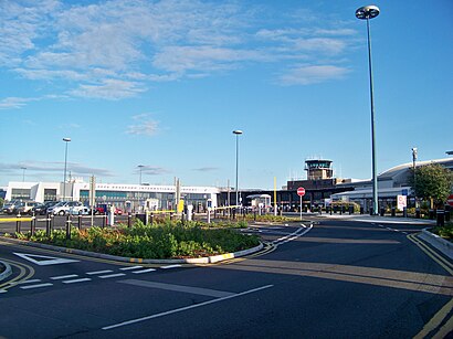
Leeds Bradford Airport Address: Leeds Bradford Airport (LBA), Whitehouse Ln, Yeadon, Leeds LS19 7TU, UK street in Leeds
Popular routes to Leeds Bradford Airport
Attractions near Leeds Bradford Airport
Ls19 7tu,Lba WDF Main,Leeds Bradford International Airport (LBA),Budget Car Hire,Leeds Bradford Airport Free Shuttle Bus,GREGGS,Complete Care Agency,Salitaire,757 Bus,Leeds Bradford Airport 1,Sentinel Airport Parking Shuttle,Sental Car Park Shuttle,Leeds Bradford Yorkshire's Airport - Pick Up & Drop Off,Jet2.com & Jet2holidays Head Office,Premium Short Stay Parking,Multiflight Limited,Multiflight Hangar 2,Yeadon,The Aviation Academy,Plane Spotting Leeds Bradford Airport CafeHow to get to popular attractions in Leeds with public transportation
Murgatroyds Fish & Chips, Leeds,Toby Carvery, Leeds,Lincoln Wing - A Block Entrance, Leeds,York Designer Outlet, Fulford,Travelodge Scarborough St Nicholas Hotel, Scarborough,Skipton Market, Skipton,Norwood Post Office, Sheffield,Lindholme Prison, Lindholme, Hatfield,MORRISONS, Harrogate,magnolia centre york hospital, York,Meanwood Health Centre, Leeds,Allerton Grange School, Leeds,Odeon, Bradford,Hull New Theatre, Hull,Holiday Inn Express Leeds - City Centre, Leeds,Parkgate, Rotherham,University Of Leeds Bodington Playing Fields, Leeds,Oulton Hall, Leeds,Cedar Court Hotel Huddersfield, Halifax,Spen Valley High School, HeckmondwikeGet around Leeds by public transport!
Travelling around Leeds has never been so easy. See step by step directions as you travel to any attraction, street or major public transport station. View bus and train timetables, arrival times, service alerts and detailed routes on a map, so you know exactly how to get to anywhere in Leeds.
When travelling to any destination around Leeds use Moovit's Live Directions with Get Off Notifications to know exactly where and how far to walk, how long to wait for your line , and how many stops are left. Moovit will alert you when it’s time to get off — no need to constantly re-check whether yours is the next stop.
Wondering how to use public transport in Leeds or how to pay for public transport in Leeds? Moovit public transport app can help you navigate your way with public transport easily, and at minimum cost. It includes public transport fees, ticket prices, and costs. Looking for a map of Leeds public transport lines? Moovit public transport app shows all public transport maps in Leeds with all bus routes and stops on an interactive map.
Leeds has 1 transport type(s), including: bus, operated by several transport agencies, including First Leeds, First South Yorkshire, First York, Arriva Yorkshire, Stagecoach Yorkshire, National Rail, First Bradford, First Halifax, Calder Valley & Huddersfield, East Yorkshire, The Keighley Bus Company, South Yorkshire Future Tram, The Harrogate Bus Company, National Rail, TM Travel and Coastliner