Directions to Leeds Playhouse with public transportation
The following transport lines have routes that pass near Leeds Playhouse
How to get to Leeds Playhouse by bus?
Click on the bus route to see step by step directions with maps, line arrival times and updated time schedules.
How to get to Leeds Playhouse by train?
Click on the train route to see step by step directions with maps, line arrival times and updated time schedules.
Bus stations near Leeds Playhouse
- Leeds City,4 min walk,
- Cultural E,4 min walk,
- Cultural G,4 min walk,
- Leeds Dyer Street Coach Station,4 min walk,
- Victoria D,4 min walk,
- Cultural C,4 min walk,
- Victoria C,4 min walk,
- Cultural D,4 min walk,
- Victoria G,5 min walk,
- Victoria A,5 min walk,
- Kirkgate High Court,7 min walk,
Train stations near Leeds Playhouse
- Leeds,64 min walk,
Bus routes to Leeds Playhouse
- A1,Leeds,
- 6,Leeds,
- X6,Leeds - Bradford,
- 7,Leeds - Harrogate,
- 8,Leeds,
- 11,Leeds,
- M20,Belgravia - Glasgow,
- 27,Leeds,
- 28,Leeds,
- 33,Leeds,
- 34,Leeds - Otley,
- 36,Ripon - Leeds,
- 60,Keighley - Leeds,
- 60A,Leeds - Keighley,
- 62,Leeds,
- M65,Belgravia - Sheffield,
- M66,Belgravia - Leeds,
- 72,Leeds - Bradford,
- M72,Newcastle Upon Tyne District ( - Belgravia,
- M76,Belgravia - Leeds,
What are the nearest stations to Leeds Playhouse?
The nearest stations to Leeds Playhouse are:
- Leeds City is 188 meters away, 4 min walk.
- Cultural E is 214 meters away, 4 min walk.
- Cultural G is 219 meters away, 4 min walk.
- Leeds Dyer Street Coach Station is 241 meters away, 4 min walk.
- Victoria D is 244 meters away, 4 min walk.
- Cultural C is 259 meters away, 4 min walk.
- Victoria C is 265 meters away, 4 min walk.
- Cultural D is 273 meters away, 4 min walk.
- Victoria G is 297 meters away, 5 min walk.
- Victoria A is 342 meters away, 5 min walk.
- Kirkgate High Court is 488 meters away, 7 min walk.
- Leeds is 4955 meters away, 64 min walk.
Which bus lines stop near Leeds Playhouse?
These bus lines stop near Leeds Playhouse: 19A, 201, 229, 28, 52, 60A, A1, X6.
Which train lines stop near Leeds Playhouse?
These train lines stop near Leeds Playhouse: NORTHERN, TRANSPENNINE EXPRESS.
What’s the nearest bus stop to Leeds Playhouse?
The nearest bus stops to Leeds Playhouse are Leeds City, Cultural E, Cultural G, Leeds Dyer Street Coach Station, Victoria D, Cultural C, Victoria C and Cultural D. The closest one is a 4 min walk away.
What time is the first train to Leeds Playhouse?
The TRANSPENNINE EXPRESS is the first train that goes to Leeds Playhouse. It stops nearby at 03:34.
What time is the last train to Leeds Playhouse?
The TRANSPENNINE EXPRESS is the last train that goes to Leeds Playhouse. It stops nearby at 04:17.
What time is the first bus to Leeds Playhouse?
The M20 is the first bus that goes to Leeds Playhouse. It stops nearby at 03:05.
What time is the last bus to Leeds Playhouse?
The N02 is the last bus that goes to Leeds Playhouse. It stops nearby at 06:15.
See Leeds Playhouse on the map
Public Transportation to Leeds Playhouse
Wondering how to get to Leeds Playhouse, United Kingdom? Moovit helps you find the best way to get to Leeds Playhouse with step-by-step directions from the nearest public transit station.
Moovit provides free maps and live directions to help you navigate through your city. View schedules, routes, timetables, and find out how long does it take to get to Leeds Playhouse in real time.
Looking for the nearest stop or station to Leeds Playhouse? Check out this list of stops closest to your destination: Leeds City; Cultural E; Cultural G; Leeds Dyer Street Coach Station; Victoria D; Cultural C; Victoria C; Cultural D; Victoria G; Victoria A; Kirkgate High Court; Leeds.
Bus:19A201229285260AA1X667844F55A1674444446171465383951Train:NORTHERNTRANSPENNINE EXPRESSCROSSCOUNTRYLONDON NORTH EASTERN RAILWAY
Want to see if there’s another route that gets you there at an earlier time? Moovit helps you find alternative routes or times. Get directions from and directions to Leeds Playhouse easily from the Moovit App or Website.
We make riding to Leeds Playhouse easy, which is why over 1.5 million users, including users in Leeds, trust Moovit as the best app for public transit. You don’t need to download an individual bus app or train app, Moovit is your all-in-one transit app that helps you find the best bus time or train time available.
For information on prices of bus and train, costs and ride fares to Leeds Playhouse, please check the Moovit app.
Use the app to navigate to popular places including to the airport, hospital, stadium, grocery store, mall, coffee shop, school, college, and university.
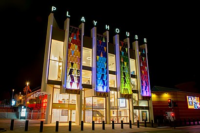
Leeds Playhouse Address: St Peters Street street in Leeds
Attractions near Leeds Playhouse
Aagrah Leeds city centre,Playhouse Gardens,Bus Stn (Stand 21), Leeds,BBC Radio Leeds,Leeds Conservatoire,LS9 8AH,840 Thornton Le Dale,Boom Battle Bar Leeds,The Wardrobe,MODA NY Square,Leeds City College, Quarry Hill Campus,Estabulo Rodizio Bar & Grill,Hsbc,Miishe African Music and Dance,Amazon Locker - Noodle,John Lewis,Yorkshire Coastliner,Ls2 7la,Leeds Coach Station National Express Terminal,Leeds City Bus StationHow to get to popular attractions in Leeds with public transportation
Fitzalan Square Tram Stop, Sheffield,St James's Hospital A&E, Leeds,Dinnington Interchange, Dinnington St. John's,Castle Square Tram Stop, Sheffield,Wybourn, Sheffield,Yorkshire Ambulance Service HQ, Wakefield,West Vale, Halifax,Moor Allerton, Leeds,Tesco, Hull,Supertram - Yellow Route: Meadowhall via City Centre to Middlewood, Sheffield,New College Pontefract, Pontefract,Quarry House, Leeds,Cleckheaton, Heckmondwike,Cottingley Towers, Leeds,Morrisons Head Office, Bradford,Ecclesfield School, Ecclesfield,The Postern Gate (Wetherspoon), York,Cineworld, Hull,Asda, Morley,Dewsbury & District Hospital, HeckmondwikeGet around Leeds by public transport!
Travelling around Leeds has never been so easy. See step by step directions as you travel to any attraction, street or major public transport station. View bus and train timetables, arrival times, service alerts and detailed routes on a map, so you know exactly how to get to anywhere in Leeds.
When travelling to any destination around Leeds use Moovit's Live Directions with Get Off Notifications to know exactly where and how far to walk, how long to wait for your line , and how many stops are left. Moovit will alert you when it’s time to get off — no need to constantly re-check whether yours is the next stop.
Wondering how to use public transport in Leeds or how to pay for public transport in Leeds? Moovit public transport app can help you navigate your way with public transport easily, and at minimum cost. It includes public transport fees, ticket prices, and costs. Looking for a map of Leeds public transport lines? Moovit public transport app shows all public transport maps in Leeds with all bus or train routes and stops on an interactive map.
Leeds has 2 transport type(s), including: bus or train, operated by several transport agencies, including First Leeds, First South Yorkshire, First York, Arriva Yorkshire, Stagecoach Yorkshire, National Rail, First Bradford, First Halifax, Calder Valley & Huddersfield, East Yorkshire, The Keighley Bus Company, South Yorkshire Future Tram, The Harrogate Bus Company, National Rail, TM Travel and Coastliner