Directions to Leicester with public transportation
The following transport lines have routes that pass near Leicester
How to get to Leicester by bus?
Click on the bus route to see step by step directions with maps, line arrival times and updated time schedules.
How to get to Leicester by train?
Click on the train route to see step by step directions with maps, line arrival times and updated time schedules.
Bus stations near Leicester
- Nelson Mandela Park, Leicester (3), 6 min walk,
- Regent Road, Southfields, 6 min walk,
Bus routes to Leicester
- HOP!, Leuicester: Haymarket - St Nicholas Circle - Royal Infirmary - Station,
- 20, Blackmore Drive - Leicester City Centre,
- 83, Leicester - Aylestone Via Clarendon Park & University,
- 83A, Leicester - Clarendon Park - Fosse Road South,
- 84, Leicester - Blaby - Broughton Astley - Lutterworth,
- X84, Leicester - Lutterworth - Rugby,
- 85, Leicester - South Wigston,
- 87, Leicester - Eyres Monsell,
- 48, Leicester,
- 47, Leicester,
What are the nearest stations to Leicester?
The nearest stations to Leicester are:
- Nelson Mandela Park, Leicester (3) is 405 meters away, 6 min walk.
- Regent Road, Southfields is 406 meters away, 6 min walk.
Which bus lines stop near Leicester?
These bus lines stop near Leicester: 22B, 54A, 84, X6.
Which train line stops near Leicester?
EAST MIDLANDS TRAINS
What’s the nearest bus stop to Leicester?
The nearest bus stops to Leicester are Nelson Mandela Park, Leicester (3) and Regent Road, Southfields. The closest one is a 6 min walk away.
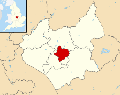
See Leicester on the map
Public Transportation to Leicester
Wondering how to get to Leicester, United Kingdom? Moovit helps you find the best way to get to Leicester with step-by-step directions from the nearest public transit station.
Moovit provides free maps and live directions to help you navigate through your city. View schedules, routes, timetables, and find out how long does it take to get to Leicester in real time.
Looking for the nearest stop or station to Leicester? Check out this list of stops closest to your destination: Nelson Mandela Park; Regent Road.
Bus: 22B, 54A, 84, X6, 48, 47, HOP!, 20, 83, 83A.Train: EAST MIDLANDS TRAINS.
Want to see if there’s another route that gets you there at an earlier time? Moovit helps you find alternative routes or times. Get directions from and directions to Leicester easily from the Moovit App or Website.
We make riding to Leicester easy, which is why over 1.5 million users, including users in Leicester, trust Moovit as the best app for public transit. You don’t need to download an individual bus app or train app, Moovit is your all-in-one transit app that helps you find the best bus time or train time available.
For information on prices of bus and train, costs and ride fares to Leicester, please check the Moovit app.
Use the app to navigate to popular places including to the airport, hospital, stadium, grocery store, mall, coffee shop, school, college, and university.
Leicester Address: Leicester street in Leicester
Attractions near Leicester
Le1 7ha,Opal Court,Ajs Food Bar,AJ's Opal Court,Opal Court Laundry Room,Subway,Medical Library,SUBWAY,Le1 7bb,LE1 7BB,Le87 2bb,Le87 2fp,Global Payments,Central Fire & Rescue Station,University of Leicester School of Law,HSBC Direct,Le1 7hb,Lancaster Road,Le1 9qg,CrfHow to get to popular attractions in Leicester with public transportation
Thrapston, East Northamptonshire,Colwick Hall Hotel, Nottingham,Wyvern Retail Park, Derby,Nottingham Forest Training Ground, Rushcliffe,Billing Aquadrome, Northampton,Red Kangaroo, Nottingham,Bridgford Garden Centre, Rushcliffe,Wollaton Hall, Nottingham,Peterborough Crown Court, Peterborough,Derby County FC, Derby,Park Farm Shopping Centre, Derby,Derby Station Pride Park Car Park, Derby,Donington Park, North West Leicestershire,Nuffield Health Derby Hospital, Derby,Nottingham Railway Station (Nottingham Railway Station (Stop S1), Nottingham), Nottingham,Meridian Business Park, Blaby,Gedling Crematorium, Gedling,Eye Kettleby Lakes, Melton,Matlock Bath, Derbyshire Dales,Nottingham Rugby Club, RushcliffeGet around East Midlands by public transport!
Travelling around East Midlands has never been so easy. See step by step directions as you travel to any attraction, street or major public transport station. View bus and train timetables, arrival times, service alerts and detailed routes on a map, so you know exactly how to get to anywhere in East Midlands.
When travelling to any destination around East Midlands use Moovit's Live Directions with Get Off Notifications to know exactly where and how far to walk, how long to wait for your line , and how many stops are left. Moovit will alert you when it’s time to get off — no need to constantly re-check whether yours is the next stop.
Wondering how to use public transport in East Midlands or how to pay for public transport in East Midlands? Moovit public transport app can help you navigate your way with public transport easily, and at minimum cost. It includes public transport fees, ticket prices, and costs. Looking for a map of East Midlands public transport lines? Moovit public transport app shows all public transport maps in East Midlands with all Bus, Train and Light rail routes and stops on an interactive map.
East Midlands has 3 transport type(s), including: Bus, Train and Light rail, operated by several transport agencies, including National Rail, Ashbourne Community Transport, Delaine Buses, Arriva Midlands, Centrebus, Our Centre, Hulleys of Baslow, D & G Bus, Stagecoach East Midlands, North Lincolnshire Council, Roberts Coaches, Lawson's of Corby, Hawkes Coaches, East Yorkshire, Soar Valley Community Bus