See Leicester Cathedral on the map
Directions to Leicester Cathedral with public transportation
The following transport lines have routes that pass near Leicester Cathedral
 Bus:
Bus: - Train:
How to get to Leicester Cathedral by bus?
Click on the bus route to see step by step directions with maps, line arrival times and updated time schedules.
How to get to Leicester Cathedral by train?
Click on the train route to see step by step directions with maps, line arrival times and updated time schedules.
Bus stations near Leicester Cathedral
- Southgates, Leicester,3 min walk,
- St Nicholas Circle, Leicester,3 min walk,
- Pocklingtons Walk, Leicester,5 min walk,
- Town Hall Square, Leicester,5 min walk,
- Causeway Lane, Leicester,7 min walk,
Bus routes to Leicester Cathedral
- HOP!,Leicester,
- HH|HOSPITAL HOPPER,Beaumont Leys,
- 103,Leicester,
- NOVUS DIRECT,Leicester,
- 104,Fosse Park,
- 203,Enderby,
- TZ1,Leicester - Twycross Zoo,
- 13,St Margarets Bus Stn - St Margarets Bus Stn,
- 18,St Margarets Bus Stn - Peverel Road,
- 20,Leicester - Blackmore Drive,
- 50,Leicester - Fosse Park - Narborough - Huncote - Croft,
- 51,Leicester - Narborough Road - Braunstone,
- 153,Leicester - Market Bosworth,
- 158,Leicester - Earl Shilton - Hinckley - Nuneaton,
- 162,Leicester - New Parks,
- 20,Blackmore Drive - Leicester City Centre,
- 48,Leicester - Wigston Little Hill - South Wigston - Leicester,
- 83,Leicester - Aylestone Via Clarendon Park & University,
- 83A,Leicester - Clarendon Park - Fosse Road South,
- 84,Leicester - Blaby - Broughton Astley - Lutterworth,
What are the nearest stations to Leicester Cathedral?
The nearest stations to Leicester Cathedral are:
- Southgates, Leicester is 180 meters away, 3 min walk.
- St Nicholas Circle, Leicester is 198 meters away, 3 min walk.
- Pocklingtons Walk, Leicester is 352 meters away, 5 min walk.
- Town Hall Square, Leicester is 369 meters away, 5 min walk.
- Causeway Lane, Leicester is 490 meters away, 7 min walk.
Which bus lines stop near Leicester Cathedral?
These bus lines stop near Leicester Cathedral: 104, 127, 28, 50, HH|HOSPITAL HOPPER, NOVUS DIRECT, X6.
Which train line stops near Leicester Cathedral?
CROSSCOUNTRY
What’s the nearest bus stop to Leicester Cathedral?
The nearest bus stops to Leicester Cathedral are Southgates, Leicester and St Nicholas Circle, Leicester. The closest one is a 3 min walk away.
What time is the first bus to Leicester Cathedral?
The 158 is the first bus that goes to Leicester Cathedral. It stops nearby at 05:11.
What time is the last bus to Leicester Cathedral?
The 48 is the last bus that goes to Leicester Cathedral. It stops nearby at 00:07.
See Leicester Cathedral on the map
Public Transportation to Leicester Cathedral
Wondering how to get to Leicester Cathedral, United Kingdom? Moovit helps you find the best way to get to Leicester Cathedral with step-by-step directions from the nearest public transit station.
Moovit provides free maps and live directions to help you navigate through your city. View schedules, routes, timetables, and find out how long does it take to get to Leicester Cathedral in real time.
Looking for the nearest stop or station to Leicester Cathedral? Check out this list of stops closest to your destination: Southgates; St Nicholas Circle; Pocklingtons Walk; Town Hall Square; Causeway Lane.
Bus:Train:
Want to see if there’s another route that gets you there at an earlier time? Moovit helps you find alternative routes or times. Get directions from and directions to Leicester Cathedral easily from the Moovit App or Website.
We make riding to Leicester Cathedral easy, which is why over 1.5 million users, including users in Leicester, trust Moovit as the best app for public transit. You don’t need to download an individual bus app or train app, Moovit is your all-in-one transit app that helps you find the best bus time or train time available.
For information on prices of bus and train, costs and ride fares to Leicester Cathedral, please check the Moovit app.
Use the app to navigate to popular places including to the airport, hospital, stadium, grocery store, mall, coffee shop, school, college, and university.
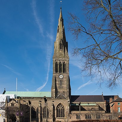
Leicester Cathedral Address: 21 Saint Martins street in Leicester
Attractions near Leicester Cathedral
The Guildhall,King Richard III Visitor Centre,Walters Architects,Reality Youth Project,Travel Talks,Diocese Of Leicester,Leicester Academies Charitable Trust,St Martins House Conf,Pearson Anderson,Hint Media,Leicester Camra,St Peter's Church,Cafe No:7,Fund My Venture,Mop-A-Lot Services,Together Leicester,Fareshare Midlands,Clockwise,Careerducate,Greyfriars Car ParkHow to get to popular attractions in Leicester with public transportation
Lidl, Peterborough,YBS Group - Lynch Wood, Peterborough,The Carlton Centre, Lincoln,Currys PC World, Nottingham,Mecca Bingo, Broxtowe,Riverside Retail Park, Northampton,Royal Derby Hospital, Derby,Francis Crick House, Northampton,Bagworth, Hinckley And Bosworth,Barlborough, Bolsover,Lakeside Arts Centre, Nottingham,The Observatory (Wetherspoon), Erewash,Memsaab Restaurant, Nottingham,Ikea, Broxtowe,Quorn & Woodhouse Railway Station (GC Railway), Charnwood,Bradgate Park & Swithland Wood Country Park, Charnwood,Hucknall Tram Stop, Ashfield,Gedling, Gedling,Chequered Flag (Hungry Horse), Corby,Steep Hill, LincolnGet around Leicester by public transport!
Travelling around Leicester has never been so easy. See step by step directions as you travel to any attraction, street or major public transport station. View bus and train timetables, arrival times, service alerts and detailed routes on a map, so you know exactly how to get to anywhere in Leicester.
When travelling to any destination around Leicester use Moovit's Live Directions with Get Off Notifications to know exactly where and how far to walk, how long to wait for your line , and how many stops are left. Moovit will alert you when it’s time to get off — no need to constantly re-check whether yours is the next stop.
Wondering how to use public transport in Leicester or how to pay for public transport in Leicester? Moovit public transport app can help you navigate your way with public transport easily, and at minimum cost. It includes public transport fees, ticket prices, and costs. Looking for a map of Leicester public transport lines? Moovit public transport app shows all public transport maps in Leicester with all bus or train routes and stops on an interactive map.
Leicester has 2 transport type(s), including: bus or train, operated by several transport agencies, including National Rail, Ashbourne Community Transport, Delaine Buses, Arriva Midlands, Centrebus, Our Centre, Hulleys of Baslow, D & G Bus, Stagecoach East Midlands, North Lincolnshire Council, National Rail, Roberts Coaches, Lawson's of Corby, Hawkes Coaches and East Yorkshire