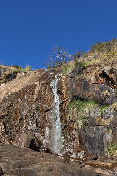
Directions to Lesmurdie Falls (Forrestfield) with public transport
The following transport lines have routes that pass near Lesmurdie Falls
How to get to Lesmurdie Falls by bus?
Click on the bus route to see step by step directions with maps, line arrival times and updated time schedules.
Bus stations near Lesmurdie Falls in Forrestfield
- George Rd After Tindale Rd, 5 min walk,
Bus lines to Lesmurdie Falls in Forrestfield
- 282, Kalamunda Bus Stn,
What are the nearest stations to Lesmurdie Falls?
The nearest stations to Lesmurdie Falls are:
- George Rd After Tindale Rd is 353 meters away, 5 min walk.
Which bus lines stop near Lesmurdie Falls?
These bus lines stop near Lesmurdie Falls: 270, 271, 275, 280.
What’s the nearest bus stop to Lesmurdie Falls in Forrestfield?
The nearest bus stop to Lesmurdie Falls in Forrestfield is George Rd After Tindale Rd. It’s a 5 min walk away.
How much is the train fare to Lesmurdie Falls?
The train fare to Lesmurdie Falls costs about $2.07 - $4.59.
How much is the bus fare to Lesmurdie Falls?
The bus fare to Lesmurdie Falls costs about $2.07 - $4.59.
See Lesmurdie Falls, Forrestfield, on the map
Public Transit to Lesmurdie Falls in Forrestfield
Wondering how to get to Lesmurdie Falls in Forrestfield, Australia? Moovit helps you find the best way to get to Lesmurdie Falls with step-by-step directions from the nearest public transit station.
Moovit provides free maps and live directions to help you navigate through your city. View schedules, routes, timetables, and find out how long does it take to get to Lesmurdie Falls in real time.
Looking for the nearest stop or station to Lesmurdie Falls? Check out this list of stops closest to your destination: George Rd After Tindale Rd.
Bus: 270, 271, 275, 280, 282.
Want to see if there’s another route that gets you there at an earlier time? Moovit helps you find alternative routes or times. Get directions from and directions to Lesmurdie Falls easily from the Moovit App or Website.
We make riding to Lesmurdie Falls easy, which is why over 1.5 million users, including users in Forrestfield, trust Moovit as the best app for public transit. You don’t need to download an individual bus app or train app, Moovit is your all-in-one transit app that helps you find the best bus time or train time available.
For information on prices of bus and train, costs and ride fares to Lesmurdie Falls, please check the Moovit app.
Use the app to navigate to popular places including to the airport, hospital, stadium, grocery store, mall, coffee shop, school, college, and university.
Location: Forrestfield, Perth
Attractions near Lesmurdie Falls
Tools of the Trade,Mazenod College,Ray Owen Sports Centre,Willoughby Park,King and Spoon,Sder Burgers,Friendlies Pharmacy,Cellarbrations,Mahid Halal Meats,Ascend Tuition Centre,Saint Brigid's College,Perth Kitchen Designs,Kath's Massage & Beaty,Rediscover Ceramics,St. Brigid's College Gym,Wa Solar Recycling,Second Life Batteries,Heartspace Therapy,Holy Monastery Of Saint John Of the Mountain,Hills FiestaHow to get to popular attractions in Forrestfield with public transportation
ECU Library, Joondalup,Uncle Billy's Chinese Restaurant, Northbridge,The Windsor Hotel, South Perth,Mount Hospital, Perth,Ipoh Garden Restaurant, Myaree,Double Double, Subiaco,Curtin University Bus Station, Bentley,Bunbury Regional Hospital, College Grove,Tafe - Thornlie Campus, Thornlie,Perth Busport, Perth,Kwinana Station, Orelia,South Metropolitan Tafe (Bentley Campus), Bentley,Crown Perth, Burswood,South West Sports Centre, Withers,Crown Perth Casino, Burswood,Wesfarmers Chemicals, Energy & Fertilisers, Murdoch,Willetton, Willetton,Tony Roma's Ribs, Seafood, & Steaks, Perth,Southlands Boulevarde, Willetton,Hbf Park, PerthGet around Perth by public transport!
Travelling around Perth has never been so easy. See step by step directions as you travel to any attraction, street or major public transport station. View bus and train timetables, arrival times, service alerts and detailed routes on a map, so you know exactly how to get to anywhere in Perth.
When travelling to any destination around Perth use Moovit's Live Directions with Get Off Notifications to know exactly where and how far to walk, how long to wait for your line , and how many stops are left. Moovit will alert you when it’s time to get off — no need to constantly re-check whether yours is the next stop.
Wondering how to use public transport in Perth or how to pay for public transport in Perth? Moovit public transport app can help you navigate your way with public transport easily, and at minimum cost. It includes public transport fees, ticket prices, and costs. Looking for a map of Perth public transport lines? Moovit public transport app shows all public transport maps in Perth with all Bus, Train and Ferry routes and stops on an interactive map.
Perth has 3 transport type(s), including: Bus, Train and Ferry, operated by several transport agencies, including Transperth Rail, Transwa, Transperth Ferry, Transperth, TransBusselton, TransAlbany, TransGoldfields, TransEsperance, TransGeraldton, TransCarnarvon, TransHedland, TransKarratha, TransBunbury, Mandurah Bus Charter