See Lewes Priory on the map
Directions to Lewes Priory with public transportation
The following transport lines have routes that pass near Lewes Priory
 Bus:
Bus: - Train:
How to get to Lewes Priory by bus?
Click on the bus route to see step by step directions with maps, line arrival times and updated time schedules.
How to get to Lewes Priory by train?
Click on the train route to see step by step directions with maps, line arrival times and updated time schedules.
Bus stations near Lewes Priory
- The Black Horse, Lewes,4 min walk,
- The Kings Head, Southover,4 min walk,
- Railway Station, Lewes,8 min walk,
- Southover Road, Lewes,8 min walk,
- Lewes,8 min walk,
Bus routes to Lewes Priory
- 28,Brighton - Lewes - Hailsham - Eastbourne,
- 29,Brighton - Uckfield - Lewes - Tunbridge Wells,
- 29A,Brighton - Lewes - Uckfield - Heathfield,
- 29B,Brighton - Lewes - Uckfield - Tunbridge Wells,
- 121,Lewes - Newick,
- 122,Lewes - Cooksbridge - Barcombe,
- 128,Lewes - Nevill Estate - Lewes,
- 132,Lewes - South Malling - Landport - Nevill - Lewes,
- 166,Lewes - Offham - Plumpton - Haywards Heath,
- 167,Burgess Hill - Ditchling - Offham - Lewes,
- 123,Newhaven,
- 129,Lewes,
- 25,Lewes,
- 39,Eastbourne,
- SOUTHERN,Seaford,
- SOUTHERN,Bus Replacement: Eastbourne,
What are the nearest stations to Lewes Priory?
The nearest stations to Lewes Priory are:
- The Black Horse, Lewes is 232 meters away, 4 min walk.
- The Kings Head, Southover is 238 meters away, 4 min walk.
- Railway Station, Lewes is 535 meters away, 8 min walk.
- Southover Road, Lewes is 600 meters away, 8 min walk.
- Lewes is 608 meters away, 8 min walk.
Which bus lines stop near Lewes Priory?
These bus lines stop near Lewes Priory: 28, 29.
Which train line stops near Lewes Priory?
SOUTHERN
What’s the nearest bus stop to Lewes Priory?
The nearest bus stops to Lewes Priory are The Black Horse, Lewes and The Kings Head, Southover. The closest one is a 4 min walk away.
What time is the first train to Lewes Priory?
The SOUTHERN is the first train that goes to Lewes Priory. It stops nearby at 05:11.
What time is the last train to Lewes Priory?
The SOUTHERN is the last train that goes to Lewes Priory. It stops nearby at 01:26.
What time is the first bus to Lewes Priory?
The 28 is the first bus that goes to Lewes Priory. It stops nearby at 05:52.
What time is the last bus to Lewes Priory?
The 28 is the last bus that goes to Lewes Priory. It stops nearby at 01:15.
See Lewes Priory on the map
Public Transportation to Lewes Priory
Wondering how to get to Lewes Priory, United Kingdom? Moovit helps you find the best way to get to Lewes Priory with step-by-step directions from the nearest public transit station.
Moovit provides free maps and live directions to help you navigate through your city. View schedules, routes, timetables, and find out how long does it take to get to Lewes Priory in real time.
Looking for the nearest stop or station to Lewes Priory? Check out this list of stops closest to your destination: The Black Horse; The Kings Head; Railway Station; Southover Road; Lewes.
Bus:Train:
Want to see if there’s another route that gets you there at an earlier time? Moovit helps you find alternative routes or times. Get directions from and directions to Lewes Priory easily from the Moovit App or Website.
We make riding to Lewes Priory easy, which is why over 1.5 million users, including users in Lewes, trust Moovit as the best app for public transit. You don’t need to download an individual bus app or train app, Moovit is your all-in-one transit app that helps you find the best bus time or train time available.
For information on prices of train and bus, costs and ride fares to Lewes Priory, please check the Moovit app.
Use the app to navigate to popular places including to the airport, hospital, stadium, grocery store, mall, coffee shop, school, college, and university.
Lewes Priory Address: 5 Mount St street in Lewes
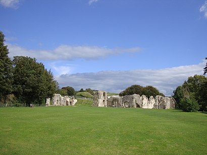
Lewes Priory is a part-demolished medieval Cluniac priory in Lewes, East Sussex in the United Kingdom. The ruins have been designated a Grade I listed building.Wiki
Attractions near Lewes Priory
Anne Of Cleves House,The Swan Pub,Trinity Church,Lewes Priory,Southover Grange Gardens,Fifteenth Century Bookshop,Sideline Clothing,County Hall,Bn7 1ue,Cote Brasserie Lewes,Evans Dr E,Fixed In A Flash,Lewes Castle - Shell Keep,Southover House,Fire Works (Fireworks),Lewes Railway Station (LWS),Lewes Rugby Football Club,Jobcentre Plus,The White Hart Hotel,Bn7 2xrHow to get to popular attractions in Lewes with public transportation
Highgate Hill, Upper Holloway,Acton, Acton,Nuffield Health Fitness & Wellbeing Centre, Willesden,Morden, St Helier,Brent, Colindale,Trafalgar Square, Charing Cross,Whitgift School, South Croydon,Wimbledon, Wimbledon,Crouch End, Crouch End,London Hilton Hotel, Mayfair,Cineworld, Ashford,Barnet, Finchley,Cranfield Airport, Central Bedfordshire,Brentwood, Brentwood,Ferney Road, East Barnet,The Whittington Hospital, Upper Holloway,Romford, Romford,Orpington, Orpington,Ikea, Croydon,University Of Brighton - Falmer Campus, Brighton And HoveGet around Lewes by public transport!
Travelling around Lewes has never been so easy. See step by step directions as you travel to any attraction, street or major public transport station. View bus and train timetables, arrival times, service alerts and detailed routes on a map, so you know exactly how to get to anywhere in Lewes.
When travelling to any destination around Lewes use Moovit's Live Directions with Get Off Notifications to know exactly where and how far to walk, how long to wait for your line , and how many stops are left. Moovit will alert you when it’s time to get off — no need to constantly re-check whether yours is the next stop.
Wondering how to use public transport in Lewes or how to pay for public transport in Lewes? Moovit public transport app can help you navigate your way with public transport easily, and at minimum cost. It includes public transport fees, ticket prices, and costs. Looking for a map of Lewes public transport lines? Moovit public transport app shows all public transport maps in Lewes with all train or bus routes and stops on an interactive map.
Lewes has 2 transport type(s), including: train or bus, operated by several transport agencies, including London Underground, London Buses, Transport for London, London Tramlink, Transport for London, National Rail, Bluestar, Berry's Coaches, Oxford Bus Company, Stagecoach West, Community First Wessex, Cresta Coaches, D & P Boat Hire, First Portsmouth, Fareham & Gosport and FYTbus