
How to get to Liverpool One by Bus or Train?

See Liverpool One on the map

Directions to Liverpool One with public transportation

The following transport lines have routes that pass near Liverpool One

  • BusBus:
  • TrainTrain:

How to get to Liverpool One by Bus?

Click on the Bus route to see step by step directions with maps, line arrival times and updated time schedules.

How to get to Liverpool One by Train?

Click on the Train route to see step by step directions with maps, line arrival times and updated time schedules.

Bus stations near Liverpool One

  • College Lane (Stop Ha),4 min walk,
  • Liverpool One,4 min walk,
  • Cook Street (Stop Cc),4 min walk,
  • Gradwell Street,4 min walk,
  • School Lane (Stop Hb),4 min walk,
  • Castle Street,4 min walk,
  • Campbell Street,5 min walk,
  • North John Street (Stop Cb),5 min walk,
  • Derby Square (Stop Lc),5 min walk,
  • Whitechapel (Stop Sd),5 min walk,
  • Castle Street (Stop La),5 min walk,
  • North John Street (Stop Lb),6 min walk,

Train stations near Liverpool One

  • Liverpool Central,13 min walk,
  • Liverpool Lime Street,27 min walk,

Ferry stations near Liverpool One

  • Liverpool Pier Head Ferry Terminal,29 min walk,

{{TRANSIT_TYPE}#Capitalized} routes to Liverpool One

  • 6,Widnes - Liverpool,
  • 82,Liverpool - Allerton,
  • 86,Garston - Liverpool,
  • 86A,Liverpool - Liverpool Airport,
  • 75,Liverpool - Halewood,
  • 79,Halewood - Liverpool,
  • 80,Speke - Liverpool,
  • 80A,Liverpool Airport - Liverpool,
  • 86,Liverpool - Allerton,
  • 86C,Liverpool,
  • 55D,Liverpool,
  • 82,Liverpool,
  • N1,Allerton,
  • 500,Liverpool,
  • 407,West Kirby - Liverpool,
  • 432,Liverpool - Wallasey,
  • 433,Wallasey - Liverpool,
  • 437,West Kirby - Liverpool,
  • 464,Liverpool - Bebington,
  • 471,Liverpool - Heswall,
Questions & Answers
  • What are the nearest stations to Liverpool One?

    The nearest stations to Liverpool One are:

    • College Lane (Stop Ha) is 229 meters away, 4 min walk.
    • Liverpool One is 237 meters away, 4 min walk.
    • Cook Street (Stop Cc) is 251 meters away, 4 min walk.
    • Gradwell Street is 255 meters away, 4 min walk.
    • School Lane (Stop Hb) is 266 meters away, 4 min walk.
    • Castle Street is 274 meters away, 4 min walk.
    • Campbell Street is 307 meters away, 5 min walk.
    • North John Street (Stop Cb) is 350 meters away, 5 min walk.
    • Derby Square (Stop Lc) is 351 meters away, 5 min walk.
    • Whitechapel (Stop Sd) is 371 meters away, 5 min walk.
    • Castle Street (Stop La) is 373 meters away, 5 min walk.
    • North John Street (Stop Lb) is 395 meters away, 6 min walk.
    • Liverpool Central is 975 meters away, 13 min walk.
    • Liverpool Lime Street is 2043 meters away, 27 min walk.
    • Liverpool Pier Head Ferry Terminal is 2251 meters away, 29 min walk.
  • Which Bus lines stop near Liverpool One?

    These Bus lines stop near Liverpool One: 10A, 433, 487, 7, 75, 82, 86A

  • Which Train lines stop near Liverpool One?

    These Train lines stop near Liverpool One: MERSEYRAIL, NORTHERN

  • What’s the nearest train station to Liverpool One?

    The nearest train station to Liverpool One is Liverpool Central. It’s a 13 min walk away.

  • What’s the nearest bus stop to Liverpool One?

    The nearest bus stops to Liverpool One are College Lane (Stop Ha), Liverpool One, Cook Street (Stop Cc), Gradwell Street, School Lane (Stop Hb) and Castle Street. The closest one is a 4 min walk away.

  • What’s the nearest ferry station to Liverpool One?

    The nearest ferry station to Liverpool One is Liverpool Pier Head Ferry Terminal. It’s a 29 min walk away.

  • What time is the first Train to Liverpool One?

    The MERSEYRAIL is the first Train that goes to Liverpool One. It stops nearby at 07:54.

  • What time is the last Train to Liverpool One?

    The NORTHERN is the last Train that goes to Liverpool One. It stops nearby at 00:39.

  • What time is the first Bus to Liverpool One?

    The 500 is the first Bus that goes to Liverpool One. It stops nearby at 04:29.

  • What time is the last Bus to Liverpool One?

    The N23 is the last Bus that goes to Liverpool One. It stops nearby at 05:45.

  • What time is the first Ferry to Liverpool One?

    The FER is the first Ferry that goes to Liverpool One. It stops nearby at 10:00.

  • What time is the last Ferry to Liverpool One?

    The FER is the last Ferry that goes to Liverpool One. It stops nearby at 16:50.

See Liverpool One on the map

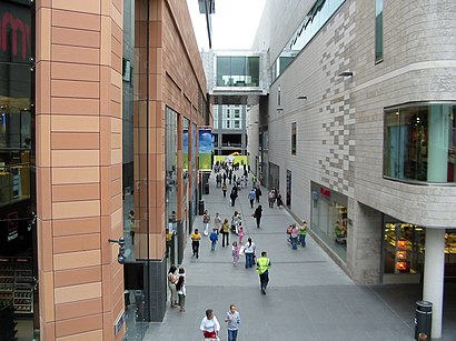
The Most Popular Urban Mobility App in Liverpool.
All local mobility options in one app

Public Transportation to Liverpool One

Wondering how to get to Liverpool One, United Kingdom? Moovit helps you find the best way to get to Liverpool One with step-by-step directions from the nearest public transit station.

Moovit provides free maps and live directions to help you navigate through your city. View schedules, routes, timetables, and find out how long does it take to get to Liverpool One in real time.

Looking for the nearest stop or station to Liverpool One? Check out this list of stops closest to your destination: College Lane (Stop Ha); Liverpool One; Cook Street (Stop Cc); Gradwell Street; School Lane (Stop Hb); Castle Street; Campbell Street; North John Street (Stop Cb); Derby Square (Stop Lc); Whitechapel (Stop Sd); Castle Street (Stop La); North John Street (Stop Lb); Liverpool Central; Liverpool Lime Street; Liverpool Pier Head Ferry Terminal.

Bus:Train:

Want to see if there’s another route that gets you there at an earlier time? Moovit helps you find alternative routes or times. Get directions from and directions to Liverpool One easily from the Moovit App or Website.

We make riding to Liverpool One easy, which is why over 1.5 million users, including users in Liverpool, trust Moovit as the best app for public transit. You don’t need to download an individual bus app or train app, Moovit is your all-in-one transit app that helps you find the best bus time or train time available.

For information on prices of Bus and Train, costs and ride fares to Liverpool One, please check the Moovit app.

Use the app to navigate to popular places including to the airport, hospital, stadium, grocery store, mall, coffee shop, school, college, and university.

Liverpool One Address: 6 Paradise Street, Liverpool, Merseyside L1 8JQ, UK street in Liverpool

Liverpool One
Liverpool OneLiverpool ONE is a shopping, residential, and leisure complex in Liverpool, England. The project involved the redevelopment of 42 acres (170,000 m2) of land in the city centre. It is a retail-led development anchored by the department store John Lewis. Debenhams had previously been an anchor tenant until the closure of its Liverpool One store in March 2021, with Marks & Spencer due to take its place in mid-2023. Additional elements include leisure facilities (such as a 14-screen Odeon cinema and 36-hole mini golf centre), apartments, offices, public open spaces, restaurants, and transport improvements. The completion of Liverpool ONE significantly boosted the local economy, while lifting Liverpool into the top five most popular retail destinations in the UK.Liverpool ONE is the largest open-air shopping centre in the UK and the tenth-largest shopping centre overall. Each store was created by a different architect, leading to stark differences between some buildings, one way in which Liverpool ONE differentiates itself from other shopping centres. The majority of the development was opened in phases on 29 May 2008 and 1 October 2008, during Liverpool's year as the European Capital of Culture, whilst the final residential units opened in early 2009. The cost of construction associated with the project was £500 million, with a total investment value of £920 million.
How to get to Liverpool One with public transport- About the place

Public transport routes with stations closest to Liverpool One

Train lines with stations closest to Liverpool One

Bus lines with stations closest to Liverpool One

Ferry lines with stations closest to Liverpool One

Easier to get to Liverpool One in…