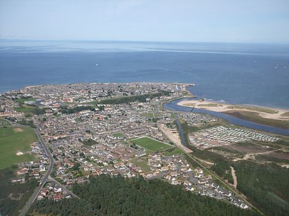
See Lossiemouth on the map
Directions to Lossiemouth with public transportation
The following transport lines have routes that pass near Lossiemouth
Bus:
How to get to Lossiemouth by Bus?
Click on the Bus route to see step by step directions with maps, line arrival times and updated time schedules.
Bus stations near Lossiemouth
- James Square, Lossiemouth,3 min walk,
- Manson Terrace, Lossiemouth,14 min walk,
{{TRANSIT_TYPE}#Capitalized} routes to Lossiemouth
- 33A,Elgin,
- 33C,Elgin,
- 133,Lossiemouth,
What are the nearest stations to Lossiemouth?
The nearest stations to Lossiemouth are:
- James Square, Lossiemouth is 154 meters away, 3 min walk.
- Manson Terrace, Lossiemouth is 1045 meters away, 14 min walk.
Which Bus lines stop near Lossiemouth?
These Bus lines stop near Lossiemouth: 33A, 33C
What’s the nearest bus stop to Lossiemouth?
The nearest bus stop to Lossiemouth is James Square, Lossiemouth. It’s a 3 min walk away.
What time is the first Bus to Lossiemouth?
The 33C is the first Bus that goes to Lossiemouth. It stops nearby at 06:08.
What time is the last Bus to Lossiemouth?
The 33A is the last Bus that goes to Lossiemouth. It stops nearby at 23:53.
How much is the Bus fare to Lossiemouth?
The Bus fare to Lossiemouth costs about £5.60 - £18.50.
See Lossiemouth on the map

Public Transportation to Lossiemouth
Wondering how to get to Lossiemouth, United Kingdom? Moovit helps you find the best way to get to Lossiemouth with step-by-step directions from the nearest public transit station.
Moovit provides free maps and live directions to help you navigate through your city. View schedules, routes, timetables, and find out how long does it take to get to Lossiemouth in real time.
Looking for the nearest stop or station to Lossiemouth? Check out this list of stops closest to your destination: James Square; Manson Terrace.
Bus:
Want to see if there’s another route that gets you there at an earlier time? Moovit helps you find alternative routes or times. Get directions from and directions to Lossiemouth easily from the Moovit App or Website.
We make riding to Lossiemouth easy, which is why over 1.5 million users, including users in Lossiemouth, trust Moovit as the best app for public transit. You don’t need to download an individual bus app or train app, Moovit is your all-in-one transit app that helps you find the best bus time or train time available.
For information on prices of Bus and Train, costs and ride fares to Lossiemouth, please check the Moovit app.
Use the app to navigate to popular places including to the airport, hospital, stadium, grocery store, mall, coffee shop, school, college, and university.
Lossiemouth Address: Queen Street street in Lossiemouth

Popular routes from Lossiemouth
To LossiemouthTo LossiemouthTo LossiemouthTo AberdeenTo LossiemouthTo LossiemouthAttractions near Lossiemouth
- Browns Giftware
- Macraj
- P Pizza
- Fred's Thread's
- New Sunrise
- Right Medicine Pharmacy
- Ali & Mac Properties
- Firth Hotels
- Pride of Lossie
- Macdrinks
- Silver Sands Leisure Park
- Lossiemouth Car Park
- Astir Consultants
- Covesea Candle
- James Square
- McClintock Dispensing Optician
- With This Dress
- MS Electrical & Renewables
- Ian Watt Garage
- Gleaner Filling Stations
How to get to popular attractions in Lossiemouth with public transportation
- The Sir John Moore (Wetherspoon), Glasgow
- Glasgow Green, Glasgow
- Nuffield Health, Edinburgh
- EICC, Edinburgh
- Scottish National Gallery, Edinburgh
- Kirkcaldy Bus Station, Kirkcaldy And Dysart
- Edinburgh Airport (EDI), Ratho Station
- Hard Rock Cafe Edinburgh, Edinburgh
- IKEA, Loanhead
- Clyde Arc (Squinty Bridge), Glasgow City
- The Standing Order (Wetherspoon), Edinburgh
- Aberdeen International Airport (ABZ), Dyce
- Paisley Gilmour Street Railway Station (PYG), Paisley
- Altens Industrial Estate, Aberdeen
- Haudagain Roundabout, Aberdeen
- Glasgow Marriott Hotel, Glasgow
- Saughton House, Edinburgh
- Glasgow Airport, Paisley
- Ninewells Hospital & Medical School, Dundee
- Buchanan Street Bus Station, Glasgow