Directions to Lower Marsh Market (Waterloo) with public transport
The following transport lines have routes that pass near Lower Marsh Market
How to get to Lower Marsh Market by bus?
Click on the bus route to see step by step directions with maps, line arrival times and updated time schedules.
How to get to Lower Marsh Market by train?
Click on the train route to see step by step directions with maps, line arrival times and updated time schedules.
How to get to Lower Marsh Market by Tube?
Click on the Tube route to see step by step directions with maps, line arrival times and updated time schedules.
Bus stops near Lower Marsh Market in Waterloo
- Waterloo Station / Waterloo Road (D), 2 min walk,
- Baylis Road / Lower Marsh (N), 3 min walk,
- The Old Vic (S), 3 min walk,
- Waterloo Station / Waterloo Road (E), 3 min walk,
- Lower Marsh (K), 4 min walk,
- Waterloo Station / Upper Taxi Road (C), 6 min walk,
- London Waterloo, 6 min walk,
Train station near Lower Marsh Market in Waterloo
- Waterloo East, 3 min walk,
Tube station near Lower Marsh Market in Waterloo
- Waterloo, 4 min walk,
River Bus station near Lower Marsh Market in Waterloo
- London Eye Waterloo Pier, 13 min walk,
Bus lines to Lower Marsh Market in Waterloo
- SL6, West Croydon,
- 59, Smithfield, St Bartholomew's Hospital,
- 68, Euston,
- N68, Tottenham Court Road,
- N171, Hither Green Station,
- 172, Aldwych,
- 176, Penge,
- 76, Waterloo, County Hall,
- 1, Canada Water,
- N1, Thamesmead,
- C10, Canada Water Bus Station,
- 188, North Greenwich,
- 139, Waterloo - Golders Green,
- 341, Waterloo - Meridian Water, Glover Drive Superstores,
- 3, Crystal Palace - Victoria,
- N3, Bromley North - Oxford Circus,
- 12, Dulwich Library - Oxford Circus,
- 53, Lambeth North, Lower Marsh - Plumstead Station,
- N53, Whitehall, Horse Guards - Plumstead Station,
- N109, Oxford Circus - Croydon Town Centre,
What are the nearest stations to Lower Marsh Market?
The nearest stations to Lower Marsh Market are:
- Waterloo Station / Waterloo Road (D) is 100 meters away, 2 min walk.
- Baylis Road / Lower Marsh (N) is 190 meters away, 3 min walk.
- The Old Vic (S) is 190 meters away, 3 min walk.
- Waterloo East is 200 meters away, 3 min walk.
- Waterloo Station / Waterloo Road (E) is 211 meters away, 3 min walk.
- Waterloo is 219 meters away, 4 min walk.
- Lower Marsh (K) is 253 meters away, 4 min walk.
- Waterloo Station / Upper Taxi Road (C) is 372 meters away, 6 min walk.
- London Waterloo is 411 meters away, 6 min walk.
- London Eye Waterloo Pier is 942 meters away, 13 min walk.
Which bus lines stop near Lower Marsh Market?
These bus lines stop near Lower Marsh Market: 192, 219, 276, 37, 388, 47, 72, A7, R3, W5.
Which train lines stop near Lower Marsh Market?
These train lines stop near Lower Marsh Market: ELIZABETH, SOUTH WESTERN RAILWAY, SOUTHEASTERN, WINDRUSH LINE.
Which Tube line stops near Lower Marsh Market?
NORTHERN (Battersea Power Station)
What’s the nearest Tube station to Lower Marsh Market in Waterloo?
The nearest Tube station to Lower Marsh Market in Waterloo is Waterloo. It’s a 4 min walk away.
What’s the nearest train station to Lower Marsh Market in Waterloo?
The nearest train station to Lower Marsh Market in Waterloo is Waterloo East. It’s a 3 min walk away.
What’s the nearest bus station to Lower Marsh Market in Waterloo?
The nearest bus station to Lower Marsh Market in Waterloo is Waterloo Station / Waterloo Road (D). It’s a 2 min walk away.
What’s the nearest River Bus station to Lower Marsh Market in Waterloo?
The nearest River Bus station to Lower Marsh Market in Waterloo is London Eye Waterloo Pier. It’s a 13 min walk away.
What time is the first Tube to Lower Marsh Market in Waterloo?
The JUBILEE is the first Tube that goes to Lower Marsh Market in Waterloo. It stops nearby at 03:26.
What time is the last Tube to Lower Marsh Market in Waterloo?
The JUBILEE is the last Tube that goes to Lower Marsh Market in Waterloo. It stops nearby at 00:51.
What time is the first train to Lower Marsh Market in Waterloo?
The SOUTH WESTERN RAILWAY is the first train that goes to Lower Marsh Market in Waterloo. It stops nearby at 06:14.
What time is the last train to Lower Marsh Market in Waterloo?
The SOUTH WESTERN RAILWAY is the last train that goes to Lower Marsh Market in Waterloo. It stops nearby at 01:44.
What time is the first bus to Lower Marsh Market in Waterloo?
The 12 is the first bus that goes to Lower Marsh Market in Waterloo. It stops nearby at 03:00.
What time is the last bus to Lower Marsh Market in Waterloo?
The 341 is the last bus that goes to Lower Marsh Market in Waterloo. It stops nearby at 04:08.
What time is the first River Bus to Lower Marsh Market in Waterloo?
The RB6 is the first River Bus that goes to Lower Marsh Market in Waterloo. It stops nearby at 21:03.
What time is the last River Bus to Lower Marsh Market in Waterloo?
The RB6 is the last River Bus that goes to Lower Marsh Market in Waterloo. It stops nearby at 23:33.
See Lower Marsh Market, Waterloo, on the map
Public Transit to Lower Marsh Market in Waterloo
Wondering how to get to Lower Marsh Market in Waterloo, United Kingdom? Moovit helps you find the best way to get to Lower Marsh Market with step-by-step directions from the nearest public transit station.
Moovit provides free maps and live directions to help you navigate through your city. View schedules, routes, timetables, and find out how long does it take to get to Lower Marsh Market in real time.
Looking for the nearest stop or station to Lower Marsh Market? Check out this list of stops closest to your destination: Waterloo Station / Waterloo Road (D); Baylis Road / Lower Marsh (N); The Old Vic (S); Waterloo East; Waterloo Station / Waterloo Road (E); Waterloo; Lower Marsh (K); Waterloo Station / Upper Taxi Road (C); London Waterloo; London Eye Waterloo Pier.
Bus: 192, 219, 276, 37, 388, 47, 72, A7, R3, W5, SL6, 59, 68, N68, N171, 76, 1, N1, C10, 188.Train: ELIZABETH, SOUTH WESTERN RAILWAY, SOUTHEASTERN, WINDRUSH LINE.Tube: NORTHERN, BAKERLOO, JUBILEE, WATERLOO & CITY.River Bus: RB1, RB6.
Want to see if there’s another route that gets you there at an earlier time? Moovit helps you find alternative routes or times. Get directions from and directions to Lower Marsh Market easily from the Moovit App or Website.
We make riding to Lower Marsh Market easy, which is why over 1.5 million users, including users in Waterloo, trust Moovit as the best app for public transit. You don’t need to download an individual bus app or train app, Moovit is your all-in-one transit app that helps you find the best bus time or train time available.
For information on prices of bus, train and Tube, costs and ride fares to Lower Marsh Market, please check the Moovit app.
Use the app to navigate to popular places including to the airport, hospital, stadium, grocery store, mall, coffee shop, school, college, and university.
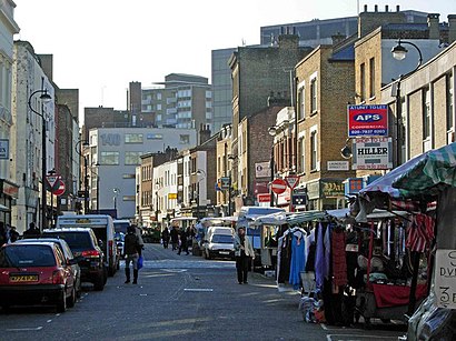
Lower Marsh Market Address: Lower Marsh street in Waterloo
Lower Marsh is a street in the Waterloo neighbourhood of London, England. It is adjacent to Waterloo railway station in the London Borough of Lambeth. It is the location of Lower Marsh Market.Wiki
Places Near Lower Marsh Market (Waterloo)
How to get to popular places in London with public transport
Get around Waterloo by public transport!
Travelling around Waterloo has never been so easy. See step by step directions as you travel to any attraction, street or major public transport station. View bus and train timetables, arrival times, service alerts and detailed routes on a map, so you know exactly how to get to anywhere in Waterloo.
When travelling to any destination around Waterloo use Moovit's Live Directions with Get Off Notifications to know exactly where and how far to walk, how long to wait for your line , and how many stops are left. Moovit will alert you when it’s time to get off — no need to constantly re-check whether yours is the next stop.
Wondering how to use public transport in Waterloo or how to pay for public transport in Waterloo? Moovit public transport app can help you navigate your way with public transport easily, and at minimum cost. It includes public transport fees, ticket prices, and costs. Looking for a map of Waterloo public transport lines? Moovit public transport app shows all public transport maps in Waterloo with all Bus, Train, Tube, Tramlink, River Bus and DLR routes and stops on an interactive map.
London has 6 transport type(s), including: Bus, Train, Tube, Tramlink, River Bus and DLR, operated by several transport agencies, including London Underground, London Buses, Transport for London, London Tramlink, National Rail, Bluestar, Berry's Coaches, Oxford Bus Company, Stagecoach West, Community First Wessex, Cresta Coaches, First Portsmouth, Fareham & Gosport, IFS Cloud Cable Car, FYTbus and Gosport-Portsmouth Ferry