See Lynton Railway Station, Clapham, on the map
Directions to Lynton Railway Station (Clapham) with public transport
The following transport lines have routes that pass near Lynton Railway Station
 Bus:
Bus: - Train:
How to get to Lynton Railway Station by bus?
Click on the bus route to see step by step directions with maps, line arrival times and updated time schedules.
How to get to Lynton Railway Station by train?
Click on the train route to see step by step directions with maps, line arrival times and updated time schedules.
Bus stations near Lynton Railway Station in Clapham
- Stop 20A Belair Rd - North West side,8 min walk,
- Stop 18B Springbank Rd - North side,8 min walk,
- Stop 19A Strathcona Ave - West side,8 min walk,
- Stop 18B Springbank Rd - South side,8 min walk,
- Stop 20 Belair Rd - East side,9 min walk,
Train stations near Lynton Railway Station in Clapham
- Torrens Park,13 min walk,
Bus lines to Lynton Railway Station in Clapham
- 173,City,
- 195,Blackwood,
- 195F,City,
- 196,Blackwood,
- 196F,Blackwood,
- 674,City (School Bus),
- 954,Mitcham (School Bus),
- 200B,Marion,
- 200C,Clapham,
- 300,Arndale,
- 300H,Glen Osmond,
- 300J,Klemzig,
- 952,Blackwood High School (School Bus),
- 200,City,
- 300G,Glenelg,
- 673,Darlington (School Bus),
- 892,Aldgate,
What are the nearest stations to Lynton Railway Station?
The nearest stations to Lynton Railway Station are:
- Stop 20A Belair Rd - North West side is 535 meters away, 8 min walk.
- Stop 18B Springbank Rd - North side is 572 meters away, 8 min walk.
- Stop 19A Strathcona Ave - West side is 599 meters away, 8 min walk.
- Stop 18B Springbank Rd - South side is 609 meters away, 8 min walk.
- Stop 20 Belair Rd - East side is 660 meters away, 9 min walk.
- Torrens Park is 1021 meters away, 13 min walk.
Which bus lines stop near Lynton Railway Station?
These bus lines stop near Lynton Railway Station: 196F, 200C, 300, G21F.
Which train line stops near Lynton Railway Station?
BEL
What’s the nearest train station to Lynton Railway Station in Clapham?
The nearest train station to Lynton Railway Station in Clapham is Torrens Park. It’s a 13 min walk away.
What’s the nearest bus stop to Lynton Railway Station in Clapham?
The nearest bus stops to Lynton Railway Station in Clapham are Stop 20A Belair Rd - North West side, Stop 18B Springbank Rd - North side, Stop 19A Strathcona Ave - West side and Stop 18B Springbank Rd - South side. The closest one is a 8 min walk away.
What time is the first train to Lynton Railway Station in Clapham?
The BEL is the first train that goes to Lynton Railway Station in Clapham. It stops nearby at 05:23.
What time is the last train to Lynton Railway Station in Clapham?
The BEL is the last train that goes to Lynton Railway Station in Clapham. It stops nearby at 01:28.
What time is the first bus to Lynton Railway Station in Clapham?
The 195 is the first bus that goes to Lynton Railway Station in Clapham. It stops nearby at 06:48.
What time is the last bus to Lynton Railway Station in Clapham?
The 200 is the last bus that goes to Lynton Railway Station in Clapham. It stops nearby at 23:11.
How much is the train fare to Lynton Railway Station?
The train fare to Lynton Railway Station costs about $2.40.
How much is the bus fare to Lynton Railway Station?
The bus fare to Lynton Railway Station costs about $2.40 - $4.25.
See Lynton Railway Station, Clapham, on the map
Public Transit to Lynton Railway Station in Clapham
Wondering how to get to Lynton Railway Station in Clapham, Australia? Moovit helps you find the best way to get to Lynton Railway Station with step-by-step directions from the nearest public transit station.
Moovit provides free maps and live directions to help you navigate through your city. View schedules, routes, timetables, and find out how long does it take to get to Lynton Railway Station in real time.
Looking for the nearest stop or station to Lynton Railway Station? Check out this list of stops closest to your destination: Stop 20A Belair Rd - North West side; Stop 18B Springbank Rd - North side; Stop 19A Strathcona Ave - West side; Stop 18B Springbank Rd - South side; Stop 20 Belair Rd - East side; Torrens Park.
Bus:Train:
Want to see if there’s another route that gets you there at an earlier time? Moovit helps you find alternative routes or times. Get directions from and directions to Lynton Railway Station easily from the Moovit App or Website.
We make riding to Lynton Railway Station easy, which is why over 1.5 million users, including users in Clapham, trust Moovit as the best app for public transit. You don’t need to download an individual bus app or train app, Moovit is your all-in-one transit app that helps you find the best bus time or train time available.
For information on prices of bus, train and light rail, costs and ride fares to Lynton Railway Station, please check the Moovit app.
Use the app to navigate to popular places including to the airport, hospital, stadium, grocery store, mall, coffee shop, school, college, and university.
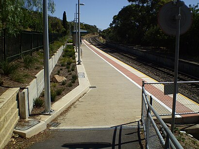
Lynton Railway Station Address: Beagle Tce street in Clapham
Lynton railway station is located on the Belair line between the Adelaide southern foothills suburbs of Lynton and Clapham, 10.7 kilometres from Adelaide station.Wiki
Attractions near Lynton Railway Station
Lynton Station,Ebuzactivators,Dti Creative,Whites Carpet Cleaning Lynton,Lynton Depot & Trails,Daylight Breaks,Modern Building Design,Zanshin Freestyle Karate Clapham Dojo,Atarfil Australia Pty,YMCA Gymnastics,Water Boatman,Clapham Primary School,Lynton Transfer Station,Balyana Residential Centre,Treetops Apartment,The Mystical Dandelio,Kellies Cottage Family Day Care,Opal Search,Ellison Mobile Auto Repairs,Herbalife Independent DistributorHow to get to popular attractions in Clapham with public transportation
Marryatville High School, Marryatville,Blackwood High School, Eden Hills,Henley Square, Henley Beach,Adelaide, Adelaide,Flinders Medical Centre Interchange, Bedford Park,Flinders Medical Centre, Bedford Park,Adelaide Oval, North Adelaide,Coromandel Railway Station, Blackwood,Aberfoyle Park, Aberfoyle Park,University of Adelaide, Adelaide,Lyell McEwin Hospital, Elizabeth Vale,Unley High School, Netherby,Thebarton Senior College, Torrensville,Happy Valley, Happy Valley,Blackwood Fitness, Blackwood,Klemzig, Klemzig,Harbour Town, Adelaide Airport,Cabra Dominican College, Cumberland Park,Gepps Cross, Gepps Cross,Burnside Village Shopping Centre, GlensideGet around Clapham by public transport!
Travelling around Clapham has never been so easy. See step by step directions as you travel to any attraction, street or major public transport station. View bus and train timetables, arrival times, service alerts and detailed routes on a map, so you know exactly how to get to anywhere in Clapham.
When travelling to any destination around Clapham use Moovit's Live Directions with Get Off Notifications to know exactly where and how far to walk, how long to wait for your line , and how many stops are left. Moovit will alert you when it’s time to get off — no need to constantly re-check whether yours is the next stop.
Wondering how to use public transport in Clapham or how to pay for public transport in Clapham? Moovit public transport app can help you navigate your way with public transport easily, and at minimum cost. It includes public transport fees, ticket prices, and costs. Looking for a map of Clapham public transport lines? Moovit public transport app shows all public transport maps in Clapham with all bus, train or light rail routes and stops on an interactive map.
Clapham has 3 transport type(s), including: bus, train or light rail, operated by several transport agencies, including Adelaide Metro (Busways), SouthLink, Torrens Transit, Adelaide Metro Train, Adelaide Metro (Torrens Connect), Adelaide Metro (Industrial Service - Torrens Transit), Adelaide Metro (School Service - SouthLink), Adelaide Metro (School Service - Torrens Transit) and Adelaide Metro (School Service - Busways)