Directions to Maffra with public transportation
The following transport lines have routes that pass near Maffra
Bus stations near Maffra
- Pearson St/Johnson St (Maffra),5 min walk,
Bus routes to Maffra
- GLASSFORD STREET - MAFFRA POST OFFICE VIA MAFFRA HOSPITAL,Maffra Post Office,
- SALE - MELBOURNE VIA TRARALGON,Melbourne,
What are the nearest stations to Maffra?
The nearest stations to Maffra are:
- Pearson St/Johnson St (Maffra) is 318 meters away, 5 min walk.
Which bus line stops near Maffra?
SALE - MELBOURNE VIA TRARALGON
What’s the nearest bus stop to Maffra?
The nearest bus stop to Maffra is Pearson St/Johnson St (Maffra). It’s a 5 min walk away.
What time is the first bus to Maffra?
The SALE - MELBOURNE VIA TRARALGON is the first bus that goes to Maffra. It stops nearby at 07:56.
What time is the last bus to Maffra?
The SALE - MELBOURNE VIA TRARALGON is the last bus that goes to Maffra. It stops nearby at 20:57.
See Maffra on the map
Public Transportation to Maffra
Wondering how to get to Maffra, Australia? Moovit helps you find the best way to get to Maffra with step-by-step directions from the nearest public transit station.
Moovit provides free maps and live directions to help you navigate through your city. View schedules, routes, timetables, and find out how long does it take to get to Maffra in real time.
Looking for the nearest stop or station to Maffra? Check out this list of stops closest to your destination: Pearson St/Johnson St (Maffra).
Bus:SALE - MELBOURNE VIA TRARALGONGLASSFORD STREET - MAFFRA POST OFFICE VIA MAFFRA HOSPITAL
Want to see if there’s another route that gets you there at an earlier time? Moovit helps you find alternative routes or times. Get directions from and directions to Maffra easily from the Moovit App or Website.
We make riding to Maffra easy, which is why over 1.5 million users, including users in Melbourne, trust Moovit as the best app for public transit. You don’t need to download an individual bus app or train app, Moovit is your all-in-one transit app that helps you find the best bus time or train time available.
For information on prices of train and bus, costs and ride fares to Maffra, please check the Moovit app.
Use the app to navigate to popular places including to the airport, hospital, stadium, grocery store, mall, coffee shop, school, college, and university.
Location: Melbourne
Popular routes to Maffra
Popular routes from Maffra
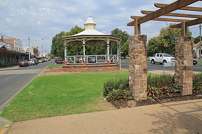
Attractions near Maffra
The Nude Foodie,Cambrai Hostel,Cambrai Backpackers Hostel,Mafeking Hill Reserve,Jeannine Helen Dawn Wa,Stobies Land & Surf,Boisdale Glassworks Maffra,Maffra Secondary College,Dave Mair Building Permits,Platinum Plumbing Plus,Raw Country,Kingdom Hall of Jehovah's Witnesses,McLean St/Kent St (Maffra),Stretton Park Aged Care,Powerscourt Railway Station,Tinamba Food & Wine Festival,Wright Refrigeration and Engineering,Stratford Primary School,Stuart Place Reserve,Garage of GainsHow to get to popular attractions in Melbourne with public transportation
901 And 902 Bus Stop, Broadmeadows,Port Melbourne Beach,Cotton on, Point Cook,Racv City Club, Melbourne,Aintree VIC Australia, Rockbank,Elgin Street, Carlton,Lakeside Stadium, Albert Park,St Augustine's Correction Ward, St Vincent's Hospital, Fitzroy,Costco, Docklands,Berwick Station,485 La Trobe St, Melbourne,Durga Temple, Rockbank,Dfo, Melbourne,Rydges Hotel, Melbourne,Elwood Beach,Hotel Grand Chancellor, Melbourne,John Cain Arena, Melbourne,Sydney Road/Brunswick Road, Brunswick,Crown Palladium, Southbank,Oakleigh Station, OakleighGet around Melbourne by public transport!
Travelling around Melbourne has never been so easy. See step by step directions as you travel to any attraction, street or major public transport station. View bus and train timetables, arrival times, service alerts and detailed routes on a map, so you know exactly how to get to anywhere in Melbourne.
When travelling to any destination around Melbourne use Moovit's Live Directions with Get Off Notifications to know exactly where and how far to walk, how long to wait for your line , and how many stops are left. Moovit will alert you when it’s time to get off — no need to constantly re-check whether yours is the next stop.
Wondering how to use public transport in Melbourne or how to pay for public transport in Melbourne? Moovit public transport app can help you navigate your way with public transport easily, and at minimum cost. It includes public transport fees, ticket prices, and costs. Looking for a map of Melbourne public transport lines? Moovit public transport app shows all public transport maps in Melbourne with all train or bus routes and stops on an interactive map.
Melbourne has 2 transport type(s), including: train or bus, operated by several transport agencies, including PTV Metropolitan Trains, PTV Metropolitan Bus, Yarra Trams, PTV Regional Bus, SkyBus, Interstate Services, V/Line and V/Line (Coach)