Directions to Mandurah (Erskine) with public transport
The following transport lines have routes that pass near Mandurah
How to get to Mandurah by bus?
Click on the bus route to see step by step directions with maps, line arrival times and updated time schedules.
Bus stations near Mandurah in Erskine
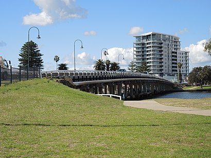
- Mandurah Rd Before Mandurah Estuary Bdg, 3 min walk,
- Halls Head Shopping Centre Halls Head Shops (Regional), 11 min walk,
- Hungerford Av Before Balmoral Pde, 14 min walk,
Bus lines to Mandurah in Erskine
- 593, Mandurah Stn,
- 594, Dawesville East,
- 645, Halls Head,
- 592, Halls Head,
What are the nearest stations to Mandurah?
The nearest stations to Mandurah are:
- Mandurah Rd Before Mandurah Estuary Bdg is 164 meters away, 3 min walk.
- Halls Head Shopping Centre Halls Head Shops (Regional) is 822 meters away, 11 min walk.
- Hungerford Av Before Balmoral Pde is 1034 meters away, 14 min walk.
Which bus lines stop near Mandurah?
These bus lines stop near Mandurah: 584, 593, 594.
What’s the nearest bus stop to Mandurah in Erskine?
The nearest bus stop to Mandurah in Erskine is Mandurah Rd Before Mandurah Estuary Bdg. It’s a 3 min walk away.
What time is the first bus to Mandurah in Erskine?
The 594 is the first bus that goes to Mandurah in Erskine. It stops nearby at 07:06.
What time is the last bus to Mandurah in Erskine?
The 594 is the last bus that goes to Mandurah in Erskine. It stops nearby at 20:02.
How much is the train fare to Mandurah?
The train fare to Mandurah costs about $2.07 - $4.59.
How much is the bus fare to Mandurah?
The bus fare to Mandurah costs about $2.07 - $4.59.
See Mandurah, Erskine, on the map
Public Transit to Mandurah in Erskine
Wondering how to get to Mandurah in Erskine, Australia? Moovit helps you find the best way to get to Mandurah with step-by-step directions from the nearest public transit station.
Moovit provides free maps and live directions to help you navigate through your city. View schedules, routes, timetables, and find out how long does it take to get to Mandurah in real time.
Looking for the nearest stop or station to Mandurah? Check out this list of stops closest to your destination: Mandurah Rd Before Mandurah Estuary Bdg; Halls Head Shopping Centre Halls Head Shops (Regional); Hungerford Av Before Balmoral Pde.
Bus: 584, 593, 594, 645, 592.
Want to see if there’s another route that gets you there at an earlier time? Moovit helps you find alternative routes or times. Get directions from and directions to Mandurah easily from the Moovit App or Website.
We make riding to Mandurah easy, which is why over 1.5 million users, including users in Erskine, trust Moovit as the best app for public transit. You don’t need to download an individual bus app or train app, Moovit is your all-in-one transit app that helps you find the best bus time or train time available.
For information on prices of bus and train, costs and ride fares to Mandurah, please check the Moovit app.
Use the app to navigate to popular places including to the airport, hospital, stadium, grocery store, mall, coffee shop, school, college, and university.
Mandurah Address: Mandurah, Western Australia street in Erskine
Attractions near Mandurah
Harcourts Mandurah,Lehantia Therapy,Harcourts Mandurah,Leisure Campers,Good Start Driving School,Waardong Court,Coffee Chloe,Harcourts Mandurah,Sweet Winks Lash Extensions,Leisure Way,Jackels Building,Castle Fun Park,Kayak Pick Up Mandurah,Access Counselling,Nectar & Kai,Harcourts Mandurah,Coach Ellery,Lend Lease - Parkland Villas Mandurah,Zarlec Electrical Solutions,Christ's ChurchHow to get to popular attractions in Erskine with public transportation
Royal Perth Hospital, Perth,Stockland Shopping Centre Baldivis, Baldivis,Fiona Stanley Hospital, Murdoch,Warwick Grove, Warwick,Piney Lakes Reserve, Booragoon,Crown Perth, Burswood,Midland Bus Station, Midland,Bunbury Senior High School, Bunbury,Westfield Carousel, Cannington,Curtin University Bus Station, Bentley,Lakeside Joondalup Shopping City, Joondalup,Tafe - Thornlie Campus, Thornlie,World Gym, Bunbury,Edith Cowan University (Joondalup Campus), Joondalup,Treendale Shopping Centre, Australind,Fremantle Markets, Fremantle,Hbf Park, Perth,ECU Library, Joondalup,Fenians Irish Pub, Perth,Dome, East Victoria ParkGet around Perth by public transport!
Travelling around Perth has never been so easy. See step by step directions as you travel to any attraction, street or major public transport station. View bus and train timetables, arrival times, service alerts and detailed routes on a map, so you know exactly how to get to anywhere in Perth.
When travelling to any destination around Perth use Moovit's Live Directions with Get Off Notifications to know exactly where and how far to walk, how long to wait for your line , and how many stops are left. Moovit will alert you when it’s time to get off — no need to constantly re-check whether yours is the next stop.
Wondering how to use public transport in Perth or how to pay for public transport in Perth? Moovit public transport app can help you navigate your way with public transport easily, and at minimum cost. It includes public transport fees, ticket prices, and costs. Looking for a map of Perth public transport lines? Moovit public transport app shows all public transport maps in Perth with all Bus, Train and Ferry routes and stops on an interactive map.
Perth has 3 transport type(s), including: Bus, Train and Ferry, operated by several transport agencies, including Transperth Rail, Transwa, Transperth Ferry, Transperth, TransBusselton, TransAlbany, TransGoldfields, TransEsperance, TransGeraldton, TransCarnarvon, TransHedland, TransKarratha, TransBunbury, Mandurah Bus Charter