Directions to Manly Council with public transportation
The following transport lines have routes that pass near Manly Council
How to get to Manly Council by bus?
Click on the bus route to see step by step directions with maps, line arrival times and updated time schedules.
Bus stops near Manly Council
- Manly Wharf Belgrave St Stand G, 1 min walk,
- Manly Wharf Belgrave St Stand F, 1 min walk,
- Manly Wharf Belgrave St Stand E, 1 min walk,
- Manly Wharf West Promenade Stand J, 2 min walk,
- Manly Wharf West Esplanade Stand D, 2 min walk,
Bus routes to Manly Council
- 144, Chatswood,
- 144N, North Sydney,
- 616N, Mackellar Girls,
- 631N, St Luke's Dy,
- 141, Austlink,
- 142, Manly,
- 150X, Manly to Milsons Point (Express Service),
- 170X, Manly to City Wynyard (Express Service),
- 608N, Blessed Sacrament to Seaforth,
- 674W, Gilbert Park (Manly Wharf) to Glenaeon Senior,
- 681N, Manly Wharf to Balgowlah Boys High,
- 687N, Harbord to Milsons Point,
- 700N, St Pauls Manly to Narraweena,
- 723N, Manly Wharf to Oxford Falls Grammar School,
- 739N, Forest High School to Seaforth,
- 749N, St. Pauls High, Manly to Mona Vale Junction,
- 781N, Manly Wharf to Oxford Falls Grammar School,
- 601N, Manly Wharf to Cromer Primary,
- 617N, Broughton St, Milsons Pt to Manly Wharf,
- 642N, Mater Maria Warriewood to Manly Wharf,
What are the nearest stations to Manly Council?
The nearest stations to Manly Council are:
- Manly Wharf Belgrave St Stand G is 23 meters away, 1 min walk.
- Manly Wharf Belgrave St Stand F is 45 meters away, 1 min walk.
- Manly Wharf Belgrave St Stand E is 73 meters away, 1 min walk.
- Manly Wharf West Promenade Stand J is 85 meters away, 2 min walk.
- Manly Wharf West Esplanade Stand D is 113 meters away, 2 min walk.
Which bus lines stop near Manly Council?
These bus lines stop near Manly Council: 132, 142, 143, 144.
Which ferry line stops near Manly Council?
F1
What’s the nearest bus stop to Manly Council?
The nearest bus stops to Manly Council are Manly Wharf Belgrave St Stand G, Manly Wharf Belgrave St Stand F and Manly Wharf Belgrave St Stand E. The closest one is a 1 min walk away.
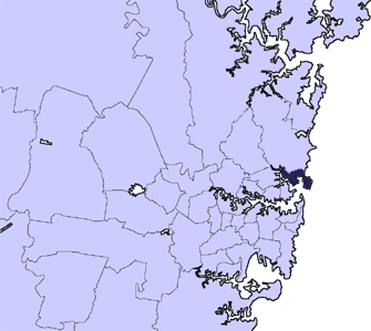
See Manly Council on the map
Public Transportation to Manly Council
Wondering how to get to Manly Council, Australia? Moovit helps you find the best way to get to Manly Council with step-by-step directions from the nearest public transit station.
Moovit provides free maps and live directions to help you navigate through your city. View schedules, routes, timetables, and find out how long does it take to get to Manly Council in real time.
Looking for the nearest stop or station to Manly Council? Check out this list of stops closest to your destination: Manly Wharf Belgrave St Stand G; Manly Wharf Belgrave St Stand F; Manly Wharf Belgrave St Stand E; Manly Wharf West Promenade Stand J; Manly Wharf West Esplanade Stand D.
Bus: 132, 142, 143, 144, 144N, 616N, 631N, 141, 150X, 170X, 608N, 674W, 681N, 601N, 617N, 642N, 656N, 695N, 162, 583N, 653N, 655N, 683N.Ferry: F1.
Want to see if there’s another route that gets you there at an earlier time? Moovit helps you find alternative routes or times. Get directions from and directions to Manly Council easily from the Moovit App or Website.
We make riding to Manly Council easy, which is why over 1.5 million users, including users in Manly, trust Moovit as the best app for public transit. You don’t need to download an individual bus app or train app, Moovit is your all-in-one transit app that helps you find the best bus time or train time available.
For information on prices of bus, train and ferry, costs and ride fares to Manly Council, please check the Moovit app.
Use the app to navigate to popular places including to the airport, hospital, stadium, grocery store, mall, coffee shop, school, college, and university.
Manly Council Address: Belgrave Street street in Manly
Attractions near Manly Council
How to get to popular places in Sydney with public transit
Get around Sydney by public transport!
Travelling around Sydney has never been so easy. See step by step directions as you travel to any attraction, street or major public transport station. View bus and train timetables, arrival times, service alerts and detailed routes on a map, so you know exactly how to get to anywhere in Sydney.
When travelling to any destination around Sydney use Moovit's Live Directions with Get Off Notifications to know exactly where and how far to walk, how long to wait for your line , and how many stops are left. Moovit will alert you when it’s time to get off — no need to constantly re-check whether yours is the next stop.
Wondering how to use public transport in Sydney or how to pay for public transport in Sydney? Moovit public transport app can help you navigate your way with public transport easily, and at minimum cost. It includes public transport fees, ticket prices, and costs. Looking for a map of Sydney public transport lines? Moovit public transport app shows all public transport maps in Sydney with all Bus, Train, Metro, Light rail and Ferry routes and stops on an interactive map.
Sydney has 5 transport type(s), including: Bus, Train, Metro, Light rail and Ferry, operated by several transport agencies, including Sydney Metro, Sydney Trains, Sydney Light Rail, Sydney Ferries, Intercity Trains, Intercity Train, NSW TrainLink, CDC NSW R14, U-Go Mobility, Keolis Downer Northern Beaches, Manly Fast Ferry, Transdev John Holland Buses, Busways, Busways North West, Dysons Buslines