Directions to Marine Parade Community Club (Southeast) with public transport
The following transport lines have routes that pass near Marine Parade Community Club
How to get to Marine Parade Community Club by bus?
Click on the bus route to see step by step directions with maps, line arrival times and updated time schedules.
How to get to Marine Parade Community Club by metro?
Click on the metro route to see step by step directions with maps, line arrival times and updated time schedules.
Bus stops near Marine Parade Community Club in Southeast
- Still Rd - Aft East Coast Rd (83301), 2 min walk,
- East Coast Rd - Opp the Holy Family CH (92121), 3 min walk,
- East Coast Rd - the Holy Family CH (92129), 3 min walk,
- Marine Parade Central Roundabout, 5 min walk,
- Still Rd Sth - D'Ecosia (92279), 5 min walk,
- Marine Parade Rd - Chij Katong Convent (Pr) (92061), 7 min walk,
- Marine Cres - Blk 34 (92231), 7 min walk,
- Marine Cres - Blk 45 (92239), 7 min walk,
- Marine Parade Rd -Marine Pde Stn Exit 4 (92051), 8 min walk,
- Marine Parade Rd - Tao Nan Sch (92069), 8 min walk,
- Marine Parade Rd - Marine Pde Stn Exit 6 (92059), 10 min walk,
Metro stations near Marine Parade Community Club in Southeast
- Marine Terrace (Te27), 10 min walk,
- Kembangan (EW6), 29 min walk,
Bus lines to Marine Parade Community Club in Southeast
- 13, Yio Chu Kang Int,
- 55, Bishan Int,
- 966, Marine Parade Rd (Parkway Parade),
- 10, Tampines Int ↔ Kent Ridge Ter,
- 12, Pasir Ris Int ↔ Kg Bahru Ter,
- 14, Bedok Int ↔ Clementi Int,
- 32, Bedok Int ↔ Buona Vista Ter,
- 40, Bedok Int ↺ Merpati Rd,
- 47, Changi Business Park Ter ↺ Amber Rd,
- 10E, [AM]: Shenton Way (Opp AXA Tower) [PM]: Bedok Rd (Man Fatt Lam Tp),
- 14E, [AM Peak]: Orchard Rd (Orchard Stn/Lucky Plaza [PM Peak]: Bedok North Ave 3 (Bet Blks 139/140),
- 14A, Grange Rd (Somerset Youth Pk),
- MPC1, Marine Parade,
- 966A, Marine Parade Rd (Opp Parkway Parade),
- 15, Pasir Ris Int ↺ Marine Parade Rd,
- 16, Bedok Int ↔ Bt Merah Int,
- 31, Tampines Int ↔ Toa Payoh Int,
- 36, Changi Airport PTB2 ↺ Tomlinson Rd,
- 43, Punggol Temp Int ↔ Upp East Coast Ter,
- 48, Bedok Nth Depot ↔ Buona Vista Ter,
What are the nearest stations to Marine Parade Community Club?
The nearest stations to Marine Parade Community Club are:
- Still Rd - Aft East Coast Rd (83301) is 124 meters away, 2 min walk.
- East Coast Rd - Opp the Holy Family CH (92121) is 159 meters away, 3 min walk.
- East Coast Rd - the Holy Family CH (92129) is 222 meters away, 3 min walk.
- Marine Parade Central Roundabout is 282 meters away, 5 min walk.
- Still Rd Sth - D'Ecosia (92279) is 343 meters away, 5 min walk.
- Marine Parade Rd - Chij Katong Convent (Pr) (92061) is 497 meters away, 7 min walk.
- Marine Cres - Blk 34 (92231) is 499 meters away, 7 min walk.
- Marine Parade Rd -Marine Pde Stn Exit 4 (92051) is 514 meters away, 8 min walk.
- Marine Cres - Blk 45 (92239) is 526 meters away, 7 min walk.
- Marine Parade Rd - Tao Nan Sch (92069) is 547 meters away, 8 min walk.
- Marine Parade Rd - Marine Pde Stn Exit 6 (92059) is 729 meters away, 10 min walk.
- Marine Terrace (Te27) is 771 meters away, 10 min walk.
- Kembangan (EW6) is 2234 meters away, 29 min walk.
Which bus lines stop near Marine Parade Community Club?
These bus lines stop near Marine Parade Community Club: 13, 135, 15, 36, 36B, 48.
Which metro line stops near Marine Parade Community Club?
THOMSON-EAST COAST LINE (to ⑭ Bayshore)
What’s the nearest metro station to Marine Parade Community Club in Southeast?
The nearest metro station to Marine Parade Community Club in Southeast is Marine Terrace (Te27). It’s a 10 min walk away.
What’s the nearest bus station to Marine Parade Community Club in Southeast?
The nearest bus station to Marine Parade Community Club in Southeast is Still Rd - Aft East Coast Rd (83301). It’s a 2 min walk away.
What time is the first metro to Marine Parade Community Club in Southeast?
The EAST WEST LINE is the first metro that goes to Marine Parade Community Club in Southeast. It stops nearby at 05:42.
What time is the last metro to Marine Parade Community Club in Southeast?
The EAST WEST LINE is the last metro that goes to Marine Parade Community Club in Southeast. It stops nearby at 00:47.
What time is the first bus to Marine Parade Community Club in Southeast?
The 10 is the first bus that goes to Marine Parade Community Club in Southeast. It stops nearby at 05:36.
What time is the last bus to Marine Parade Community Club in Southeast?
The 197 is the last bus that goes to Marine Parade Community Club in Southeast. It stops nearby at 01:09.
See Marine Parade Community Club, Southeast, on the map
Public Transit to Marine Parade Community Club in Southeast
Wondering how to get to Marine Parade Community Club in Southeast? Moovit helps you find the best way to get to Marine Parade Community Club with step-by-step directions from the nearest public transit station.
Moovit provides free maps and live directions to help you navigate through your city. View schedules, routes, timetables, and find out how long does it take to get to Marine Parade Community Club in real time.
Looking for the nearest stop or station to Marine Parade Community Club? Check out this list of stops closest to your destination: Still Rd - Aft East Coast Rd (83301); East Coast Rd - Opp the Holy Family CH (92121); East Coast Rd - the Holy Family CH (92129); Marine Parade Central Roundabout; Still Rd Sth - D'Ecosia (92279); Marine Parade Rd - Chij Katong Convent (Pr) (92061); Marine Cres - Blk 34 (92231); Marine Parade Rd -Marine Pde Stn Exit 4 (92051); Marine Cres - Blk 45 (92239); Marine Parade Rd - Tao Nan Sch (92069); Marine Parade Rd - Marine Pde Stn Exit 6 (92059); Marine Terrace (Te27); Kembangan (EW6).
Bus: 13, 135, 15, 36, 36B, 48, 55, 966, 10, 12, 14, 32, 40, 14A, MPC1.Metro: THOMSON-EAST COAST LINE, EAST WEST LINE.
Want to see if there’s another route that gets you there at an earlier time? Moovit helps you find alternative routes or times. Get directions from and directions to Marine Parade Community Club easily from the Moovit App or Website.
We make riding to Marine Parade Community Club easy, which is why over 1.5 million users, including users in Southeast, trust Moovit as the best app for public transit. You don’t need to download an individual bus app or train app, Moovit is your all-in-one transit app that helps you find the best bus time or train time available.
For information on prices of bus and metro, costs and ride fares to Marine Parade Community Club, please check the Moovit app.
Use the app to navigate to popular places including to the airport, hospital, stadium, grocery store, mall, coffee shop, school, college, and university.
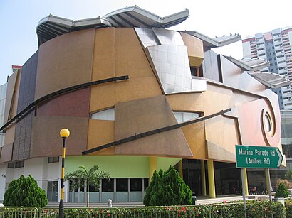
Marine Parade Community Club Address: Marine Parade Road street in Southeast
Places Near Marine Parade Community Club (Southeast)
How to get to popular places in Singapore with public transport
Get around Southeast by public transport!
Travelling around Southeast has never been so easy. See step by step directions as you travel to any attraction, street or major public transport station. View bus and train timetables, arrival times, service alerts and detailed routes on a map, so you know exactly how to get to anywhere in Southeast.
When travelling to any destination around Southeast use Moovit's Live Directions with Get Off Notifications to know exactly where and how far to walk, how long to wait for your line , and how many stops are left. Moovit will alert you when it’s time to get off — no need to constantly re-check whether yours is the next stop.
Wondering how to use public transport in Southeast or how to pay for public transport in Southeast? Moovit public transport app can help you navigate your way with public transport easily, and at minimum cost. It includes public transport fees, ticket prices, and costs. Looking for a map of Southeast public transport lines? Moovit public transport app shows all public transport maps in Southeast with all Bus, Train, Metro, MRT & LRT, Ferry and Cable Car routes and stops on an interactive map.
Singapore has 6 transport type(s), including: Bus, Train, Metro, MRT & LRT, Ferry and Cable Car, operated by several transport agencies, including SMRT, SBS Transit, Tower Transit, Go-Ahead Singapore, Premium Bus, City Direct Bus, Changi Airport, Sentosa Development Corporation, Cross Border Bus, Singapore Cable Car Network, NUS Shuttle (ComfortDelGro), NTU Shuttle (ComfortDelGro), JTC Corp, Shuttle Bus (Appx. Schedule) and Tourist Bus (Book in Advance)