See Marsalform, Żebbuġ, on the map
Directions to Marsalform (Żebbuġ) with public transport
The following transport lines have routes that pass near Marsalform
 Bus:
Bus:
How to get to Marsalform by bus?
Click on the bus route to see step by step directions with maps, line arrival times and updated time schedules.
Bus stations near Marsalform in Żebbuġ
- Ulisse,2 min walk,
- Sajjied,5 min walk,
Bus lines to Marsalform in Żebbuġ
- 310,Victoria - Marsalforn - Victoria,
- 322,Vapur,
What are the nearest stations to Marsalform?
The nearest stations to Marsalform are:
- Ulisse is 109 meters away, 2 min walk.
- Sajjied is 370 meters away, 5 min walk.
Which bus lines stop near Marsalform?
These bus lines stop near Marsalform: 310, 322.
What’s the nearest bus stop to Marsalform in Żebbuġ?
The nearest bus stop to Marsalform in Żebbuġ is Ulisse. It’s a 2 min walk away.
See Marsalform, Żebbuġ, on the map
Public Transit to Marsalform in Żebbuġ
Wondering how to get to Marsalform in Żebbuġ, Malta? Moovit helps you find the best way to get to Marsalform with step-by-step directions from the nearest public transit station.
Moovit provides free maps and live directions to help you navigate through your city. View schedules, routes, timetables, and find out how long does it take to get to Marsalform in real time.
Looking for the nearest stop or station to Marsalform? Check out this list of stops closest to your destination: Ulisse; Sajjied.
Bus:
Want to see if there’s another route that gets you there at an earlier time? Moovit helps you find alternative routes or times. Get directions from and directions to Marsalform easily from the Moovit App or Website.
We make riding to Marsalform easy, which is why over 1.5 million users, including users in Żebbuġ, trust Moovit as the best app for public transit. You don’t need to download an individual bus app or train app, Moovit is your all-in-one transit app that helps you find the best bus time or train time available.
For information on prices of bus and ferry, costs and ride fares to Marsalform, please check the Moovit app.
Use the app to navigate to popular places including to the airport, hospital, stadium, grocery store, mall, coffee shop, school, college, and university.
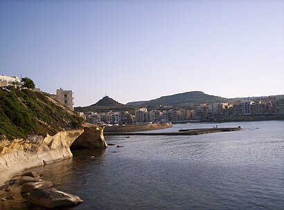
Marsalform Address: Triq Il-Wied street in Żebbuġ
Attractions near Marsalform
Il Plajja Beach Hotel Gozo,Marsalforn Bus Station,Triq il-Mungbell,Marsalforn,La Perla Snack Bar,Smiley's Gozo,Jack's Bar Bistro,Triq Kappillan Frank Debono,Café Del Mar,Ta Mena Winery,On Two Wheels Bike Rental,La Trattoria Marsalforn Gozo,Triq Ulisse / Bajja ta' Marsalforn,I Toscani,Bank Of Valletta,Vitamin Sea Watersports,Crab Shell Kiosk Xwejni,Lantern Guest House - Bahim Hotel,Lantern Guest House (Lantern Guest House - Bahim Hotel Hotel Marsalforn),The Chill Bar & CafeHow to get to popular attractions in Żebbuġ with public transportation
Casino Portomaso, San Ġiljan,Aeroporto di Malta (MLA) (Ajruport Internazzjonali ta' Malta), Hal Luqa,Mgarr, Mġarr,Golden Tulip Vivaldi Hotel, San Ġiljan,Mgarr,Surfside Bar and Grill, Tas-Sliema,Corinthia Hotel St George's Bay, San Ġiljan,The Westin Dragonara Resort, San Ġiljan,L-Imdina, Mdina,Ajruport Internazzjonali Ta 'Malta - Wasliet, Hal Luqa,Vittoriosa | Birgu , Birgu,Rotunda of St Marija Assunta (The Mosta Dome), Mosta,Kalkara, Kalkara,Paola Square, Paola,Rabat, Ħad-Dingli,db San Antonio Hotel & Spa, Naxxar,Hamrun, Hamrun,Hal-Tarxien, Tarxien,Ta' Xbiex, Msida,Departures, Hal LuqaGet around Żebbuġ by public transport!
Travelling around Żebbuġ has never been so easy. See step by step directions as you travel to any attraction, street or major public transport station. View bus and train timetables, arrival times, service alerts and detailed routes on a map, so you know exactly how to get to anywhere in Żebbuġ.
When travelling to any destination around Żebbuġ use Moovit's Live Directions with Get Off Notifications to know exactly where and how far to walk, how long to wait for your line , and how many stops are left. Moovit will alert you when it’s time to get off — no need to constantly re-check whether yours is the next stop.
Wondering how to use public transport in Żebbuġ or how to pay for public transport in Żebbuġ? Moovit public transport app can help you navigate your way with public transport easily, and at minimum cost. It includes public transport fees, ticket prices, and costs. Looking for a map of Żebbuġ public transport lines? Moovit public transport app shows all public transport maps in Żebbuġ with all bus or ferry routes and stops on an interactive map.
Żebbuġ has 2 transport type(s), including: bus or ferry, operated by several transport agencies, including Malta Public Transport, Valletta Ferry Services, Gozo Channel and Comino Ferries Co-Op Ltd.