See Moffat Beach on the map
Directions to Moffat Beach with public transportation
The following transport lines have routes that pass near Moffat Beach
 Bus:
Bus:
How to get to Moffat Beach by bus?
Click on the bus route to see step by step directions with maps, line arrival times and updated time schedules.
Bus stations near Moffat Beach
- Queen St Near Ulm St,2 min walk,
Bus routes to Moffat Beach
- 602,Maroochydore Station,
- 603,Corbould Park Racecourse,
What are the nearest stations to Moffat Beach?
The nearest stations to Moffat Beach are:
- Queen St Near Ulm St is 119 meters away, 2 min walk.
Which bus lines stop near Moffat Beach?
These bus lines stop near Moffat Beach: 600, 602, 605, 607.
What’s the nearest bus stop to Moffat Beach?
The nearest bus stop to Moffat Beach is Queen St Near Ulm St. It’s a 2 min walk away.
What time is the first bus to Moffat Beach?
The 602 is the first bus that goes to Moffat Beach. It stops nearby at 07:09.
What time is the last bus to Moffat Beach?
The 602 is the last bus that goes to Moffat Beach. It stops nearby at 19:54.
How much is the bus fare to Moffat Beach?
The bus fare to Moffat Beach costs about $2.84 - $8.72.
How much is the train fare to Moffat Beach?
The train fare to Moffat Beach costs about $3.55 - $8.72.
See Moffat Beach on the map
Public Transportation to Moffat Beach
Wondering how to get to Moffat Beach, Australia? Moovit helps you find the best way to get to Moffat Beach with step-by-step directions from the nearest public transit station.
Moovit provides free maps and live directions to help you navigate through your city. View schedules, routes, timetables, and find out how long does it take to get to Moffat Beach in real time.
Looking for the nearest stop or station to Moffat Beach? Check out this list of stops closest to your destination: Queen St Near Ulm St.
Bus:
Want to see if there’s another route that gets you there at an earlier time? Moovit helps you find alternative routes or times. Get directions from and directions to Moffat Beach easily from the Moovit App or Website.
We make riding to Moffat Beach easy, which is why over 1.5 million users, including users in Moffat Beach, trust Moovit as the best app for public transit. You don’t need to download an individual bus app or train app, Moovit is your all-in-one transit app that helps you find the best bus time or train time available.
For information on prices of bus and train, costs and ride fares to Moffat Beach, please check the Moovit app.
Use the app to navigate to popular places including to the airport, hospital, stadium, grocery store, mall, coffee shop, school, college, and university.
Moffat Beach Address: Grigor St 149 Moffat Beach, 4551 Sunshine Coast street in Moffat Beach
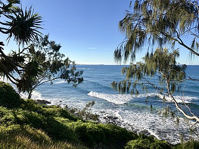
Moffat Beach is a coastal suburb in the Sunshine Coast Region, Queensland, Australia. In the 2021 census, Moffat Beach had a population of 2,691 people.Wiki
Attractions near Moffat Beach
Caloundra Car Sound & Air Conditioning,Soda Studio,Tara Sage Fine Art,Love Charlie Xo,Asia Pacific Piping Systems,Henzells Agency,Leon Equipment Solutions Pty,Raven Small Engine Repairs,Master Drafting,Flash Fibres,Ellis RV,QST Property,TCL Joinery,Jaycekay,LW Survey Company,Justbenny Fabrication,Loving Life Support Services,Image Up Club,Tyler Rhys Design Pty,Aerial EnergyHow to get to popular attractions in Moffat Beach with public transportation
Dfo, Pinkenba,Fortitude Valley, Fortitude Valley,Brisbane Girls Grammar School, Spring Hill,New Farm Park Ferry Terminal,Bracken Ridge, Bracken Ridge,UQ Centre, St Lucia,Surfers Paradise,State Library Of Queensland, South Brisbane,Strathpine Centre, Strathpine,South Bank Parklands, South Brisbane,Princess Alexandra Hospital, Woolloongabba,Griffith University Mount Gravatt Campus (Queensland Institute Of Business And Technology), Mount Gravatt,Surfers Paradise YHA, Main Beach,Forest Lake, Forest Lake,Noosa Heads, Noosa Heads,Logan Hyperdome, Shailer Park,Australian Catholic University, Banyo,Capalaba Central Shopping Centre, Capalaba,Kelvin Grove, Kelvin Grove,Clayfield College, ClayfieldGet around Moffat Beach by public transport!
Travelling around Moffat Beach has never been so easy. See step by step directions as you travel to any attraction, street or major public transport station. View bus and train timetables, arrival times, service alerts and detailed routes on a map, so you know exactly how to get to anywhere in Moffat Beach.
When travelling to any destination around Moffat Beach use Moovit's Live Directions with Get Off Notifications to know exactly where and how far to walk, how long to wait for your line , and how many stops are left. Moovit will alert you when it’s time to get off — no need to constantly re-check whether yours is the next stop.
Wondering how to use public transport in Moffat Beach or how to pay for public transport in Moffat Beach? Moovit public transport app can help you navigate your way with public transport easily, and at minimum cost. It includes public transport fees, ticket prices, and costs. Looking for a map of Moffat Beach public transport lines? Moovit public transport app shows all public transport maps in Moffat Beach with all bus or train routes and stops on an interactive map.
Moffat Beach has 2 transport type(s), including: bus or train, operated by several transport agencies, including TransLink SEQ, TransLink, TransLink, TransLink, Christensens Bus and Coach, North Stradbroke Island Buses and Griffith Uni Intercampus bus