See Mount Coolum on the map
Directions to Mount Coolum with public transportation
The following transport lines have routes that pass near Mount Coolum
 Bus:
Bus:
How to get to Mount Coolum by bus?
Click on the bus route to see step by step directions with maps, line arrival times and updated time schedules.
Bus stations near Mount Coolum
- David Low Way at Mount Coolum,10 min walk,
Bus routes to Mount Coolum
- 620,Mudjimba Beach,
- 622,Maroochydore Station,
What are the nearest stations to Mount Coolum?
The nearest stations to Mount Coolum are:
- David Low Way at Mount Coolum is 705 meters away, 10 min walk.
Which bus line stops near Mount Coolum?
620
What’s the nearest bus stop to Mount Coolum?
The nearest bus stop to Mount Coolum is David Low Way at Mount Coolum. It’s a 10 min walk away.
What time is the first bus to Mount Coolum?
The 620 is the first bus that goes to Mount Coolum. It stops nearby at 04:54.
What time is the last bus to Mount Coolum?
The 620 is the last bus that goes to Mount Coolum. It stops nearby at 23:31.
How much is the bus fare to Mount Coolum?
The bus fare to Mount Coolum costs about $2.84 - $6.63.
See Mount Coolum on the map
Public Transportation to Mount Coolum
Wondering how to get to Mount Coolum, Australia? Moovit helps you find the best way to get to Mount Coolum with step-by-step directions from the nearest public transit station.
Moovit provides free maps and live directions to help you navigate through your city. View schedules, routes, timetables, and find out how long does it take to get to Mount Coolum in real time.
Looking for the nearest stop or station to Mount Coolum? Check out this list of stops closest to your destination: David Low Way at Mount Coolum.
Bus:
Want to see if there’s another route that gets you there at an earlier time? Moovit helps you find alternative routes or times. Get directions from and directions to Mount Coolum easily from the Moovit App or Website.
We make riding to Mount Coolum easy, which is why over 1.5 million users, including users in Brisbane, trust Moovit as the best app for public transit. You don’t need to download an individual bus app or train app, Moovit is your all-in-one transit app that helps you find the best bus time or train time available.
For information on prices of bus, costs and ride fares to Mount Coolum, please check the Moovit app.
Use the app to navigate to popular places including to the airport, hospital, stadium, grocery store, mall, coffee shop, school, college, and university.
Location: Brisbane
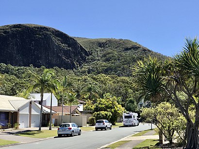
Mount Coolum is a coastal suburb in the Sunshine Coast Region, Queensland, Australia. In the 2021 census, Mount Coolum had a population of 4,545 people.Wiki
Popular routes to Mount Coolum
Popular routes from Mount Coolum
Attractions near Mount Coolum
Will2build,Nirvana Luxor,SMPC Creative Designbranding & Digital Agency,Coolum Rise,Lis S Soul Sanctuary,Peta Zafir,Daily Dose,Packnic Picnic,French in Oz,Sass & Niki Wedding Hair,Timber Garden Cabins,Island Thatch,Adventure & Travel Marketing,X Class,Finding Your Balance,Luxvibe,Sunshine Coast Occupational Medicine,Mount Coolum Shopping Centre,Nicola Pearce Performance Dietitian,Wright Place Mount CoolumHow to get to popular attractions in Brisbane with public transportation
Clayfield College, Clayfield,Southport Sharks, Southport,Snapper Rocks Beach,Belmont Tavern, Belmont,Noosa Heads, Noosa Heads,Whites Hill State College, Camp Hill,UQ Centre, St Lucia,Peregian Beach,James Cook University, City,Cavendish Road State High School, Holland Park,Pacific Fair, Broadbeach Waters,Stafford City, Stafford,Bunnings Warehouse, Morayfield,Inala Plaza, Inala,New Farm Park Ferry Terminal,Eatons Hill, Eatons Hill,Mooloolaba, Mooloolaba,Queen Elizabeth II Jubilee Hospital, Coopers Plains,Ashmore, Ashmore,Sunnybank Hills Shoppingtown, Sunnybank HillsGet around Brisbane by public transport!
Travelling around Brisbane has never been so easy. See step by step directions as you travel to any attraction, street or major public transport station. View bus and train timetables, arrival times, service alerts and detailed routes on a map, so you know exactly how to get to anywhere in Brisbane.
When travelling to any destination around Brisbane use Moovit's Live Directions with Get Off Notifications to know exactly where and how far to walk, how long to wait for your line , and how many stops are left. Moovit will alert you when it’s time to get off — no need to constantly re-check whether yours is the next stop.
Wondering how to use public transport in Brisbane or how to pay for public transport in Brisbane? Moovit public transport app can help you navigate your way with public transport easily, and at minimum cost. It includes public transport fees, ticket prices, and costs. Looking for a map of Brisbane public transport lines? Moovit public transport app shows all public transport maps in Brisbane with all bus routes and stops on an interactive map.
Brisbane has 1 transport type(s), including: bus, operated by several transport agencies, including TransLink SEQ, TransLink, TransLink, TransLink, Christensens Bus and Coach, North Stradbroke Island Buses and Griffith Uni Intercampus bus