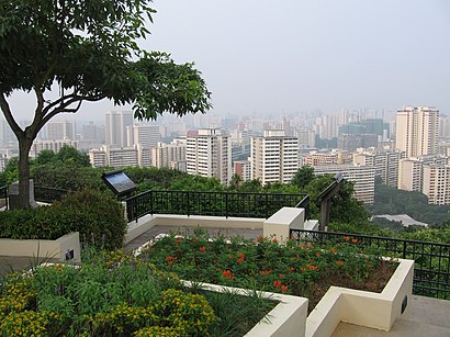
See Mount Faber, Singapore, on the map
Own work
Directions to Mount Faber (Singapore) with public transport
The following transport lines have routes that pass near Mount Faber
 Bus:
Bus: - Metro:
How to get to Mount Faber by bus?
Click on the bus route to see step by step directions with maps, line arrival times and updated time schedules.
How to get to Mount Faber by train?
Click on the train route to see step by step directions with maps, line arrival times and updated time schedules.
How to get to Mount Faber by metro?
Click on the metro route to see step by step directions with maps, line arrival times and updated time schedules.
Bus stations near Mount Faber in Singapore
- Telok Blangah Rd - Opp Vivocity (14119),7 min walk,
- Taxi Stand F32 - Telok Blangah Rd (Harbourfront MRT Exit D),8 min walk,
- Telok Blangah Rd - Vivocity (14141),10 min walk,
Metro stations near Mount Faber in Singapore
- Harbourfront (NE1|CC29),10 min walk,
Mrt & lrt stations near Mount Faber in Singapore
- Vivocity Station,15 min walk,
Bus lines to Mount Faber in Singapore
- 10,Tampines Int ↔ Kent Ridge Ter,
- 30,Bedok Int ↔ Boon Lay Int,
- 57,Bishan Int ↔ Bt Merah Int,
- 61,Bt Batok Int ↔ Eunos Int,
- 65,Tampines Int ↔ HarbourFront Int,
- 80,Sengkang Int ↔ HarbourFront Int,
- 97,Jurong East Int ↔ Marina Ctr Ter,
- 100,Serangoon Int ↔ Ghim Moh Ter,
- 131,St. Michael’s Ter ↔ Bt Merah Int,
- 143,Toa Payoh Int ↔ Jurong East Int,
- 145,Toa Payoh Int ↔ Buona Vista Ter,
- 166,Ang Mo Kio Int ↔ Clementi Int,
- 855,Yishun Int ↔ HarbourFront Int,
- 30E,[AM Peak]: Pasir Panjang Rd (Opp Heng Mui Keng Terrace) [PM Peak]: Bedok Int,
- 97E,[AM Peak]: Marina Ctr Ter [PM Peak]: Jurong East Int,
- 123M,HarbourFront Int ↺ Tiong Bahru Rd,
- SHUTTLE 22,HarbourFront ↔ Serangoon,
- AMARA SANCTUARY SHUTTLE,Amara Sanctuary Resort Sentosa,
- SOFITEL SENTOSA HOTEL SHUTTLE,HarbourFront MRT Exit D,
- RWS8,Rws Basement → Telok Blangah Road (Vivocity),
What are the nearest stations to Mount Faber?
The nearest stations to Mount Faber are:
- Telok Blangah Rd - Opp Vivocity (14119) is 467 meters away, 7 min walk.
- Taxi Stand F32 - Telok Blangah Rd (Harbourfront MRT Exit D) is 572 meters away, 8 min walk.
- Harbourfront (NE1|CC29) is 678 meters away, 10 min walk.
- Telok Blangah Rd - Vivocity (14141) is 682 meters away, 10 min walk.
- Vivocity Station is 1086 meters away, 15 min walk.
Which bus lines stop near Mount Faber?
These bus lines stop near Mount Faber: 143, 145, 65.
Which metro lines stop near Mount Faber?
These metro lines stop near Mount Faber: CIRCLE LINE, NORTH EAST LINE.
What’s the nearest MRT & LRT station to Mount Faber in Singapore?
The nearest MRT & LRT station to Mount Faber in Singapore is Vivocity Station. It’s a 15 min walk away.
What’s the nearest metro station to Mount Faber in Singapore?
The nearest metro station to Mount Faber in Singapore is Harbourfront (NE1|CC29). It’s a 10 min walk away.
What’s the nearest bus stop to Mount Faber in Singapore?
The nearest bus stop to Mount Faber in Singapore is Telok Blangah Rd - Opp Vivocity (14119). It’s a 7 min walk away.
See Mount Faber, Singapore, on the map
Own work
Public Transit to Mount Faber in Singapore
Wondering how to get to Mount Faber in Singapore, Singapore? Moovit helps you find the best way to get to Mount Faber with step-by-step directions from the nearest public transit station.
Moovit provides free maps and live directions to help you navigate through your city. View schedules, routes, timetables, and find out how long does it take to get to Mount Faber in real time.
Looking for the nearest stop or station to Mount Faber? Check out this list of stops closest to your destination: Telok Blangah Rd - Opp Vivocity (14119); Taxi Stand F32 - Telok Blangah Rd (Harbourfront MRT Exit D); Harbourfront (NE1|CC29); Telok Blangah Rd - Vivocity (14141); Vivocity Station.
Bus:Metro:
Want to see if there’s another route that gets you there at an earlier time? Moovit helps you find alternative routes or times. Get directions from and directions to Mount Faber easily from the Moovit App or Website.
We make riding to Mount Faber easy, which is why over 1.5 million users, including users in Singapore, trust Moovit as the best app for public transit. You don’t need to download an individual bus app or train app, Moovit is your all-in-one transit app that helps you find the best bus time or train time available.
For information on prices of metro and bus, costs and ride fares to Mount Faber, please check the Moovit app.
Use the app to navigate to popular places including to the airport, hospital, stadium, grocery store, mall, coffee shop, school, college, and university.
Mount Faber Address: Temenggong Road street in Singapore
Own work
Popular routes to Mount Faber, Singapore
Attractions near Mount Faber
20 Temenggong Rd,Nagaiche,TQ Communications,Hornet Computer Systems,Turquoise Communications,Restaurant Mariner Deck,51 Marang Rd,Hornet Computer Systems (S) Pte LTD,Temenggong Road,099280,Telok Blangah,Temenggong Artists-in-Residence LTD.,Autospa,Medicalweb Pte. LTD.,Global HRS Maritime Pte. LTD.,Xin Rong Services Pte. LTD.,Skin Consultancy Pte. LTD.,Fussfree Auto,Marang Trail,Mount Faber RoadHow to get to popular attractions in Singapore with public transportation
HarbourFront Departure Hall, Singapore,NTUC Foodfare, Northwest,NUS FASS AS1, Southwest,Asia Pacific Breweries Limited, Southwest,包公XO鱼头米粉 Bao Gong XO Fish Head Beehoon, Southwest,Dyna-Mac Engineering Services Pte. Ltd., Southwest,Bus Stop 23491 (Joo Koon Stn), Southwest,Blk 18 @ TradeHub 21, Southwest,AbbVie, Southwest,Bus Stop 59561 (Blk 798), Singapore,Star Point, Southwest,Setsco, Southwest,Harry's Bar, Singapore,Hillview Camp, Southwest,Jurong Logistics Hub, Southwest,Black Society 黑社會, Singapore,Sanofi Aventis, Southwest,Jia Xiang Sarawak Kuching Kolo Mee 家香面, Singapore,Prime Supermarket, Southwest,Emerson Process Management Asia Pacific Pte Ltd, SouthwestGet around Singapore by public transport!
Travelling around Singapore has never been so easy. See step by step directions as you travel to any attraction, street or major public transport station. View bus and train timetables, arrival times, service alerts and detailed routes on a map, so you know exactly how to get to anywhere in Singapore.
When travelling to any destination around Singapore use Moovit's Live Directions with Get Off Notifications to know exactly where and how far to walk, how long to wait for your line , and how many stops are left. Moovit will alert you when it’s time to get off — no need to constantly re-check whether yours is the next stop.
Wondering how to use public transport in Singapore or how to pay for public transport in Singapore? Moovit public transport app can help you navigate your way with public transport easily, and at minimum cost. It includes public transport fees, ticket prices, and costs. Looking for a map of Singapore public transport lines? Moovit public transport app shows all public transport maps in Singapore with all metro or bus routes and stops on an interactive map.
Singapore has 2 transport type(s), including: metro or bus, operated by several transport agencies, including SMRT, SBS Transit, SMRT, MRT/LRT Replacement Services, SBS Transit, SBS Transit, SMRT, Tower Transit, Go-Ahead Singapore, Premium Bus, City Direct Bus, Changi Airport, Sentosa Development Corporation, Sentosa Development Corporation and Cross Border Bus