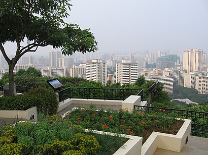
Directions to Mount Faber Park (Singapore) with public transport
The following transport lines have routes that pass near Mount Faber Park
How to get to Mount Faber Park by bus?
Click on the bus route to see step by step directions with maps, line arrival times and updated time schedules.
How to get to Mount Faber Park by metro?
Click on the metro route to see step by step directions with maps, line arrival times and updated time schedules.
Mrt & lrt stations near Mount Faber Park in Singapore
- Vivocity Station, 2 min walk,
Bus stops near Mount Faber Park in Singapore
- Telok Blangah Way - Opp Blk 27 (14299), 6 min walk,
- Telok Blangah Way - Blk 27 (14291), 6 min walk,
- Henderson Rd - Bef Telok Blangah Hts (14059), 9 min walk,
- Telok Blangah Hts - Blk 59 (14349), 12 min walk,
Cable Car stations near Mount Faber Park in Singapore
- Habourfront Station, 10 min walk,
Metro stations near Mount Faber Park in Singapore
- Harbourfront (NE1|CC29), 10 min walk,
Bus lines to Mount Faber Park in Singapore
- 124, Harbourfront Int,
- 131, St. Michael's Ter,
- 195, Marina Ctr Ter,
- 195A, Tiong Bahru Plaza,
- 121, Shenton Way Ter,
- 272, Bt Merah Int,
- 145, Toa Payoh Int ↔ Buona Vista Ter,
- 176, Bt Panjang Int ↔ Bt Merah Int,
- 273, Bt Merah Int ↺ Henderson Rd,
- 120, Kg Bahru Ter,
What are the nearest stations to Mount Faber Park?
The nearest stations to Mount Faber Park are:
- Vivocity Station is 114 meters away, 2 min walk.
- Telok Blangah Way - Opp Blk 27 (14299) is 458 meters away, 6 min walk.
- Telok Blangah Way - Blk 27 (14291) is 459 meters away, 6 min walk.
- Henderson Rd - Bef Telok Blangah Hts (14059) is 632 meters away, 9 min walk.
- Habourfront Station is 717 meters away, 10 min walk.
- Harbourfront (NE1|CC29) is 746 meters away, 10 min walk.
- Telok Blangah Hts - Blk 59 (14349) is 928 meters away, 12 min walk.
Which bus lines stop near Mount Faber Park?
These bus lines stop near Mount Faber Park: 124, 143, 145, 176, 188.
Which metro line stops near Mount Faber Park?
NORTH EAST LINE
What’s the nearest MRT & LRT station to Mount Faber Park in Singapore?
The nearest MRT & LRT station to Mount Faber Park in Singapore is Vivocity Station. It’s a 2 min walk away.
What’s the nearest metro station to Mount Faber Park in Singapore?
The nearest metro station to Mount Faber Park in Singapore is Harbourfront (NE1|CC29). It’s a 10 min walk away.
What’s the nearest bus stop to Mount Faber Park in Singapore?
The nearest bus stops to Mount Faber Park in Singapore are Telok Blangah Way - Opp Blk 27 (14299) and Telok Blangah Way - Blk 27 (14291). The closest one is a 6 min walk away.
What’s the nearest cable car station to Mount Faber Park in Singapore?
The nearest cable car station to Mount Faber Park in Singapore is Habourfront Station. It’s a 10 min walk away.
What time is the first MRT & LRT to Mount Faber Park in Singapore?
The SENTOSA EXPRESS is the first MRT & LRT that goes to Mount Faber Park in Singapore. It stops nearby at 07:00.
What time is the last MRT & LRT to Mount Faber Park in Singapore?
The SENTOSA EXPRESS is the last MRT & LRT that goes to Mount Faber Park in Singapore. It stops nearby at 00:04.
What time is the first metro to Mount Faber Park in Singapore?
The CIRCLE LINE is the first metro that goes to Mount Faber Park in Singapore. It stops nearby at 05:51.
What time is the last metro to Mount Faber Park in Singapore?
The NORTH EAST LINE is the last metro that goes to Mount Faber Park in Singapore. It stops nearby at 00:00.
What time is the first bus to Mount Faber Park in Singapore?
The 124 is the first bus that goes to Mount Faber Park in Singapore. It stops nearby at 05:40.
What time is the last bus to Mount Faber Park in Singapore?
The 145 is the last bus that goes to Mount Faber Park in Singapore. It stops nearby at 00:47.
What time is the first cable car to Mount Faber Park in Singapore?
The MOUNT FABER LINE is the first cable car that goes to Mount Faber Park in Singapore. It stops nearby at 08:45.
What time is the last cable car to Mount Faber Park in Singapore?
The MOUNT FABER LINE is the last cable car that goes to Mount Faber Park in Singapore. It stops nearby at 21:36.
See Mount Faber Park, Singapore, on the map
Public Transit to Mount Faber Park in Singapore
Wondering how to get to Mount Faber Park in Singapore, Singapore? Moovit helps you find the best way to get to Mount Faber Park with step-by-step directions from the nearest public transit station.
Moovit provides free maps and live directions to help you navigate through your city. View schedules, routes, timetables, and find out how long does it take to get to Mount Faber Park in real time.
Looking for the nearest stop or station to Mount Faber Park? Check out this list of stops closest to your destination: Vivocity Station; Telok Blangah Way - Opp Blk 27 (14299); Telok Blangah Way - Blk 27 (14291); Henderson Rd - Bef Telok Blangah Hts (14059); Habourfront Station; Harbourfront (NE1|CC29); Telok Blangah Hts - Blk 59 (14349).
Bus: 124, 143, 145, 176, 188, 121, 272, 131, 195, 195A, 273, 120.Metro: NORTH EAST LINE, CIRCLE LINE.Cable Car: MOUNT FABER LINE.
Want to see if there’s another route that gets you there at an earlier time? Moovit helps you find alternative routes or times. Get directions from and directions to Mount Faber Park easily from the Moovit App or Website.
We make riding to Mount Faber Park easy, which is why over 1.5 million users, including users in Singapore, trust Moovit as the best app for public transit. You don’t need to download an individual bus app or train app, Moovit is your all-in-one transit app that helps you find the best bus time or train time available.
For information on prices of bus and metro, costs and ride fares to Mount Faber Park, please check the Moovit app.
Use the app to navigate to popular places including to the airport, hospital, stadium, grocery store, mall, coffee shop, school, college, and university.
Mount Faber Park Address: Mount Faber Rd, Mount Faber Park, Singapore street in Singapore
Attractions near Mount Faber Park
Faber Fire Command Fortress Plotting Room,Mount Faber Fire Command,Mount Faber Carpark C,Map Of the Southern Ridges,Henderson Waves (亨德森波浪桥),Bell of Happiness,Masjid Al-Amin Telok Blangah Way,Masjid al-Amin,Al-Amin Mosque,Bus Stop 14271 (Al-Amin Mosque),Danish Seamens Church (Danish Seamen's Church),Danish Seamen's Church,105 Mount Faber Rd, Singapore 099202 Mount Faber Road,Telok Blangah Way,Bef Telok Blangah Hts,Mount Faber Park,Sasco Senior Citizens' Home,SASCO DACE (Day Activity Care for the Elderly),Bus Stop 14051 (Aft Telok Blangah Heights),Bukit MerahHow to get to popular attractions in Singapore with public transportation
Multi Purpose Hall 656 Jurong West St 61, Southwest,Bukit Timah Shopping Center, Southwest,The Fullerton Bay Hotel, Singapore,Hong Yi Hao Trading Ptd Ltd, Northwest,Mandai Avenue, Northwest,Citilink Warehouse Complex, Southwest,Bus Stop 20121 (Opp Blk 51), Southwest,Al Ehsan, Southwest,Tuas Power Station, Southwest,Keppel Shipyard Fire Station (benoi), Southwest,American Express, Southwest,West Coast Park, Southwest,Lta Office @ Green Channel, Northwest,15 Pioneer Walk Coffee Shop, Southwest,Tang Plaza, Singapore,Greenlink Medical Clinic, Singapore,Mount Elizabeth Novena Hospital, Singapore,Blk 413 Coffee Shop, Southwest,Indian Heritage Centre, Singapore,Copthorne King Hotel, SingaporeGet around Singapore by public transport!
Travelling around Singapore has never been so easy. See step by step directions as you travel to any attraction, street or major public transport station. View bus and train timetables, arrival times, service alerts and detailed routes on a map, so you know exactly how to get to anywhere in Singapore.
When travelling to any destination around Singapore use Moovit's Live Directions with Get Off Notifications to know exactly where and how far to walk, how long to wait for your line , and how many stops are left. Moovit will alert you when it’s time to get off — no need to constantly re-check whether yours is the next stop.
Wondering how to use public transport in Singapore or how to pay for public transport in Singapore? Moovit public transport app can help you navigate your way with public transport easily, and at minimum cost. It includes public transport fees, ticket prices, and costs. Looking for a map of Singapore public transport lines? Moovit public transport app shows all public transport maps in Singapore with all Bus, Train, Metro, MRT & LRT, Ferry and Cable Car routes and stops on an interactive map.
Singapore has 6 transport type(s), including: Bus, Train, Metro, MRT & LRT, Ferry and Cable Car, operated by several transport agencies, including SMRT, SBS Transit, MRT/LRT Replacement Services, Tower Transit, Go-Ahead Singapore, Premium Bus, City Direct Bus, Changi Airport, Sentosa Development Corporation, Cross Border Bus, Singapore Cable Car Network, NUS Shuttle (ComfortDelGro), NTU Shuttle (ComfortDelGro), JTC Corp, Shuttle Bus (Appx. Schedule)