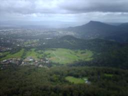
See Mount Kembla, Sydney, on the map
Directions to Mount Kembla (Sydney) with public transport
The following transport lines have routes that pass near Mount Kembla
 Bus: 343526
Which bus lines stop near Mount Kembla?
These bus lines stop near Mount Kembla: 343, 526.
See Mount Kembla, Sydney, on the map
Public Transit to Mount Kembla in Sydney
Wondering how to get to Mount Kembla in Sydney, Australia? Moovit helps you find the best way to get to Mount Kembla with step-by-step directions from the nearest public transit station.
Moovit provides free maps and live directions to help you navigate through your city. View schedules, routes, timetables, and find out how long does it take to get to Mount Kembla in real time.
Bus:343526
Want to see if there’s another route that gets you there at an earlier time? Moovit helps you find alternative routes or times. Get directions from and directions to Mount Kembla easily from the Moovit App or Website.
We make riding to Mount Kembla easy, which is why over 1.5 million users, including users in Sydney, trust Moovit as the best app for public transit. You don’t need to download an individual bus app or train app, Moovit is your all-in-one transit app that helps you find the best bus time or train time available.
For information on prices of bus, costs and ride fares to Mount Kembla, please check the Moovit app.
Use the app to navigate to popular places including to the airport, hospital, stadium, grocery store, mall, coffee shop, school, college, and university.
Location: Sydney
Attractions near Mount Kembla
Kembla Heights,Dendrobium Mine,Tl 11 39,Tl 11 40,Tl 11 41,Mt Kembla Lookout,Mt Kembla Summit Park,The Australian Motorlife Museum,Dapto West Catholic Cemetery,Port Kembla No. 2 Mine,Weighbridge,Wollongong Waste And Resource Recovery Park,Windy Gully Cemetary,Whytes Gully Waste Desposal Depot,Windy Gully,Mrc,Mausoleum,Wollongong Lawn Cemetery Kembla Grange,Cedars Christian College,Illawarra Christian School Cordeaux CampusHow to get to popular attractions in Sydney with public transportation
The Star Casino, Pyrmont,Bar Reggio, Darlinghurst,Single O, Surry Hills,Cruise Bar, The Rocks (Sydney - NSW),Carlingford Court, Carlingford,The Bathers' Pavilion, Mosman,Dove & Olive Hotel, Surry Hills,Panania Station, Panania,Circular Quay, No. 3 Wharf, Sydney,Munich Brauhaus, The Rocks (Sydney - NSW),Flemington Station, Homebush West,Epping Station (Concourse), Epping (NSW),Strathfield Station (Main Concourse), Strathfield (NSW),Minto Station, Minto,Mortdale Station, Mortdale,Central, Haymarket,North Ryde Station, North Ryde,The Treehouse, North Sydney,Pontoon Bar, Sydney,Bronte Beach, BronteGet around Sydney by public transport!
Travelling around Sydney has never been so easy. See step by step directions as you travel to any attraction, street or major public transport station. View bus and train timetables, arrival times, service alerts and detailed routes on a map, so you know exactly how to get to anywhere in Sydney.
When travelling to any destination around Sydney use Moovit's Live Directions with Get Off Notifications to know exactly where and how far to walk, how long to wait for your line , and how many stops are left. Moovit will alert you when it’s time to get off — no need to constantly re-check whether yours is the next stop.
Wondering how to use public transport in Sydney or how to pay for public transport in Sydney? Moovit public transport app can help you navigate your way with public transport easily, and at minimum cost. It includes public transport fees, ticket prices, and costs. Looking for a map of Sydney public transport lines? Moovit public transport app shows all public transport maps in Sydney with all bus routes and stops on an interactive map.
Sydney has 1 transport type(s), including: bus, operated by several transport agencies, including Sydney Metro, Sydney Trains, Sydney Light Rail, Sydney Ferries, Intercity Trains, Intercity Train, NSW TrainLink, CDC NSW R14, U-Go Mobility, Keolis Downer Northern Beaches, Manly Fast Ferry, Transdev John Holland Buses, Busways, Busways North West and Dysons Buslines