Directions to Mount Smart Stadium (Penrose) with public transport
The following transport lines have routes that pass near Mount Smart Stadium
 Bus: 66, 67A, 74, RBO, 321.
- Train: ONE, STH.
How to get to Mount Smart Stadium by bus?
Click on the bus route to see step by step directions with maps, line arrival times and updated time schedules.
How to get to Mount Smart Stadium by train?
Click on the train route to see step by step directions with maps, line arrival times and updated time schedules.
Bus stops near Mount Smart Stadium in Penrose
- Patrick Street, 5 min walk,
- Olive Road, 6 min walk,
- Penrose Station/Station Road, 7 min walk,
- Holloway Place, 18 min walk,
Train stations near Mount Smart Stadium in Penrose
- Onehunga Train Station, 22 min walk,
- Ellerslie Train Station 1, 26 min walk,
Bus lines to Mount Smart Stadium in Penrose
- 67A, Otahuhu To New Lynn Via Onehunga,
- 74, Glen Innes To Onehunga Via Panmure,
- 66, Sylvia Park To Pt Chevalier Beach Via Mt Albert Rd,
- RBO, Onehunga To Newmarket Onehunga Rail Bus,
- 321, Middlemore Station To Britomart Via Greenlane Hospital,
What are the nearest stations to Mount Smart Stadium?
The nearest stations to Mount Smart Stadium are:
- Patrick Street is 349 meters away, 5 min walk.
- Olive Road is 383 meters away, 6 min walk.
- Penrose Station/Station Road is 481 meters away, 7 min walk.
- Holloway Place is 1338 meters away, 18 min walk.
- Onehunga Train Station is 1664 meters away, 22 min walk.
- Ellerslie Train Station 1 is 1895 meters away, 26 min walk.
Which bus lines stop near Mount Smart Stadium?
These bus lines stop near Mount Smart Stadium: 66, 67A, 74.
Which train lines stop near Mount Smart Stadium?
These train lines stop near Mount Smart Stadium: ONE, STH.
What’s the nearest train station to Mount Smart Stadium in Penrose?
The nearest train station to Mount Smart Stadium in Penrose is Onehunga Train Station. It’s a 22 min walk away.
What’s the nearest bus station to Mount Smart Stadium in Penrose?
The nearest bus station to Mount Smart Stadium in Penrose is Patrick Street. It’s a 5 min walk away.
What time is the first train to Mount Smart Stadium in Penrose?
The ONE is the first train that goes to Mount Smart Stadium in Penrose. It stops nearby at 06:23.
What time is the last train to Mount Smart Stadium in Penrose?
The STH is the last train that goes to Mount Smart Stadium in Penrose. It stops nearby at 22:50.
What time is the first bus to Mount Smart Stadium in Penrose?
The 67A is the first bus that goes to Mount Smart Stadium in Penrose. It stops nearby at 05:50.
What time is the last bus to Mount Smart Stadium in Penrose?
The 74 is the last bus that goes to Mount Smart Stadium in Penrose. It stops nearby at 00:04.
See Mount Smart Stadium, Penrose, on the map
Public Transit to Mount Smart Stadium in Penrose
Wondering how to get to Mount Smart Stadium in Penrose? Moovit helps you find the best way to get to Mount Smart Stadium with step-by-step directions from the nearest public transit station.
Moovit provides free maps and live directions to help you navigate through your city. View schedules, routes, timetables, and find out how long does it take to get to Mount Smart Stadium in real time.
Looking for the nearest stop or station to Mount Smart Stadium? Check out this list of stops closest to your destination: Patrick Street; Olive Road; Penrose Station/Station Road; Holloway Place; Onehunga Train Station; Ellerslie Train Station 1.
Bus: 66, 67A, 74, RBO, 321.Train: ONE, STH.
Want to see if there’s another route that gets you there at an earlier time? Moovit helps you find alternative routes or times. Get directions from and directions to Mount Smart Stadium easily from the Moovit App or Website.
We make riding to Mount Smart Stadium easy, which is why over 1.5 million users, including users in Penrose, trust Moovit as the best app for public transit. You don’t need to download an individual bus app or train app, Moovit is your all-in-one transit app that helps you find the best bus time or train time available.
For information on prices of bus and train, costs and ride fares to Mount Smart Stadium, please check the Moovit app.
Use the app to navigate to popular places including to the airport, hospital, stadium, grocery store, mall, coffee shop, school, college, and university.
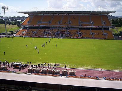
Mount Smart Stadium Address: Beasley Avenue street in Penrose
- East Stand,
- Mt Smart Stadium-Gate D,
- East Lounge,
- 2 Beasley Avenue,
- Mt Smart Stadium,
- Warriors Superstore,
- Gate C,
- Central Cutting Forms,
- Mount Smart Stadium,
- Colin Kay Stand,
- Stacey Jones Lounge,
- NZ Warriors Ltd,
- Auckland Stadiums Office,
- Mo2fix,
- Japan Tyres,
- 17,
- Icp,
- 16 Beasley Avenue,
- Mt Smart Stadium-Gate B,
- 20 Rockridge Ave Parking
Places Near Mount Smart Stadium (Penrose)
- Commerce A, Building 114, Room G10, Auckland Central East,
- Poderi Crisci, Waiheke Island,
- Piha Beach, Auckland Central West,
- Cable Bay Winery, Waiheke Island,
- Cosco, Auckland Central West,
- Sylvia Park Shopping Centre, Mt Wellington South,
- Auckland Hospital Main Building, Grafton East,
- Mt Smart Stadium, Penrose,
- Paramount Muay Thai Gym, Manurewa Central,
- Eden Park, Kingsland,
- Mudbrick Vineyard & Restaurant, Waiheke Island,
- John Bing Muay Thai Boxing Gym, St Lukes,
- Ward 76 - General Surgical, Auckland Hospital, Grafton East,
- Auckland City Hospital, Grafton East,
- Westlake Boys High School, Westlake,
- Greenlane hospital, One Tree Hill Central,
- Science Centre Room G75 (303S-G75), Auckland Central East,
- Middlemore Hospital, Middlemore,
- Ward 75 Orthopaedic Sugery Ward, Grafton East,
- Ward 4 & 5 (AT & R) - Middlemore Hospital, Middlemore
How to get to popular places in Auckland and Hamilton with public transport
Get around Penrose by public transport!
Travelling around Penrose has never been so easy. See step by step directions as you travel to any attraction, street or major public transport station. View bus and train timetables, arrival times, service alerts and detailed routes on a map, so you know exactly how to get to anywhere in Penrose.
When travelling to any destination around Penrose use Moovit's Live Directions with Get Off Notifications to know exactly where and how far to walk, how long to wait for your line , and how many stops are left. Moovit will alert you when it’s time to get off — no need to constantly re-check whether yours is the next stop.
Wondering how to use public transport in Penrose or how to pay for public transport in Penrose? Moovit public transport app can help you navigate your way with public transport easily, and at minimum cost. It includes public transport fees, ticket prices, and costs. Looking for a map of Penrose public transport lines? Moovit public transport app shows all public transport maps in Penrose with all Bus, Train and Ferry routes and stops on an interactive map.
Auckland and Hamilton has 3 transport type(s), including: Bus, Train and Ferry, operated by several transport agencies, including AT Metro, AT Metro Bus, Fullers360, SeaLink Pine Harbour, Belaire Ferries, Tranzit Group Ltd, New Zealand Bus, Bayes Coachlines, Howick and Eastern, Ritchies Transport, Waiheke Bus Company, Mahu City Express, Go Bus, Busit and SeaLink