See Nambour Railway Station on the map
Directions to Nambour Railway Station with public transportation
The following transport lines have routes that pass near Nambour Railway Station
 Bus:
Bus: - Train:
How to get to Nambour Railway Station by bus?
Click on the bus route to see step by step directions with maps, line arrival times and updated time schedules.
Bus stations near Nambour Railway Station
- Howard St at Sydney Street,2 min walk,
- Lowe St at Nambour Central,3 min walk,
- Currie St at Nambour Library,4 min walk,
- Coronation Ave at Matthew Street,7 min walk,
- Price St Near Hospital Rd,8 min walk,
Train stations near Nambour Railway Station
- Woombye Station,61 min walk,
Bus routes to Nambour Railway Station
- 636,Usc Station,
- 612,Maroochydore Station,
- 637,Nambour Station,
- 638,Nambour Central, Lowe St,
- 610,Maroochydore Station,
- 630,Nambour Station,
- 631,Nambour Station,
What are the nearest stations to Nambour Railway Station?
The nearest stations to Nambour Railway Station are:
- Howard St at Sydney Street is 81 meters away, 2 min walk.
- Lowe St at Nambour Central is 165 meters away, 3 min walk.
- Currie St at Nambour Library is 264 meters away, 4 min walk.
- Coronation Ave at Matthew Street is 484 meters away, 7 min walk.
- Price St Near Hospital Rd is 552 meters away, 8 min walk.
- Woombye Station is 4786 meters away, 61 min walk.
Which bus lines stop near Nambour Railway Station?
These bus lines stop near Nambour Railway Station: 610, 612, 630, 631, 636.
What’s the nearest bus stop to Nambour Railway Station?
The nearest bus stop to Nambour Railway Station is Howard St at Sydney Street. It’s a 2 min walk away.
What time is the first train to Nambour Railway Station?
The SUNS is the first train that goes to Nambour Railway Station. It stops nearby at 04:37.
What time is the last train to Nambour Railway Station?
The IPSW is the last train that goes to Nambour Railway Station. It stops nearby at 01:21.
What time is the first bus to Nambour Railway Station?
The 610 is the first bus that goes to Nambour Railway Station. It stops nearby at 05:24.
What time is the last bus to Nambour Railway Station?
The 610 is the last bus that goes to Nambour Railway Station. It stops nearby at 23:06.
How much is the bus fare to Nambour Railway Station?
The bus fare to Nambour Railway Station costs about $2.84 - $5.30.
See Nambour Railway Station on the map
Public Transportation to Nambour Railway Station
Wondering how to get to Nambour Railway Station, Australia? Moovit helps you find the best way to get to Nambour Railway Station with step-by-step directions from the nearest public transit station.
Moovit provides free maps and live directions to help you navigate through your city. View schedules, routes, timetables, and find out how long does it take to get to Nambour Railway Station in real time.
Looking for the nearest stop or station to Nambour Railway Station? Check out this list of stops closest to your destination: Howard St at Sydney Street; Lowe St at Nambour Central; Currie St at Nambour Library; Coronation Ave at Matthew Street; Price St Near Hospital Rd; Woombye Station.
Bus:Train:
Want to see if there’s another route that gets you there at an earlier time? Moovit helps you find alternative routes or times. Get directions from and directions to Nambour Railway Station easily from the Moovit App or Website.
We make riding to Nambour Railway Station easy, which is why over 1.5 million users, including users in Nambour, trust Moovit as the best app for public transit. You don’t need to download an individual bus app or train app, Moovit is your all-in-one transit app that helps you find the best bus time or train time available.
For information on prices of bus, costs and ride fares to Nambour Railway Station, please check the Moovit app.
Use the app to navigate to popular places including to the airport, hospital, stadium, grocery store, mall, coffee shop, school, college, and university.
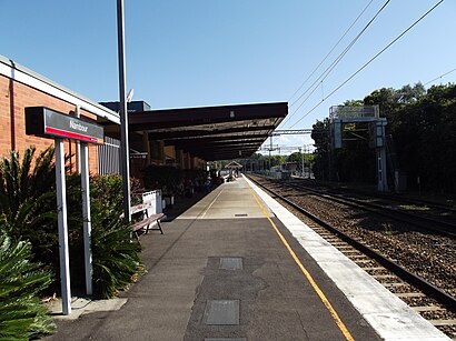
Nambour Railway Station Address: Civic Way street in Nambour
Nambour railway station is located on the North Coast line in Queensland, Australia. It serves the town of Nambour in the Sunshine Coast Region.Wiki
Attractions near Nambour Railway Station
C Squarecommunity Service Building,Capacity1,Southern Sun,Steps,With the Grain Timber Floors,The Century 21,Nambour News & Casket Agency,Nambour Alliance,Urban Fiction Comics,Coastlife Digital,Civil Quality Assurance,Board Games and More,Sundoctors Skin Cancer Clinics Nambour,Majestic Cinemas & Event Centre Nambour,Little India in Nambour,ZLR*Rosie Nails,Sway Music Services,Red Boss,Sunshine Coast Pinball,Sunshine TroupeHow to get to popular attractions in Nambour with public transportation
Strathpine Centre, Strathpine,Waxy's Irish Pub,RACQ, Eight Mile Plains,Whites Hill State College, Camp Hill,Queensland University Of Technology, City,Bracken Ridge, Bracken Ridge,Sea World, Main Beach,Toombul Shopping Centre, Nundah,Queensland Children's Hospital, South Brisbane,Snapper Rocks Beach,Fortitude Valley, Fortitude Valley,Lonestar Tavern, Mermaid Waters,Fortitude Valley, Fortitude Valley,Toombul Interchange, Nundah,Gold Coast,Tower Of Terror II, Coomera,UQ Centre, St Lucia,Rochedale State High School, Rochedale,Toowong Village Shopping Centre, Toowong,Mooloolaba, MooloolabaGet around Nambour by public transport!
Travelling around Nambour has never been so easy. See step by step directions as you travel to any attraction, street or major public transport station. View bus and train timetables, arrival times, service alerts and detailed routes on a map, so you know exactly how to get to anywhere in Nambour.
When travelling to any destination around Nambour use Moovit's Live Directions with Get Off Notifications to know exactly where and how far to walk, how long to wait for your line , and how many stops are left. Moovit will alert you when it’s time to get off — no need to constantly re-check whether yours is the next stop.
Wondering how to use public transport in Nambour or how to pay for public transport in Nambour? Moovit public transport app can help you navigate your way with public transport easily, and at minimum cost. It includes public transport fees, ticket prices, and costs. Looking for a map of Nambour public transport lines? Moovit public transport app shows all public transport maps in Nambour with all bus routes and stops on an interactive map.
Nambour has 1 transport type(s), including: bus, operated by several transport agencies, including TransLink SEQ, TransLink, TransLink, TransLink, Christensens Bus and Coach, North Stradbroke Island Buses and Griffith Uni Intercampus bus