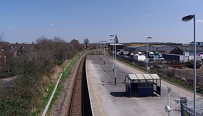
See Netherfield Station, Gedling, on the map
Directions to Netherfield Station (Gedling) with public transport
The following transport lines have routes that pass near Netherfield Station
 Bus:
Bus:
How to get to Netherfield Station by bus?
Click on the bus route to see step by step directions with maps, line arrival times and updated time schedules.
Bus stations near Netherfield Station in Gedling
- Chaworth Road, Colwick,3 min walk,
- Sainsburys, Colwick,4 min walk,
- Shops, Netherfield,6 min walk,
- Morris Street, Netherfield,7 min walk,
- Carlton,7 min walk,
Bus lines to Netherfield Station in Gedling
- N26,Southwell,
- 44,Gedling,
- 44A,Nottingham,
- 50,Netherfield,
- N73,Mapperley - Carlton - Netherfield,
- 773|NOTTSBUS CONNECT,Netherfield - Bakersfield - Netherfield,
- 774|NOTTSBUS CONNECT,Netherfield - Gedling - Netherfield,
- 775|NOTTSBUS CONNECT,Netherfield,
- EAST MIDLANDS RAILWAY,Newark Castle,
- EAST MIDLANDS RAILWAY,Bus Replacement: Nottingham,
What are the nearest stations to Netherfield Station?
The nearest stations to Netherfield Station are:
- Chaworth Road, Colwick is 180 meters away, 3 min walk.
- Sainsburys, Colwick is 293 meters away, 4 min walk.
- Shops, Netherfield is 388 meters away, 6 min walk.
- Morris Street, Netherfield is 464 meters away, 7 min walk.
- Carlton is 507 meters away, 7 min walk.
Which bus line stops near Netherfield Station?
N73
What’s the nearest bus stop to Netherfield Station in Gedling?
The nearest bus stop to Netherfield Station in Gedling is Chaworth Road, Colwick. It’s a 3 min walk away.
See Netherfield Station, Gedling, on the map
Public Transit to Netherfield Station in Gedling
Wondering how to get to Netherfield Station in Gedling, United Kingdom? Moovit helps you find the best way to get to Netherfield Station with step-by-step directions from the nearest public transit station.
Moovit provides free maps and live directions to help you navigate through your city. View schedules, routes, timetables, and find out how long does it take to get to Netherfield Station in real time.
Looking for the nearest stop or station to Netherfield Station? Check out this list of stops closest to your destination: Chaworth Road; Sainsburys; Shops; Morris Street; Carlton.
Bus:
Want to see if there’s another route that gets you there at an earlier time? Moovit helps you find alternative routes or times. Get directions from and directions to Netherfield Station easily from the Moovit App or Website.
We make riding to Netherfield Station easy, which is why over 1.5 million users, including users in Gedling, trust Moovit as the best app for public transit. You don’t need to download an individual bus app or train app, Moovit is your all-in-one transit app that helps you find the best bus time or train time available.
For information on prices of bus, costs and ride fares to Netherfield Station, please check the Moovit app.
Use the app to navigate to popular places including to the airport, hospital, stadium, grocery store, mall, coffee shop, school, college, and university.
Location: Gedling, East Midlands
Attractions near Netherfield Station
Steve Galloway,Swinstead Services Limited,Colwick Industrial Estate,Plant Welding & Engineering,Ng4 2gb,Desi Cafe,Emo's Automotive,Colwick Substation,T R Fabrications,Classical Guitar and Lute Performer,T K Plant,Liberty Interiors,Apl Auto Services,H & A Vehicle Services,CB Security Services,Astute Efficiency,CF End Point Assessment Iqa Services,Summerby's Catering,Cocofalls,Proper BurgerHow to get to popular attractions in Gedling with public transportation
Lakeside Arts Centre, Nottingham,Kettering General Hospital, Kettering,Ikea, Broxtowe,Hilton Leicester Hotel, Blaby,James France Building, Charnwood,Peterborough Power Signal Box, Peterborough,Billing Aquadrome, Northampton,Lenton Boulevard, Nottingham,Western Park, Leicester,Forest Fields, Nottingham,Nuffield Health Nottingham Fitness & Wellbeing Gym, Gedling,Bassett Lowke Halls, Northampton,Nottingham Station, Nottingham,The Castlewood (Brewers Fayre), Bolsover,Wingerworth, North East Derbyshire,The Observatory (Wetherspoon), Erewash,Currys PC World, Lincoln,Virgin Active, Northampton,Burton Latimer, Kettering,Bilborough College, NottinghamGet around Gedling by public transport!
Travelling around Gedling has never been so easy. See step by step directions as you travel to any attraction, street or major public transport station. View bus and train timetables, arrival times, service alerts and detailed routes on a map, so you know exactly how to get to anywhere in Gedling.
When travelling to any destination around Gedling use Moovit's Live Directions with Get Off Notifications to know exactly where and how far to walk, how long to wait for your line , and how many stops are left. Moovit will alert you when it’s time to get off — no need to constantly re-check whether yours is the next stop.
Wondering how to use public transport in Gedling or how to pay for public transport in Gedling? Moovit public transport app can help you navigate your way with public transport easily, and at minimum cost. It includes public transport fees, ticket prices, and costs. Looking for a map of Gedling public transport lines? Moovit public transport app shows all public transport maps in Gedling with all bus routes and stops on an interactive map.
Gedling has 1 transport type(s), including: bus, operated by several transport agencies, including National Rail, Ashbourne Community Transport, Delaine Buses, Arriva Midlands, Centrebus, Our Centre, Hulleys of Baslow, D & G Bus, Stagecoach East Midlands, North Lincolnshire Council, National Rail, Roberts Coaches, Lawson's of Corby, Hawkes Coaches and East Yorkshire