See Newcastle City Hall (Australia) on the map
Directions to Newcastle City Hall (Australia) with public transportation
The following transport lines have routes that pass near Newcastle City Hall (Australia)
 Bus:
Bus: - Train:
How to get to Newcastle City Hall (Australia) by bus?
Click on the bus route to see step by step directions with maps, line arrival times and updated time schedules.
How to get to Newcastle City Hall (Australia) by train?
Click on the train route to see step by step directions with maps, line arrival times and updated time schedules.
Bus stations near Newcastle City Hall (Australia)
- University House King St,2 min walk,
- Newcastle Art Gallery Darby St,6 min walk,
- Darby St Opp Newcastle Art Gallery,6 min walk,
Bus routes to Newcastle City Hall (Australia)
- 11,Customs House,
- 13,Glendale,
- 23,Wallsend,
- 714,Merewether,
- 732,Newcastle Stn,
- 824,Belmont Depot,
- 836,Newcastle Grammar,
- 14,Charlestown,
- 735,Newcastle,
- 815,Kotara HS,
- 818,Queens Wharf,
- 715,Merewether HS,
What are the nearest stations to Newcastle City Hall (Australia)?
The nearest stations to Newcastle City Hall (Australia) are:
- University House King St is 126 meters away, 2 min walk.
- Newcastle Art Gallery Darby St is 378 meters away, 6 min walk.
- Darby St Opp Newcastle Art Gallery is 409 meters away, 6 min walk.
Which bus lines stop near Newcastle City Hall (Australia)?
These bus lines stop near Newcastle City Hall (Australia): 11, 13, 14.
Which train lines stop near Newcastle City Hall (Australia)?
These train lines stop near Newcastle City Hall (Australia): CCN, HUN.
What’s the nearest bus stop to Newcastle City Hall (Australia)?
The nearest bus stop to Newcastle City Hall (Australia) is University House King St. It’s a 2 min walk away.
See Newcastle City Hall (Australia) on the map
Public Transportation to Newcastle City Hall (Australia)
Wondering how to get to Newcastle City Hall (Australia), Australia? Moovit helps you find the best way to get to Newcastle City Hall (Australia) with step-by-step directions from the nearest public transit station.
Moovit provides free maps and live directions to help you navigate through your city. View schedules, routes, timetables, and find out how long does it take to get to Newcastle City Hall (Australia) in real time.
Looking for the nearest stop or station to Newcastle City Hall (Australia)? Check out this list of stops closest to your destination: University House King St; Newcastle Art Gallery Darby St; Darby St Opp Newcastle Art Gallery.
Bus:Train:
Want to see if there’s another route that gets you there at an earlier time? Moovit helps you find alternative routes or times. Get directions from and directions to Newcastle City Hall (Australia) easily from the Moovit App or Website.
We make riding to Newcastle City Hall (Australia) easy, which is why over 1.5 million users, including users in Newcastle, trust Moovit as the best app for public transit. You don’t need to download an individual bus app or train app, Moovit is your all-in-one transit app that helps you find the best bus time or train time available.
For information on prices of bus and train, costs and ride fares to Newcastle City Hall (Australia), please check the Moovit app.
Use the app to navigate to popular places including to the airport, hospital, stadium, grocery store, mall, coffee shop, school, college, and university.
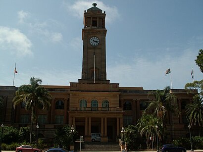
Newcastle City Hall (Australia) Address: 290 King St Newcastle NSW 2300 street in Newcastle
Attractions near Newcastle City Hall (Australia)
Newcastle Town Hall,Newcastle City Hall,Civic Theatre,Civic Precinct Newcastle,DiG Festival,AA Park,375 Hunter Street,King Street,Absinthe,Civic Playhouse,DiGiT Expo,Newcastle City Council,Civic Plaza,Christie Place,Newcastle Permanent,FogHorn Brewhouse,Newcastle Growers Best,The Fruit & Bean Machine,Ray Ray's Roadhouse,Wheeler PlaceHow to get to popular attractions in Newcastle with public transportation
Lidcombe Station (Concourse), Lidcombe,Narrabeen, Narrabeen,The Bathers' Pavilion, Mosman,Petersham Station, Petersham,Riverwood Station, Riverwood,Shady Pines Saloon, Darlinghurst,Katoomba Station, Katoomba,Single O, Surry Hills,Darling Harbour,St Marys Station, St Marys (NSW),Chatswood Station (Main Concourse), Chatswood,MarketPlace Leichhardt, Leichhardt (NSW),Ms. G's, Potts Point,Manly Beach, Manly (NSW),The Rose Hotel, Chippendale,Panania Station, Panania,Narwee Station, Narwee,The Beresford Hotel, Surry Hills,Concord Hospital, Concord West,Wollongong Station, WollongongGet around Newcastle by public transport!
Travelling around Newcastle has never been so easy. See step by step directions as you travel to any attraction, street or major public transport station. View bus and train timetables, arrival times, service alerts and detailed routes on a map, so you know exactly how to get to anywhere in Newcastle.
When travelling to any destination around Newcastle use Moovit's Live Directions with Get Off Notifications to know exactly where and how far to walk, how long to wait for your line , and how many stops are left. Moovit will alert you when it’s time to get off — no need to constantly re-check whether yours is the next stop.
Wondering how to use public transport in Newcastle or how to pay for public transport in Newcastle? Moovit public transport app can help you navigate your way with public transport easily, and at minimum cost. It includes public transport fees, ticket prices, and costs. Looking for a map of Newcastle public transport lines? Moovit public transport app shows all public transport maps in Newcastle with all bus or train routes and stops on an interactive map.
Newcastle has 2 transport type(s), including: bus or train, operated by several transport agencies, including Sydney Metro, Sydney Trains, Sydney Light Rail, Sydney Ferries, Intercity Trains, Intercity Train, NSW TrainLink, CDC NSW R14, U-Go Mobility, Keolis Downer Northern Beaches, Manly Fast Ferry, Transdev John Holland Buses, Busways, Busways North West and Dysons Buslines