Directions to Norwich with public transportation
The following transport lines have routes that pass near Norwich
How to get to Norwich by bus?
Click on the bus route to see step by step directions with maps, line arrival times and updated time schedules.
Bus stations near Norwich
- Prince Of Wales Road, Norwich, 3 min walk,
- Bank Street, Norwich, 5 min walk,
- Castle Meadow, Norwich City Centre, 5 min walk,
- Upper King Street, Norwich, 5 min walk,
- Tombland, Norwich, 6 min walk,
Bus routes to Norwich
- 5B, Eaton - Norwich - Dussindale - Wroxham - Stalham,
- 6B, Riverside Retail Park - Newmarket Road - Eaton,
- 7, Norwich - Great Yarmouth,
- 8, Norwich - Dereham - Toftwood,
- 8A, Norwich - North Tuddenham - Toftwood,
- X13, Norwich - Attleborough,
- 14, Dussindale - Wymondham,
- 14A, Dussindale - Silfield,
- 15, Blofield Heath - Silfield,
- 15A, Silfield - Blofield Heath,
- 16, Lingwood - Wymondham,
- 16A, Wymondham - Lingwood,
- 17, Broadland Gate - Norwich City Centre,
- 23, Heartsease - Costessey,
- 23A, Heartsease - Costessey,
- 24, Thorpe St. Andrew - Queens Hills,
- 24A, Thorpe St. Andrew - Queens Hills,
- 24B, Thorpe St Andrew - Costessey,
- 25, Riverside & Rail Station - University,
- 26, Rail Station - Norfolk & Norwich Hospital,
What are the nearest stations to Norwich?
The nearest stations to Norwich are:
- Prince Of Wales Road, Norwich is 218 meters away, 3 min walk.
- Bank Street, Norwich is 312 meters away, 5 min walk.
- Castle Meadow, Norwich City Centre is 322 meters away, 5 min walk.
- Upper King Street, Norwich is 339 meters away, 5 min walk.
- Tombland, Norwich is 431 meters away, 6 min walk.
Which bus lines stop near Norwich?
These bus lines stop near Norwich: 11B, 12, 14, 16, 21, 24, 29.
What’s the nearest bus stop to Norwich?
The nearest bus stop to Norwich is Prince Of Wales Road, Norwich. It’s a 3 min walk away.
What time is the first bus to Norwich?
The 31 is the first bus that goes to Norwich. It stops nearby at 05:29.
What time is the last bus to Norwich?
The 25 is the last bus that goes to Norwich. It stops nearby at 23:56.
See Norwich on the map
Public Transportation to Norwich
Wondering how to get to Norwich, United Kingdom? Moovit helps you find the best way to get to Norwich with step-by-step directions from the nearest public transit station.
Moovit provides free maps and live directions to help you navigate through your city. View schedules, routes, timetables, and find out how long does it take to get to Norwich in real time.
Looking for the nearest stop or station to Norwich? Check out this list of stops closest to your destination: Prince Of Wales Road; Bank Street; Castle Meadow; Upper King Street; Tombland.
Bus: 11B, 12, 14, 16, 21, 24, 29, 5B, 6B, 7, 8, 8A, 30, 30A, 21A, 23, 28, UTC, 36, 36A, 36B, 37, 5, 10, 10A, 11, 11A, 1, 1A.
Want to see if there’s another route that gets you there at an earlier time? Moovit helps you find alternative routes or times. Get directions from and directions to Norwich easily from the Moovit App or Website.
We make riding to Norwich easy, which is why over 1.5 million users, including users in Norwich, trust Moovit as the best app for public transit. You don’t need to download an individual bus app or train app, Moovit is your all-in-one transit app that helps you find the best bus time or train time available.
For information on prices of bus, costs and ride fares to Norwich, please check the Moovit app.
Use the app to navigate to popular places including to the airport, hospital, stadium, grocery store, mall, coffee shop, school, college, and university.
Norwich Address: 5 Queen Street Norwich Norwich NR2 4 street in Norwich
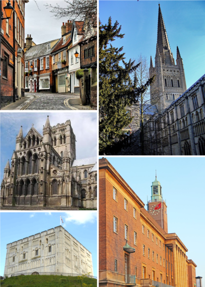
Attractions near Norwich
Form Recognition,Meridian Virtual Office,Service Service,Asi Recruitment,Brewin Dolphin,Crawford Consulting,Notice Media,Hales Group,Gap Personnel,Curveball Media,Hill Osborne,Locam Design,Nerdwallet Uk,Revolución De Cuba,Hideout,Sowerbys,Allgood & Davey,Vodka Revolution,Temples,Leaders Estate AgencyHow to get to popular attractions in Norwich with public transportation
Madingley Road Park & Ride, Cambridge,Hotel De Paris, North Norfolk,Pleasurewood Hills, Waveney,Møller Centre, Cambridge,Cromer Pier, North Norfolk,Holiday Inn Norwich - North, Norwich,Cromer, North Norfolk,Sainsbury's, Ipswich,Robert Kett Junior School, South Norfolk,Wymondham, South Norfolk,Wells-Next-The-Sea, North Norfolk,St Andrews Car Park, Norwich,Bell School Of Cambridge, Cambridge,The Range, South Norfolk,DC10, South Cambridgeshire,Godmanchester, Huntingdonshire,Globe Hotel (Wetherspoon), King'S Lynn And West Norfolk,Hunstanton Beach, King'S Lynn And West Norfolk,Better Jesus Green Lido, Cambridge,Needham Lake, Mid SuffolkGet around East Anglia by public transport!
Travelling around East Anglia has never been so easy. See step by step directions as you travel to any attraction, street or major public transport station. View bus and train timetables, arrival times, service alerts and detailed routes on a map, so you know exactly how to get to anywhere in East Anglia.
When travelling to any destination around East Anglia use Moovit's Live Directions with Get Off Notifications to know exactly where and how far to walk, how long to wait for your line , and how many stops are left. Moovit will alert you when it’s time to get off — no need to constantly re-check whether yours is the next stop.
Wondering how to use public transport in East Anglia or how to pay for public transport in East Anglia? Moovit public transport app can help you navigate your way with public transport easily, and at minimum cost. It includes public transport fees, ticket prices, and costs. Looking for a map of East Anglia public transport lines? Moovit public transport app shows all public transport maps in East Anglia with all Bus, Train and Ferry routes and stops on an interactive map.
East Anglia has 3 transport type(s), including: Bus, Train and Ferry, operated by several transport agencies, including National Rail, Ambassador Travel, Harwich Harbour Ferry, Stephensons of Essex, Villager Minibus Sharnbrook, The Voluntary Network, Dews Coaches, Lord's Travel, Felixstowe Ferry Boat Yard, Hadleigh Community Transport, Beestons, Fenland Association for Community Transport, First Norfolk & Suffolk, Mulleys Motorways, Halesworth Area Community Transport