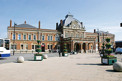
Directions to Norwich Train Station with public transportation
The following transport lines have routes that pass near Norwich Train Station
How to get to Norwich Train Station by bus?
Click on the bus route to see step by step directions with maps, line arrival times and updated time schedules.
Bus stops near Norwich Train Station
- Norwich, 1 min walk,
- Railway Station, Norwich, 1 min walk,
- Riverside Road, Norwich, 2 min walk,
- Prince Of Wales Road, Norwich, 3 min walk,
- Sorting Office, Norwich, 4 min walk,
- Hill House Road, Thorpe Hamlet, 6 min walk,
- Morrisons, Riverside, 7 min walk,
Bus routes to Norwich Train Station
- EAST MIDLANDS RAILWAY, Manchester Piccadilly,
- GREATER ANGLIA, Stansted Airport,
- UTC, Rail Station - UTCN site,
- 3B, Norwich - Barnham Broom - Watton,
- PR3, Postwick Park & Ride - Norwich,
- 5B, Norwich - Newmarket Road - Eaton,
- 7, Norwich - Great Yarmouth,
- 8, Norwich - Dereham - Toftwood,
- 8A, Norwich - North Tuddenham - Toftwood,
- X13, Norwich - Attleborough,
- 14, Dussindale - Wymondham,
- 14A, Dussindale - Silfield,
- 15, Blofield Heath - Silfield,
- 16, Lingwood - Wymondham,
- 17, Broadland Gate - Norwich City Centre,
- 25, Riverside & Rail Station - University,
- 26, Rail Station - Norfolk & Norwich Hospital,
- 26A, Rail Station - Bowthorpe,
- 33, Pilson Green - City Centre,
- 33A, Pilson Green - City Centre,
What are the nearest stations to Norwich Train Station?
The nearest stations to Norwich Train Station are:
- Norwich is 30 meters away, 1 min walk.
- Railway Station, Norwich is 31 meters away, 1 min walk.
- Riverside Road, Norwich is 119 meters away, 2 min walk.
- Prince Of Wales Road, Norwich is 189 meters away, 3 min walk.
- Sorting Office, Norwich is 277 meters away, 4 min walk.
- Hill House Road, Thorpe Hamlet is 424 meters away, 6 min walk.
- Morrisons, Riverside is 463 meters away, 7 min walk.
Which bus lines stop near Norwich Train Station?
These bus lines stop near Norwich Train Station: 16, 24, 28, 29, 35, 36, 501, 8.
What’s the nearest bus station to Norwich Train Station?
The nearest bus stations to Norwich Train Station are Norwich and Railway Station, Norwich. The closest one is a 1 min walk away.
What time is the first train to Norwich Train Station?
The GREATER ANGLIA is the first train that goes to Norwich Train Station. It stops nearby at 05:00.
What time is the last train to Norwich Train Station?
The GREATER ANGLIA is the last train that goes to Norwich Train Station. It stops nearby at 00:36.
What time is the first bus to Norwich Train Station?
The 25 is the first bus that goes to Norwich Train Station. It stops nearby at 03:24.
What time is the last bus to Norwich Train Station?
The 25 is the last bus that goes to Norwich Train Station. It stops nearby at 02:28.
See Norwich Train Station on the map
Public Transportation to Norwich Train Station
Wondering how to get to Norwich Train Station, United Kingdom? Moovit helps you find the best way to get to Norwich Train Station with step-by-step directions from the nearest public transit station.
Moovit provides free maps and live directions to help you navigate through your city. View schedules, routes, timetables, and find out how long does it take to get to Norwich Train Station in real time.
Looking for the nearest stop or station to Norwich Train Station? Check out this list of stops closest to your destination: Norwich; Railway Station; Riverside Road; Prince Of Wales Road; Sorting Office; Hill House Road; Morrisons.
Bus: 16, 24, 28, 29, 35, 36, 501, 8, EAST MIDLANDS RAILWAY, GREATER ANGLIA, UTC, 3B, PR3, 5B, 7, 3, 15A, 16A, 31, 57, 23, 23A, 24A, 24B, PR2, 82.
Want to see if there’s another route that gets you there at an earlier time? Moovit helps you find alternative routes or times. Get directions from and directions to Norwich Train Station easily from the Moovit App or Website.
We make riding to Norwich Train Station easy, which is why over 1.5 million users, including users in Norwich, trust Moovit as the best app for public transit. You don’t need to download an individual bus app or train app, Moovit is your all-in-one transit app that helps you find the best bus time or train time available.
For information on prices of bus, costs and ride fares to Norwich Train Station, please check the Moovit app.
Use the app to navigate to popular places including to the airport, hospital, stadium, grocery store, mall, coffee shop, school, college, and university.
Norwich Train Station Address: Station Approach Norwich Norwich NR1 1 street in Norwich
Places Near Norwich Train Station
How to get to popular places in East Anglia with public transport
Get around Norwich by public transport!
Travelling around Norwich has never been so easy. See step by step directions as you travel to any attraction, street or major public transport station. View bus and train timetables, arrival times, service alerts and detailed routes on a map, so you know exactly how to get to anywhere in Norwich.
When travelling to any destination around Norwich use Moovit's Live Directions with Get Off Notifications to know exactly where and how far to walk, how long to wait for your line , and how many stops are left. Moovit will alert you when it’s time to get off — no need to constantly re-check whether yours is the next stop.
Wondering how to use public transport in Norwich or how to pay for public transport in Norwich? Moovit public transport app can help you navigate your way with public transport easily, and at minimum cost. It includes public transport fees, ticket prices, and costs. Looking for a map of Norwich public transport lines? Moovit public transport app shows all public transport maps in Norwich with all Bus, Train and Ferry routes and stops on an interactive map.
East Anglia has 3 transport type(s), including: Bus, Train and Ferry, operated by several transport agencies, including National Rail, Villager Minibus Sharnbrook, Swift Taxi Cabs, Fareline Bus & Coach Services, Borderbus, Star Cabs, C G Myall & Son, Whippet Coaches, Go Start Community Transport, High Suffolk Community Transport, Stagecoach East, Felix Taxis & Co., Flagfinders, A2B Bus and Coach and Coach Services