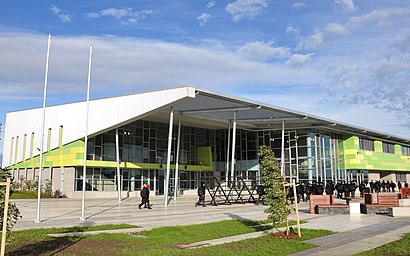
Directions to Nossal High School (Berwick) with public transport
The following transport lines have routes that pass near Nossal High School
How to get to Nossal High School by bus?
Click on the bus route to see step by step directions with maps, line arrival times and updated time schedules.
How to get to Nossal High School by train?
Click on the train route to see step by step directions with maps, line arrival times and updated time schedules.
Bus stations near Nossal High School in Berwick
- Berwick Station (Berwick), 2 min walk,
- Federation University/Clyde Rd (Berwick), 6 min walk,
- Berwick, Reserve St/Clyde Rd (Berwick), 11 min walk,
Train stations near Nossal High School in Berwick
- Berwick, 47 min walk,
Bus lines to Nossal High School in Berwick
- 837, Berwick Station,
- 839, North Berwick,
- 831, Kingsmere Estate - Berwick Station,
- 835, Berwick Station,
- 847, Berwick - Casey Central SC,
- 888, Clyde - Berwick Station,
- 889, Clyde North - Berwick Station,
- 899, The Avenue Village SC - Berwick Station,
- 836, Eden Rise Sc,
- 834, Berwick Station,
- 828, Hampton,
- 838, Fountain Gate Sc,
What are the nearest stations to Nossal High School?
The nearest stations to Nossal High School are:
- Berwick Station (Berwick) is 80 meters away, 2 min walk.
- Federation University/Clyde Rd (Berwick) is 394 meters away, 6 min walk.
- Berwick, Reserve St/Clyde Rd (Berwick) is 820 meters away, 11 min walk.
- Berwick is 3676 meters away, 47 min walk.
Which bus lines stop near Nossal High School?
These bus lines stop near Nossal High School: 828, 888.
Which train line stops near Nossal High School?
PAKENHAM
What’s the nearest bus stop to Nossal High School in Berwick?
The nearest bus stop to Nossal High School in Berwick is Berwick Station (Berwick). It’s a 2 min walk away.
What time is the first train to Nossal High School in Berwick?
The PAKENHAM is the first train that goes to Nossal High School in Berwick. It stops nearby at 03:16.
What time is the last train to Nossal High School in Berwick?
The PAKENHAM is the last train that goes to Nossal High School in Berwick. It stops nearby at 01:05.
What time is the first bus to Nossal High School in Berwick?
The 889 is the first bus that goes to Nossal High School in Berwick. It stops nearby at 07:44.
What time is the last bus to Nossal High School in Berwick?
The 834 is the last bus that goes to Nossal High School in Berwick. It stops nearby at 22:19.
See Nossal High School, Berwick, on the map
Public Transit to Nossal High School in Berwick
Wondering how to get to Nossal High School in Berwick, Australia? Moovit helps you find the best way to get to Nossal High School with step-by-step directions from the nearest public transit station.
Moovit provides free maps and live directions to help you navigate through your city. View schedules, routes, timetables, and find out how long does it take to get to Nossal High School in real time.
Looking for the nearest stop or station to Nossal High School? Check out this list of stops closest to your destination: Berwick Station (Berwick); Federation University/Clyde Rd (Berwick); Berwick, Reserve St/Clyde Rd (Berwick); Berwick.
Bus: 828, 888, 837, 839, 831, 835, 847, 889, 836, 834, 838.Train: PAKENHAM, TRARALGON - MELBOURNE VIA PAKENHAM, MOE & MORWELL.
Want to see if there’s another route that gets you there at an earlier time? Moovit helps you find alternative routes or times. Get directions from and directions to Nossal High School easily from the Moovit App or Website.
We make riding to Nossal High School easy, which is why over 1.5 million users, including users in Berwick, trust Moovit as the best app for public transit. You don’t need to download an individual bus app or train app, Moovit is your all-in-one transit app that helps you find the best bus time or train time available.
For information on prices of bus and train, costs and ride fares to Nossal High School, please check the Moovit app.
Use the app to navigate to popular places including to the airport, hospital, stadium, grocery store, mall, coffee shop, school, college, and university.
Location: Berwick, Melbourne
Attractions near Nossal High School
Nossal Select Entry High School,Insight Education Centre for the Blind and Vision Impaired,Clip N Climb,Signature Nail Systems,CCBT Student Salon,SNS Academy Australia,Bilstein,Masquerade Talent Studios,Masquerade Youth Productions,Presto Printing,Performance Bar,Your Aesthetic,Auswiss Hi-Tech Engineering,Red Fox Pottery,Poolsafetyinspection,The Hope Centre OP Shop,DBL Shot Cafe Berwick,Clic Church,Lioness Performance,Rise Rehab MyoHow to get to popular attractions in Berwick with public transportation
Smoking Area Melbourne Airport T4, Melbourne Airport - Bal,Highpoint Shopping Centre, Maribyrnong,Urbnsurf Wave Park, Tullamarine,Victoria Street, North Melbourne,Clyde North, Cranbourne East - Bal,Spencer Street, West Melbourne,Bonnie Brook, Rockbank,Avalon Airport (AVV), Lara,Captain Cook's Cottage, East Melbourne,42-48 Balston Street, Southbank,Como Centre, South Yarra,Xavier College, Kew,Brighton Beach,Cabrini Hospital Brighton, Brighton,Queen Victoria Market, Melbourne,Swinburne University Of Technology , Hawthorn,Royal Botanic Gardens, South Yarra,Studley Park Road, Kew,Strathtulloh, Melton South,Royal Botanic Gardens Cranbourne, Cranbourne South - BalGet around Melbourne by public transport!
Travelling around Melbourne has never been so easy. See step by step directions as you travel to any attraction, street or major public transport station. View bus and train timetables, arrival times, service alerts and detailed routes on a map, so you know exactly how to get to anywhere in Melbourne.
When travelling to any destination around Melbourne use Moovit's Live Directions with Get Off Notifications to know exactly where and how far to walk, how long to wait for your line , and how many stops are left. Moovit will alert you when it’s time to get off — no need to constantly re-check whether yours is the next stop.
Wondering how to use public transport in Melbourne or how to pay for public transport in Melbourne? Moovit public transport app can help you navigate your way with public transport easily, and at minimum cost. It includes public transport fees, ticket prices, and costs. Looking for a map of Melbourne public transport lines? Moovit public transport app shows all public transport maps in Melbourne with all Bus, Train and Tram routes and stops on an interactive map.
Melbourne has 3 transport type(s), including: Bus, Train and Tram, operated by several transport agencies, including PTV Metropolitan Trains, PTV Metropolitan Bus, Yarra Trams, PTV Regional Bus, SkyBus, Interstate Services, V/Line, V/Line (Coach)