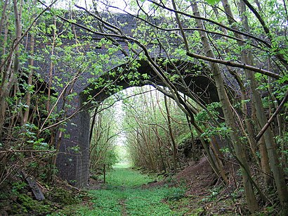
Directions to Notgrove Railway Cutting (Cotswold) with public transport
The following transport lines have routes that pass near Notgrove Railway Cutting
How to get to Notgrove Railway Cutting by bus?
Click on the bus route to see step by step directions with maps, line arrival times and updated time schedules.
Bus stations near Notgrove Railway Cutting in Cotswold
- Westfield, Notgrove,34 min walk,
Bus lines to Notgrove Railway Cutting in Cotswold
- 801,Chipping Norton,
What are the nearest stations to Notgrove Railway Cutting?
The nearest stations to Notgrove Railway Cutting are:
- Westfield, Notgrove is 2684 meters away, 34 min walk.
Which bus line stops near Notgrove Railway Cutting?
801
See Notgrove Railway Cutting, Cotswold, on the map
Public Transit to Notgrove Railway Cutting in Cotswold
Wondering how to get to Notgrove Railway Cutting in Cotswold, United Kingdom? Moovit helps you find the best way to get to Notgrove Railway Cutting with step-by-step directions from the nearest public transit station.
Moovit provides free maps and live directions to help you navigate through your city. View schedules, routes, timetables, and find out how long does it take to get to Notgrove Railway Cutting in real time.
Looking for the nearest stop or station to Notgrove Railway Cutting? Check out this list of stops closest to your destination: Westfield.
Bus:801
Want to see if there’s another route that gets you there at an earlier time? Moovit helps you find alternative routes or times. Get directions from and directions to Notgrove Railway Cutting easily from the Moovit App or Website.
We make riding to Notgrove Railway Cutting easy, which is why over 1.5 million users, including users in Cotswold, trust Moovit as the best app for public transit. You don’t need to download an individual bus app or train app, Moovit is your all-in-one transit app that helps you find the best bus time or train time available.
For information on prices of bus, costs and ride fares to Notgrove Railway Cutting, please check the Moovit app.
Use the app to navigate to popular places including to the airport, hospital, stadium, grocery store, mall, coffee shop, school, college, and university.
Location: Cotswold, South West
Attractions near Notgrove Railway Cutting
Notgrove Railway Cutting,Westfield Farm,Bourton-On-The-Water Caravan And Motorhome Club Campsite ,Dales Croft,Notgrove,Coronation Copse,Hampen Railway Cutting,Notgrove Village Hall,The Nuttery @ Notgrove Hub,Joanna Rolfe,Yellow Rose de,Nutrition4health,Littleborough,Hampen Farm,Lower Barn Farm,Hampen Cottages,Hampen House,Eland Farms,Adorevintage,Mini Ice Cream vanHow to get to popular attractions in Cotswold with public transportation
Gloucestershire, Gloucester,Torquay, Torbay,The Mall at Cribbs Causeway, South Gloucestershire,Hampshire, Eastleigh,Ocean Village, Southampton,Bodmin, Cornwall,Torquay Harbour,Wadebridge, Cornwall,Exeter St Davids Railway Station (EXD), Exeter,The Sir John Baker (Wetherspoon), Portsmouth,The Eden Project, Cornwall,Salisbury City Centre, Wiltshire,Exeter Motorway Services , Exeter,Bristol Temple Meads Railway Station (BRI) (TPB), Bristol, City Of,Lloyds Bank, Bristol, City Of,Sally Lunn's Historic Eating House & Museum, Bath And North East Somerset,Cineworld, Poole,Eastern Avenue, Gloucester,Sainsbury’s, Southampton,Sony Europe, Basingstoke And DeaneGet around Cotswold by public transport!
Travelling around Cotswold has never been so easy. See step by step directions as you travel to any attraction, street or major public transport station. View bus and train timetables, arrival times, service alerts and detailed routes on a map, so you know exactly how to get to anywhere in Cotswold.
When travelling to any destination around Cotswold use Moovit's Live Directions with Get Off Notifications to know exactly where and how far to walk, how long to wait for your line , and how many stops are left. Moovit will alert you when it’s time to get off — no need to constantly re-check whether yours is the next stop.
Wondering how to use public transport in Cotswold or how to pay for public transport in Cotswold? Moovit public transport app can help you navigate your way with public transport easily, and at minimum cost. It includes public transport fees, ticket prices, and costs. Looking for a map of Cotswold public transport lines? Moovit public transport app shows all public transport maps in Cotswold with all bus routes and stops on an interactive map.
Cotswold has 1 transport type(s), including: bus, operated by several transport agencies, including National Rail, Stagecoach South, Padstow Harbour Commissioners, Royal Buses, Tavistock Community Transport, River Link, Beaminster Town Council, Yeos Contracts, MD Coaches, Newport Bus, First Bristol, Bath & the West, First Kernow, St Mawes Ferry, First Wessex, Dorset & South Somerset and Isles of Scilly Steamship Co