Directions to Old Aberdeen with public transportation
The following transport lines have routes that pass near Old Aberdeen
How to get to Old Aberdeen by bus?
Click on the bus route to see step by step directions with maps, line arrival times and updated time schedules.
How to get to Old Aberdeen by train?
Click on the train route to see step by step directions with maps, line arrival times and updated time schedules.
Bus stations near Old Aberdeen
- St Machar Drive, Old Aberdeen, 3 min walk,
- Sir Duncan Rice Library, Old Aberdeen, 3 min walk,
Bus routes to Old Aberdeen
- 20, Aberdeen,
- 19, Peterculter,
- 19S, Milltimber,
What are the nearest stations to Old Aberdeen?
The nearest stations to Old Aberdeen are:
- St Machar Drive, Old Aberdeen is 159 meters away, 3 min walk.
- Sir Duncan Rice Library, Old Aberdeen is 165 meters away, 3 min walk.
Which bus lines stop near Old Aberdeen?
These bus lines stop near Old Aberdeen: 18, 20, 727, 8.
Which train line stops near Old Aberdeen?
SCOTRAIL
What’s the nearest bus stop to Old Aberdeen?
The nearest bus stops to Old Aberdeen are St Machar Drive, Old Aberdeen and Sir Duncan Rice Library, Old Aberdeen. The closest one is a 3 min walk away.
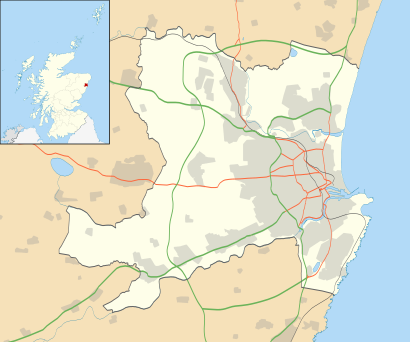
See Old Aberdeen on the map
- Administrative borders and coastline data from Boundary-Line product.
- All other geographic data from Meridian 2 product.
- Inset derived from Inset derived from File:Scotland location map.svg by NordNordWest.
Public Transportation to Old Aberdeen
Wondering how to get to Old Aberdeen, United Kingdom? Moovit helps you find the best way to get to Old Aberdeen with step-by-step directions from the nearest public transit station.
Moovit provides free maps and live directions to help you navigate through your city. View schedules, routes, timetables, and find out how long does it take to get to Old Aberdeen in real time.
Looking for the nearest stop or station to Old Aberdeen? Check out this list of stops closest to your destination: St Machar Drive; Sir Duncan Rice Library.
Bus: 18, 20, 727, 8, 19, 19S.Train: SCOTRAIL.
Want to see if there’s another route that gets you there at an earlier time? Moovit helps you find alternative routes or times. Get directions from and directions to Old Aberdeen easily from the Moovit App or Website.
We make riding to Old Aberdeen easy, which is why over 1.5 million users, including users in Aberdeen, trust Moovit as the best app for public transit. You don’t need to download an individual bus app or train app, Moovit is your all-in-one transit app that helps you find the best bus time or train time available.
For information on prices of bus and train, costs and ride fares to Old Aberdeen, please check the Moovit app.
Use the app to navigate to popular places including to the airport, hospital, stadium, grocery store, mall, coffee shop, school, college, and university.
Location: Aberdeen, Scotland
- Administrative borders and coastline data from Boundary-Line product.
- All other geographic data from Meridian 2 product.
- Inset derived from Inset derived from File:Scotland location map.svg by NordNordWest.
Attractions near Old Aberdeen
Seann Obar Dheathain,Auld Aiberdeen,Tillydrone Avenue, Aberdeen,Infohub,Hub Shop,University of Aberdeen Students' Association,tiki cafe,Tiki Cafe,The Hub,Cruickshank Botanic Gardens,Subway,Fraser Noble Building,FN 116,University of Aberdeen Library,Zoology Building,Fraser Noble 1,Zoology Museum,Waterlines,Sir Duncan Rice Library,University of Aberdeen - School of Biological SciencesHow to get to popular attractions in Aberdeen with public transportation
Aberdeen International Airport (ABZ), Dyce,Forth Bridge,Tesco, Aberdeen,IKEA, Glasgow,St Andrews University Library, St Andrews,Marks & Spencer, Edinburgh,Hillhead, Glasgow,Radisson Blu Hotel, Glasgow,Braehead Shopping Centre, Glasgow,Edinburgh Christmas Market, Edinburgh,Bellgrove Railway Station (BLG), Glasgow,Dunfermline Bus Station, Dunfermline,The Queen Elizabeth University Hospital Campus, Glasgow,The Shore, Edinburgh,Motherwell, Motherwell,Stirling Railway Station (STG), Stirling,Glasgow Green, Glasgow,Motherwell Railway Station (MTH), Motherwell,New Town, Edinburgh,Paisley Gilmour Street Railway Station (PYG), PaisleyGet around Scotland by public transport!
Travelling around Scotland has never been so easy. See step by step directions as you travel to any attraction, street or major public transport station. View bus and train timetables, arrival times, service alerts and detailed routes on a map, so you know exactly how to get to anywhere in Scotland.
When travelling to any destination around Scotland use Moovit's Live Directions with Get Off Notifications to know exactly where and how far to walk, how long to wait for your line , and how many stops are left. Moovit will alert you when it’s time to get off — no need to constantly re-check whether yours is the next stop.
Wondering how to use public transport in Scotland or how to pay for public transport in Scotland? Moovit public transport app can help you navigate your way with public transport easily, and at minimum cost. It includes public transport fees, ticket prices, and costs. Looking for a map of Scotland public transport lines? Moovit public transport app shows all public transport maps in Scotland with all Bus, Train, Light rail and Ferry routes and stops on an interactive map.
Scotland has 4 transport type(s), including: Bus, Train, Light rail and Ferry, operated by several transport agencies, including First Greater Glasgow, First Aberdeen, Lothian Buses, McGill's Bus Service, Stagecoach East Scotland, Stagecoach Bluebird, Xplore Dundee, Community Transport Glasgow, Prentice Westwood, McCall's Coaches, J P Minibus, National Rail, R Robertson & Son, Burnbrae Garage, Ember