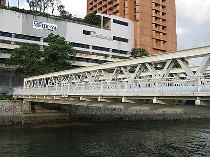
See Ord Bridge, Singapore, on the map
Own work
Directions to Ord Bridge (Singapore) with public transport
The following transport lines have routes that pass near Ord Bridge
Bus:
Metro:
Ferry:
How to get to Ord Bridge by Bus?
Click on the Bus route to see step by step directions with maps, line arrival times and updated time schedules.
How to get to Ord Bridge by Metro?
Click on the Metro route to see step by step directions with maps, line arrival times and updated time schedules.
Metro stations near Ord Bridge in Singapore
- Fort Canning (DT20),3 min walk,
Bus stations near Ord Bridge in Singapore
- River Valley Rd - Bef Fort Canning Stn (04331),4 min walk,
- Clemenceau Ave - Opp Shell Hse (04329),4 min walk,
Bus lines to Ord Bridge in Singapore
- 32,Bedok Int,
- 54,Bishan Int,
- 195,Marina Ctr Ter,
- 195A,Tiong Bahru Plaza,
- FUNVEE CITY HOP-ON HOP-OFF BUS,City Tourist Hub,
- TS3,Johor Bahru Ciq,
- 64,Sims Place Ter,
- 123,Beach Stn Ter,
- 143,Jurong East Int,
- BIG BUS TOURS YELLOW LINE,Suntec Hub,
What are the nearest stations to Ord Bridge?
The nearest stations to Ord Bridge are:
- Fort Canning (DT20) is 172 meters away, 3 min walk.
- River Valley Rd - Bef Fort Canning Stn (04331) is 244 meters away, 4 min walk.
- Clemenceau Ave - Opp Shell Hse (04329) is 273 meters away, 4 min walk.
Which Bus lines stop near Ord Bridge?
These Bus lines stop near Ord Bridge: 123, 143, 147E, 54
Which Metro lines stop near Ord Bridge?
These Metro lines stop near Ord Bridge: DOWNTOWN LINE, NORTH EAST LINE
Which Ferry lines stop near Ord Bridge?
These Ferry lines stop near Ord Bridge: WATERB SHUTTLE SERVICE
What’s the nearest metro station to Ord Bridge in Singapore?
The nearest metro station to Ord Bridge in Singapore is Fort Canning (DT20). It’s a 3 min walk away.
What’s the nearest bus stop to Ord Bridge in Singapore?
The nearest bus stops to Ord Bridge in Singapore are River Valley Rd - Bef Fort Canning Stn (04331) and Clemenceau Ave - Opp Shell Hse (04329). The closest one is a 4 min walk away.
See Ord Bridge, Singapore, on the map
Own work

Public Transit to Ord Bridge in Singapore
Wondering how to get to Ord Bridge in Singapore, Singapore? Moovit helps you find the best way to get to Ord Bridge with step-by-step directions from the nearest public transit station.
Moovit provides free maps and live directions to help you navigate through your city. View schedules, routes, timetables, and find out how long does it take to get to Ord Bridge in real time.
Looking for the nearest stop or station to Ord Bridge? Check out this list of stops closest to your destination: Fort Canning (DT20); River Valley Rd - Bef Fort Canning Stn (04331); Clemenceau Ave - Opp Shell Hse (04329).
Bus:Metro:Ferry:
Want to see if there’s another route that gets you there at an earlier time? Moovit helps you find alternative routes or times. Get directions from and directions to Ord Bridge easily from the Moovit App or Website.
We make riding to Ord Bridge easy, which is why over 1.5 million users, including users in Singapore, trust Moovit as the best app for public transit. You don’t need to download an individual bus app or train app, Moovit is your all-in-one transit app that helps you find the best bus time or train time available.
For information on prices of Bus, Metro and Ferry, costs and ride fares to Ord Bridge, please check the Moovit app.
Use the app to navigate to popular places including to the airport, hospital, stadium, grocery store, mall, coffee shop, school, college, and university.
Ord Bridge Address: Clark Quay street in Singapore

Own work
Attractions near Ord Bridge
- Ue Square Car Park
- Planet Paradise Thai Disco
- Clarke Ord
- Ord Tan Tye Pl
- Ord Brg
- Tan Tye Pl
- Crew Room
- Crew Room (Club Fantasy)
- Crew Room (West Palace)
- Q & M Dental Group - River Valley
- Tokiwado Food Products Singapore
- Planet Venus Singapore
- Shirley's Classic
- The Family Place
- Sentimont Fashion
- River Terrace Coffee House / Poolside Patio
- Club POSH
- Lip Trainer Patakara
- Club Harman
- Liang Court CP
How to get to popular attractions in Singapore with public transportation
- Sembawang Jetty, Northwest
- Ya Kun Kaya Toast 亞坤, Northwest
- Ananas Cafe, Northwest
- Jurong Logistics Hub, Southwest
- Blue Riverview Playground, Northwest
- Compass One, Northeast
- Exxonmobil Chemical, Southwest
- AbbVie, Southwest
- Bagus Cafe, Southwest
- Beach Pool, Southwest
- NTUC FairPrice, Southwest
- Prime Supermarket, Southwest
- Al-Firdaus Mosque, Southwest
- SAF.eMart, Southwest
- Asia Pacific Breweries Limited, Southwest
- The Coffee Bean & Tea Leaf, Singapore
- Jia Xiang Sarawak Kuching Kolo Mee 家香面, Singapore
- Overhead Bridge Across Kranji Expressway (KJE), Southwest
- Ion Orchard, Singapore
- Setsco, Southwest