See Piccadilly Circus, Soho, on the map
Directions to Piccadilly Circus (Soho) with public transport
The following transport lines have routes that pass near Piccadilly Circus
 Bus:
Bus: - Train:
- Tube:
How to get to Piccadilly Circus by bus?
Click on the bus route to see step by step directions with maps, line arrival times and updated time schedules.
How to get to Piccadilly Circus by train?
Click on the train route to see step by step directions with maps, line arrival times and updated time schedules.
How to get to Piccadilly Circus by Tube?
Click on the Tube route to see step by step directions with maps, line arrival times and updated time schedules.
Bus stations near Piccadilly Circus in Soho
- Trocadero / Haymarket (K),3 min walk,
- Beak Street / Hamleys Toy Store (V),6 min walk,
- Old Bond Street / Royal Academy (G),6 min walk,
- Beak Street / Hamleys Toy Store (L),6 min walk,
- Charles I I Street (U),7 min walk,
- Regent Street / St James's (Z),9 min walk,
- Regent Street / St James's (Y),9 min walk,
Tube stations near Piccadilly Circus in Soho
- Green Park,7 min walk,
- Piccadilly Circus,10 min walk,
- Charing Cross,10 min walk,
Train stations near Piccadilly Circus in Soho
- Charing Cross,11 min walk,
Bus lines to Piccadilly Circus in Soho
- 14,Russell Square,
- 19,Battersea Bridge, South Side,
- N19,Clapham Junction,
- 38,Clapton Pond,
- N38,Walthamstow Central,
- N15,Trafalgar Square - Romford Market,
- N18,Trafalgar Square - Harrow Weald, Bus Garage,
- N113,Trafalgar Square - Edgware,
- 139,Waterloo - Golders Green,
- 9,Hammersmith,
- N9,Heathrow Terminal 5,
- 23,Westbourne Park,
- N97,Trafalgar Square,
- N3,Oxford Circus,
- 12,Dulwich Library,
- 94,Piccadilly Circus,
- N109,Croydon Town Centre,
- N136,Chislehurst, War Memorial,
- 159,Oxford Circus,
- 88,Parliament Hill Fields,
What are the nearest stations to Piccadilly Circus?
The nearest stations to Piccadilly Circus are:
- Trocadero / Haymarket (K) is 161 meters away, 3 min walk.
- Beak Street / Hamleys Toy Store (V) is 392 meters away, 6 min walk.
- Old Bond Street / Royal Academy (G) is 410 meters away, 6 min walk.
- Beak Street / Hamleys Toy Store (L) is 412 meters away, 6 min walk.
- Green Park is 492 meters away, 7 min walk.
- Charles I I Street (U) is 519 meters away, 7 min walk.
- Regent Street / St James's (Z) is 615 meters away, 9 min walk.
- Regent Street / St James's (Y) is 688 meters away, 9 min walk.
- Piccadilly Circus is 712 meters away, 10 min walk.
- Charing Cross is 747 meters away, 10 min walk.
Which bus lines stop near Piccadilly Circus?
These bus lines stop near Piccadilly Circus: 139, 159, 453, 9, 94.
Which train lines stop near Piccadilly Circus?
These train lines stop near Piccadilly Circus: ELIZABETH, SOUTHEASTERN.
Which Tube lines stop near Piccadilly Circus?
These Tube lines stop near Piccadilly Circus: BAKERLOO, PICCADILLY.
What’s the nearest Tube station to Piccadilly Circus in Soho?
The nearest Tube station to Piccadilly Circus in Soho is Green Park. It’s a 7 min walk away.
What’s the nearest train station to Piccadilly Circus in Soho?
The nearest train station to Piccadilly Circus in Soho is Charing Cross. It’s a 11 min walk away.
What’s the nearest bus stop to Piccadilly Circus in Soho?
The nearest bus stop to Piccadilly Circus in Soho is Trocadero / Haymarket (K). It’s a 3 min walk away.
What time is the first Tube to Piccadilly Circus in Soho?
The JUBILEE is the first Tube that goes to Piccadilly Circus in Soho. It stops nearby at 05:26.
What time is the last Tube to Piccadilly Circus in Soho?
The JUBILEE is the last Tube that goes to Piccadilly Circus in Soho. It stops nearby at 00:45.
What time is the first train to Piccadilly Circus in Soho?
The SOUTHEASTERN is the first train that goes to Piccadilly Circus in Soho. It stops nearby at 05:20.
What time is the last train to Piccadilly Circus in Soho?
The SOUTHEASTERN is the last train that goes to Piccadilly Circus in Soho. It stops nearby at 23:20.
What time is the first bus to Piccadilly Circus in Soho?
The N136 is the first bus that goes to Piccadilly Circus in Soho. It stops nearby at 03:00.
What time is the last bus to Piccadilly Circus in Soho?
The N9 is the last bus that goes to Piccadilly Circus in Soho. It stops nearby at 04:12.
See Piccadilly Circus, Soho, on the map
Public Transit to Piccadilly Circus in Soho
Wondering how to get to Piccadilly Circus in Soho, United Kingdom? Moovit helps you find the best way to get to Piccadilly Circus with step-by-step directions from the nearest public transit station.
Moovit provides free maps and live directions to help you navigate through your city. View schedules, routes, timetables, and find out how long does it take to get to Piccadilly Circus in real time.
Looking for the nearest stop or station to Piccadilly Circus? Check out this list of stops closest to your destination: Trocadero / Haymarket (K); Beak Street / Hamleys Toy Store (V); Old Bond Street / Royal Academy (G); Beak Street / Hamleys Toy Store (L); Green Park; Charles I I Street (U); Regent Street / St James's (Z); Regent Street / St James's (Y); Piccadilly Circus; Charing Cross.
Bus:Train:Tube:
Want to see if there’s another route that gets you there at an earlier time? Moovit helps you find alternative routes or times. Get directions from and directions to Piccadilly Circus easily from the Moovit App or Website.
We make riding to Piccadilly Circus easy, which is why over 1.5 million users, including users in Soho, trust Moovit as the best app for public transit. You don’t need to download an individual bus app or train app, Moovit is your all-in-one transit app that helps you find the best bus time or train time available.
For information on prices of Tube, train and bus, costs and ride fares to Piccadilly Circus, please check the Moovit app.
Use the app to navigate to popular places including to the airport, hospital, stadium, grocery store, mall, coffee shop, school, college, and university.
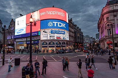
Piccadilly Circus Address: Coventry Street street in Soho
Attractions near Piccadilly Circus
Criterion Theatre,Piccadilly Circus London Underground Station,The Horses Of Helios,Statue of Eros,Shaftesbury Memorial Fountain,Piccadilly Circus Tube Station,Shaftesbury Avenue (piccadilly circus shaftesbury),Piccadilly Circus (glasshouse street piccadilly circus),Picadilly Circus,Piccadilly Circus,Cinnabon Trocadero,Piccadilly Regent Street,Piccadilly Circus taxi rank,Piccadilly Circus,7 - 14 Coventry Street,Lillywhites,Hard Rock Cafe Piccadilly Circus,33 Glasshouse Street,The Hard Rock Cafe,McKinsey & Co.How to get to popular attractions in Soho with public transportation
Chase Farm Hospital, Enfield,Windsor Castle, Windsor,Reading College, Reading,Epping, Epping,Warner Bros. Studio Tour London - the Making Of Harry Potter, Three Rivers,University Of Brighton - Falmer Campus, Brighton And Hove,Greenham Common, West Berkshire,Costco Wholesale, South Croydon,Amazon.co.uk HQ, Slough,Beaconsfield Old Town, Beaconsfield,Lewisham Shopping Centre, Lewisham,Romford, Romford,Brent, Colindale,Cineworld, Ashford,Camden Market Hall, Camden Town,Catford Library, Catford,Renaissance London Heathrow Hotel, Heathrow,Oxford Circus, Soho,Highgate Hill, Upper Holloway,Queen's Club, West KensingtonGet around Soho by public transport!
Travelling around Soho has never been so easy. See step by step directions as you travel to any attraction, street or major public transport station. View bus and train timetables, arrival times, service alerts and detailed routes on a map, so you know exactly how to get to anywhere in Soho.
When travelling to any destination around Soho use Moovit's Live Directions with Get Off Notifications to know exactly where and how far to walk, how long to wait for your line , and how many stops are left. Moovit will alert you when it’s time to get off — no need to constantly re-check whether yours is the next stop.
Wondering how to use public transport in Soho or how to pay for public transport in Soho? Moovit public transport app can help you navigate your way with public transport easily, and at minimum cost. It includes public transport fees, ticket prices, and costs. Looking for a map of Soho public transport lines? Moovit public transport app shows all public transport maps in Soho with all Tube, train or bus routes and stops on an interactive map.
Soho has 3 transport type(s), including: Tube, train or bus, operated by several transport agencies, including London Underground, London Buses, Transport for London, London Tramlink, Transport for London, National Rail, Bluestar, Berry's Coaches, Oxford Bus Company, Stagecoach West, Community First Wessex, Cresta Coaches, D & P Boat Hire, First Portsmouth, Fareham & Gosport and FYTbus