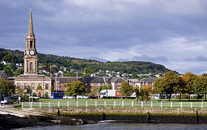
Port Glasgow station - Monday schedule
| Line | Direction | Time |
|---|---|---|
| SCOTRAIL | Glasgow Central | 05:37 |
| SCOTRAIL | Glasgow Central | 06:30 |
| SCOTRAIL | Gourock | 06:40 |
| SCOTRAIL | Glasgow Central | 07:00 |
| SCOTRAIL | Wemyss Bay | 07:15 |
| SCOTRAIL | Glasgow Central | 07:40 |
| SCOTRAIL | Gourock | 07:42 |
| SCOTRAIL | Glasgow Central | 07:48 |
| SCOTRAIL | Glasgow Central | 07:57 |
| SCOTRAIL | Glasgow Central | 08:10 |
| SCOTRAIL | Glasgow Central | 08:17 |
| SCOTRAIL | Glasgow Central | 08:27 |
| SCOTRAIL | Glasgow Central | 08:57 |
| SCOTRAIL | Gourock | 09:12 |
| SCOTRAIL | Wemyss Bay | 09:17 |
| SCOTRAIL | Glasgow Central | 09:18 |
| SCOTRAIL | Glasgow Central | 09:27 |
| SCOTRAIL | Gourock | 09:41 |
| SCOTRAIL | Glasgow Central | 09:57 |
| SCOTRAIL | Gourock | 10:11 |
| SCOTRAIL | Glasgow Central | 10:17 |
| SCOTRAIL | Wemyss Bay | 10:17 |
| SCOTRAIL | Glasgow Central | 10:27 |
| SCOTRAIL | Gourock | 10:41 |
| SCOTRAIL | Glasgow Central | 10:57 |
See Port Glasgow on the map
Directions to Port Glasgow with public transportation
The following transport lines have routes that pass near Port Glasgow
Bus:
Train:
How to get to Port Glasgow by Bus?
Click on the Bus route to see step by step directions with maps, line arrival times and updated time schedules.
How to get to Port Glasgow by Train?
Click on the Train route to see step by step directions with maps, line arrival times and updated time schedules.
Bus stations near Port Glasgow
- Glen Avenue, Port Glasgow,3 min walk,
- Bus Station, Port Glasgow,4 min walk,
- Princes Street, Port Glasgow,4 min walk,
Train stations near Port Glasgow
- Bogston,6 min walk,
{{TRANSIT_TYPE}#Capitalized} routes to Port Glasgow
- 532,Greenock,
- X7,Greenock - Glasgow via Kilmacolm,
- 530,Port Glasgow - Kilmacolm,
- 531,Greenock - Slaemuir,
- 533,Greenock - Park Farm,
- X22,Port Glasgow - Clydebank,
- 535,Devol - Larkfield Ind Est,
- 545,Pt Glasgow or Greenock - IRH or McInroys Pt,
- 802,Larkfield Ind Est - Port Glasgow,
- 901,Largs - Glasgow,
- 906,Largs - Glasgow,
What are the nearest stations to Port Glasgow?
The nearest stations to Port Glasgow are:
- Glen Avenue, Port Glasgow is 192 meters away, 3 min walk.
- Bus Station, Port Glasgow is 264 meters away, 4 min walk.
- Princes Street, Port Glasgow is 274 meters away, 4 min walk.
- Bogston is 400 meters away, 6 min walk.
Which Bus lines stop near Port Glasgow?
These Bus lines stop near Port Glasgow: 901, 906
Which Train lines stop near Port Glasgow?
These Train lines stop near Port Glasgow: SCOTRAIL
What’s the nearest train station to Port Glasgow?
The nearest train station to Port Glasgow is Bogston. It’s a 6 min walk away.
What’s the nearest bus stop to Port Glasgow?
The nearest bus stop to Port Glasgow is Glen Avenue, Port Glasgow. It’s a 3 min walk away.
What time is the first Train to Port Glasgow?
The SCOTRAIL is the first Train that goes to Port Glasgow. It stops nearby at 06:26.
What time is the last Train to Port Glasgow?
The SCOTRAIL is the last Train that goes to Port Glasgow. It stops nearby at 00:30.
What time is the first Bus to Port Glasgow?
The X7 is the first Bus that goes to Port Glasgow. It stops nearby at 05:37.
What time is the last Bus to Port Glasgow?
The X7 is the last Bus that goes to Port Glasgow. It stops nearby at 23:40.
See Port Glasgow on the map

Public transport to Port Glasgow station
Looking for directions to Port Glasgow in Port Glasgow, United Kingdom?
Download the Moovit App to find the current schedule and step-by-step directions for Bus or Train routes that pass through Port Glasgow.
Looking for the nearest stops closest to Port Glasgow ? Check out this list of closest stops to your destination: Glen Avenue; Bus Station; Princes Street; Bogston.
Bus:Train:
We make riding on public transit to Port Glasgow easy, which is why over 1.5 million users, including users in Port Glasgow trust Moovit as the best app for public transit.
Use the app to navigate to popular places including to the airport, hospital, stadium, grocery store, mall, coffee shop, school, college, and university.
The station has the following entrances: Station Rd
The first line to this station is SCOTRAIL, at 05:37, and the last line is SCOTRAIL at 00:26.
This station serves National Rail’s lines

Popular routes to Port Glasgow
From Port GlasgowFrom Port GlasgowFrom Port GlasgowFrom Port GlasgowFrom Port GlasgowFrom Port GlasgowFrom Port GlasgowFrom Port GlasgowFrom Port GlasgowFrom Port GlasgowPopular routes from Port Glasgow
To Robert Gordon UniversityTo LocheeTo University Of GlasgowTo Inverness College UHITo Andrew Miller BuildingTo University Of Edinburgh - Easter Bush CampusTo AuchterarderTo OxgangsTo Edinburgh Napier University - Sighthill CampusTo Robert Gordon UniversityBus stops near Port Glasgow
Train stations near Port Glasgow
Popular public transport stations in Port Glasgow
- Holly Tree Hotel, Kentallen
- Lochend Road, Ratho Station
- York Place, Perth
- P & O Ferry Terminal, Cairnryan
- Wallace Monument Car Park, Causewayhead
- Hamilton West
- Ben Lomond Walk, Balloch
- Kaimes Crossroads, Kaimes
- George Square, Glasgow
- Ayr
- Mayshade Garden Centre, Bonnyrigg
- Burns Avenue, Saltcoats
- Dalhousie Street, Glasgow
- George Street (The Dome), Edinburgh
- Royal Dunkeld Hotel, Dunkeld
- Waterloo Lane, Glasgow
- Restaurant, Allt A Chruinn
- Capledrae Farm, Ballingry
- St Johns Hospital, Howden
- Black Isle Showground, Muir Of Ord