Directions to Port Hacking (Dolans Bay) with public transport
The following transport lines have routes that pass near Port Hacking
How to get to Port Hacking by bus?
Click on the bus route to see step by step directions with maps, line arrival times and updated time schedules.
How to get to Port Hacking by train?
Click on the train route to see step by step directions with maps, line arrival times and updated time schedules.
Which bus lines stop near Port Hacking?
These bus lines stop near Port Hacking: 977, 978.
Which train line stops near Port Hacking?
T4
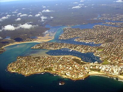
See Port Hacking, Dolans Bay, on the map
Public Transit to Port Hacking in Dolans Bay
Wondering how to get to Port Hacking in Dolans Bay, Australia? Moovit helps you find the best way to get to Port Hacking with step-by-step directions from the nearest public transit station.
Moovit provides free maps and live directions to help you navigate through your city. View schedules, routes, timetables, and find out how long does it take to get to Port Hacking in real time.
Bus: 977, 978.Train: T4.
Want to see if there’s another route that gets you there at an earlier time? Moovit helps you find alternative routes or times. Get directions from and directions to Port Hacking easily from the Moovit App or Website.
We make riding to Port Hacking easy, which is why over 1.5 million users, including users in Dolans Bay, trust Moovit as the best app for public transit. You don’t need to download an individual bus app or train app, Moovit is your all-in-one transit app that helps you find the best bus time or train time available.
For information on prices of bus and train, costs and ride fares to Port Hacking, please check the Moovit app.
Use the app to navigate to popular places including to the airport, hospital, stadium, grocery store, mall, coffee shop, school, college, and university.
Location: Dolans Bay, Sydney
Attractions near Port Hacking
Winifred Falls,Anice Falls,The Meadows,Warumbul,South West Arm,Stewart Toyota,President Private Hospital,Lexus Of Sutherland,Port Hacking Substation,David Wilson Chemist,Australian Health Care,Gymea Baptist,Turner Lodge,Sydney Institute Gymea Tafe,Gymea Bay Oval,Hazelhurst Gallery,Bowie Reserve,House Of Fortune,Gymea Technology High School,St. Catherine Labouré Primary SchoolHow to get to popular attractions in Dolans Bay with public transportation
Campus Centre, Randwick,St Vincents Hospital, Darlinghurst,Charlestown, Charlestown (NSW),Darling Harbour,Westfield Tuggerah, Tuggerah,OMD, Pyrmont,Reuben Hills Coffee Roastery & Café, Surry Hills,The Treehouse, North Sydney,Adriano Zumbo Pâtissier, Pyrmont,Paddington Town Hall, Paddington (NSW),Westfield Eastgardens, Eastgardens,Maroubra Beach, Maroubra,4 Pines Brewpub, Manly (NSW),Westfield Mt Druitt, Mount Druitt,Broadway Shopping Centre, Glebe (NSW),Westfield Warringah Mall, Brookvale,The Russian Club, Strathfield (NSW),Charlestown Square Shopping Centre, Charlestown (NSW),MarketPlace Leichhardt, Leichhardt (NSW),Bavarian Bier Cafe, SydneyGet around Sydney by public transport!
Travelling around Sydney has never been so easy. See step by step directions as you travel to any attraction, street or major public transport station. View bus and train timetables, arrival times, service alerts and detailed routes on a map, so you know exactly how to get to anywhere in Sydney.
When travelling to any destination around Sydney use Moovit's Live Directions with Get Off Notifications to know exactly where and how far to walk, how long to wait for your line , and how many stops are left. Moovit will alert you when it’s time to get off — no need to constantly re-check whether yours is the next stop.
Wondering how to use public transport in Sydney or how to pay for public transport in Sydney? Moovit public transport app can help you navigate your way with public transport easily, and at minimum cost. It includes public transport fees, ticket prices, and costs. Looking for a map of Sydney public transport lines? Moovit public transport app shows all public transport maps in Sydney with all Bus, Train, Metro, Light rail and Ferry routes and stops on an interactive map.
Sydney has 5 transport type(s), including: Bus, Train, Metro, Light rail and Ferry, operated by several transport agencies, including Sydney Metro, Sydney Trains, Sydney Light Rail, Sydney Ferries, Intercity Trains, Intercity Train, NSW TrainLink, CDC NSW R14, U-Go Mobility, Keolis Downer Northern Beaches, Manly Fast Ferry, Transdev John Holland Buses, Busways, Busways North West, Dysons Buslines