Directions to Portslade (Brighton And Hove) with public transport
The following transport lines have routes that pass near Portslade
How to get to Portslade by bus?
Click on the bus route to see step by step directions with maps, line arrival times and updated time schedules.
How to get to Portslade by train?
Click on the train route to see step by step directions with maps, line arrival times and updated time schedules.
Bus stations near Portslade in Brighton And Hove
- Carlton Terrace, Portslade,2 min walk,
- Portslade Station, Portslade,2 min walk,
- Portslade Railway Station, Hove,3 min walk,
- Boundary Road, Hove,6 min walk,
- Links Road, Portslade,6 min walk,
Train stations near Portslade in Brighton And Hove
- Preston Park,39 min walk,
Bus lines to Portslade in Brighton And Hove
- 6,West Hove Sainsburys - Brighton,
- 46,Southwick - Brighton - Hollingbury,
- 71,Hove Park - Brighton - Whitehawk,
- 93,Hove - Blatchington Mill School,
- 95,Hangleton - Portslade - Hove - Cardinal Newman School,
- 96,Hove - Hangleton,
- 1X,Mile Oak,
- 16,Portslade-By-Sea,
- 16A,Hangleton,
- 25,Hove - Brighton - University Of Sussex,
- 49,Hove - Brighton - Moulsecoomb,
- 95A,Portslade - Cardinal Newman School,
- N1,Portslade Village,
- 1,Portslade Village,
- 2,Steyning - Shoreham - Hove - Brighton - Rottingdean,
- 2B,Steyning - Hove,
- 55,Portslade - Hollingbury,
- 59,Shoreham - Brighton,
- 59A,Shoreham - Cardinal Newman School,
- 60,Brighton,
What are the nearest stations to Portslade?
The nearest stations to Portslade are:
- Carlton Terrace, Portslade is 113 meters away, 2 min walk.
- Portslade Station, Portslade is 137 meters away, 2 min walk.
- Portslade Railway Station, Hove is 152 meters away, 3 min walk.
- Boundary Road, Hove is 422 meters away, 6 min walk.
- Links Road, Portslade is 430 meters away, 6 min walk.
- Preston Park is 2996 meters away, 39 min walk.
Which bus lines stop near Portslade?
These bus lines stop near Portslade: 025, 1, 1X, 49, 700.
Which train line stops near Portslade?
SOUTHERN
What’s the nearest bus stop to Portslade in Brighton And Hove?
The nearest bus stops to Portslade in Brighton And Hove are Carlton Terrace, Portslade and Portslade Station, Portslade. The closest one is a 2 min walk away.
What time is the first train to Portslade in Brighton And Hove?
The THAMESLINK is the first train that goes to Portslade in Brighton And Hove. It stops nearby at 05:46.
What time is the last train to Portslade in Brighton And Hove?
The THAMESLINK is the last train that goes to Portslade in Brighton And Hove. It stops nearby at 01:20.
What time is the first bus to Portslade in Brighton And Hove?
The N1 is the first bus that goes to Portslade in Brighton And Hove. It stops nearby at 03:12.
What time is the last bus to Portslade in Brighton And Hove?
The N1 is the last bus that goes to Portslade in Brighton And Hove. It stops nearby at 03:12.
See Portslade, Brighton And Hove, on the map
Public Transit to Portslade in Brighton And Hove
Wondering how to get to Portslade in Brighton And Hove, United Kingdom? Moovit helps you find the best way to get to Portslade with step-by-step directions from the nearest public transit station.
Moovit provides free maps and live directions to help you navigate through your city. View schedules, routes, timetables, and find out how long does it take to get to Portslade in real time.
Looking for the nearest stop or station to Portslade? Check out this list of stops closest to your destination: Carlton Terrace; Portslade Station; Portslade Railway Station; Boundary Road; Links Road; Preston Park.
Bus:02511X497006467193952595A1616AN1Train:SOUTHERNGATWICK EXPRESSTHAMESLINK
Want to see if there’s another route that gets you there at an earlier time? Moovit helps you find alternative routes or times. Get directions from and directions to Portslade easily from the Moovit App or Website.
We make riding to Portslade easy, which is why over 1.5 million users, including users in Brighton And Hove, trust Moovit as the best app for public transit. You don’t need to download an individual bus app or train app, Moovit is your all-in-one transit app that helps you find the best bus time or train time available.
For information on prices of train and bus, costs and ride fares to Portslade, please check the Moovit app.
Use the app to navigate to popular places including to the airport, hospital, stadium, grocery store, mall, coffee shop, school, college, and university.
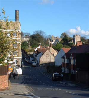
Portslade Address: Station Road street in Brighton And Hove
Attractions near Portslade
Portslade Railway Station (Stop H), Hove,Jobcentre Plus,Ivam Maciel BJJ - Brazilian Jiu-Jitsu and MMA Academy,Portland Road (portland station),Hair Station,Tim Henson Consultancy,Carlton Terrace / Hallyburton,ALDI,L and C Group,Westbourne Gardens Hove,Bn41 1dy,A270 (boundary road / a270),GM Doney Blacksmith,Benfield Primary School-Extended School Clubs,Sainsburys,Valelink Limited,New Church Road : Boundary Road,EDF Energy,Diocesan Church House (Chichester),Portslade Post OfficeHow to get to popular attractions in Brighton And Hove with public transportation
Windsor Royal Shopping, Windsor,Trafalgar Square, Charing Cross,Asda, Park Royal,Brent, Colindale,Kingston Hospital, Norbiton,Royal Observatory Greenwich, Greenwich,Whitgift School, South Croydon,Cineworld, Chichester (Town),Dover Beach, Dover,O2 Academy Brixton, Brixton,The Whittington Hospital, Upper Holloway,Park Plaza Westminster Bridge, Waterloo,Morden, St Helier,Heathrow Terminal 3, Heathrow,Oxford Brookes University Gipsy Lane Site, Oxford,Goring-on-Thames, South Oxfordshire,Westbourne Studios, Westbourne Park,Crouch End, Crouch End,Cricklewood, Cricklewood,Ikea, CroydonGet around Brighton And Hove by public transport!
Travelling around Brighton And Hove has never been so easy. See step by step directions as you travel to any attraction, street or major public transport station. View bus and train timetables, arrival times, service alerts and detailed routes on a map, so you know exactly how to get to anywhere in Brighton And Hove.
When travelling to any destination around Brighton And Hove use Moovit's Live Directions with Get Off Notifications to know exactly where and how far to walk, how long to wait for your line , and how many stops are left. Moovit will alert you when it’s time to get off — no need to constantly re-check whether yours is the next stop.
Wondering how to use public transport in Brighton And Hove or how to pay for public transport in Brighton And Hove? Moovit public transport app can help you navigate your way with public transport easily, and at minimum cost. It includes public transport fees, ticket prices, and costs. Looking for a map of Brighton And Hove public transport lines? Moovit public transport app shows all public transport maps in Brighton And Hove with all train or bus routes and stops on an interactive map.
Brighton And Hove has 2 transport type(s), including: train or bus, operated by several transport agencies, including London Underground, London Buses, Transport for London, London Tramlink, Transport for London, National Rail, Bluestar, Berry's Coaches, Oxford Bus Company, Stagecoach West, Community First Wessex, Cresta Coaches, D & P Boat Hire, First Portsmouth, Fareham & Gosport and FYTbus