See Portsmouth Historic Dockyard on the map
Directions to Portsmouth Historic Dockyard with public transportation
The following transport lines have routes that pass near Portsmouth Historic Dockyard
 Train:
How to get to Portsmouth Historic Dockyard by train?
Click on the train route to see step by step directions with maps, line arrival times and updated time schedules.
Which train line stops near Portsmouth Historic Dockyard?
GREAT WESTERN RAILWAY
See Portsmouth Historic Dockyard on the map
Public Transportation to Portsmouth Historic Dockyard
Wondering how to get to Portsmouth Historic Dockyard, United Kingdom? Moovit helps you find the best way to get to Portsmouth Historic Dockyard with step-by-step directions from the nearest public transit station.
Moovit provides free maps and live directions to help you navigate through your city. View schedules, routes, timetables, and find out how long does it take to get to Portsmouth Historic Dockyard in real time.
Train:
Want to see if there’s another route that gets you there at an earlier time? Moovit helps you find alternative routes or times. Get directions from and directions to Portsmouth Historic Dockyard easily from the Moovit App or Website.
We make riding to Portsmouth Historic Dockyard easy, which is why over 1.5 million users, including users in Portsmouth, trust Moovit as the best app for public transit. You don’t need to download an individual bus app or train app, Moovit is your all-in-one transit app that helps you find the best bus time or train time available.
For information on prices of train, costs and ride fares to Portsmouth Historic Dockyard, please check the Moovit app.
Use the app to navigate to popular places including to the airport, hospital, stadium, grocery store, mall, coffee shop, school, college, and university.
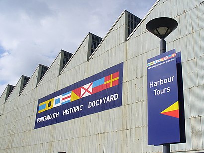
Portsmouth Historic Dockyard Address: Queen Street Portsmouth Portsmouth PO1 3 street in Portsmouth
Attractions near Portsmouth Historic Dockyard
Cafe Oasis,Wightlink Isle of Wight Ferries,Po1 3ee,Mary Rose Museum,Portsmouth Harbour Station,Royal Maritime Club Hotel Portsmouth,Portsmouth Harbour Railway Station (PMH),Po1 3lt,Po1 3gw,Gosport Ferry (Portsmouth Terminal),Portsmouth Harbour Station Pier (Pier), Portsmouth,Po1 3ea,Po1 3gb,portsmouth outlet,Wightlink Fastcat Terminal,Spinnaker Tower,Vue Cinema,Slug & Lettuce Portsmouth,Curzon Howe Road,OakleyHow to get to popular attractions in Portsmouth with public transportation
Stroud Railway Station (STD), Stroud,Salisbury City Centre, Wiltshire,Defence Academy of the United Kingdom, Vale Of White Horse,Penzance, Cornwall,The Giddy Bridge (Wetherspoon), Southampton,Bodmin, Cornwall,Poole Quay, Poole,Sandbanks Beach, Poole,Dulverton, West Somerset,EE, South Hams,Tesco, Exeter,Cosmo Restaurant, Bristol, City Of,Stoke Gifford, South Gloucestershire,The Quay (Wetherspoon), Poole,Oceana Boulevard, Southampton,Ikea, Bristol, City Of,Tesco, Poole,The Union Rooms (Wetherspoon), Plymouth,We The Curious, Bristol, City Of,Ilfracombe Harbour, North DevonGet around Portsmouth by public transport!
Travelling around Portsmouth has never been so easy. See step by step directions as you travel to any attraction, street or major public transport station. View bus and train timetables, arrival times, service alerts and detailed routes on a map, so you know exactly how to get to anywhere in Portsmouth.
When travelling to any destination around Portsmouth use Moovit's Live Directions with Get Off Notifications to know exactly where and how far to walk, how long to wait for your line , and how many stops are left. Moovit will alert you when it’s time to get off — no need to constantly re-check whether yours is the next stop.
Wondering how to use public transport in Portsmouth or how to pay for public transport in Portsmouth? Moovit public transport app can help you navigate your way with public transport easily, and at minimum cost. It includes public transport fees, ticket prices, and costs. Looking for a map of Portsmouth public transport lines? Moovit public transport app shows all public transport maps in Portsmouth with all train routes and stops on an interactive map.
Portsmouth has 1 transport type(s), including: train, operated by several transport agencies, including National Rail, Stagecoach South, Padstow Harbour Commissioners, Royal Buses, Tavistock Community Transport, River Link, Beaminster Town Council, Yeos Contracts, MD Coaches, Newport Bus, First Bristol, Bath & the West, First Kernow, St Mawes Ferry, First Wessex, Dorset & South Somerset and Isles of Scilly Steamship Co